Airborne Lidar point cloud building top surface gradual extraction method based on classifying and laying

A progressive extraction and building technology, applied in image analysis, image data processing, instruments, etc., can solve problems such as scattered point cloud data, difficult to get good results on the top of buildings, and slow algorithm efficiency

Active Publication Date: 2015-12-09
CHUZHOU UNIV
View PDF1 Cites 23 Cited by
  • Summary
  • Abstract
  • Description
  • Claims
  • Application Information

AI Technical Summary

Problems solved by technology

The disadvantages of this method are: firstly, the result of top surface segmentation is related to the order of segmentation. For buildings with complex structures, there may be segmentation errors, such as dividing one actual top surface into multiple top surfaces, dividing multiple actual top surfaces The surface is divided into a top surface, etc.; secondly, when the Lidar point cloud contains a large number of sampling points, the algorithm efficiency is slow
[0006] In fact, the top structures of most surface buildings are complex and diverse, and the point cloud data measured by Lidar are scattered, have no topology, and even have measurement errors and noise
Because of this, it is difficult to obtain good results by using the same method to divide the top surface of the building at one time.

Method used


Image

  • Airborne Lidar point cloud building top surface gradual extraction method based on classifying and laying
  • Airborne Lidar point cloud building top surface gradual extraction method based on classifying and laying
  • Airborne Lidar point cloud building top surface gradual extraction method based on classifying and laying

Examples


Embodiment Construction

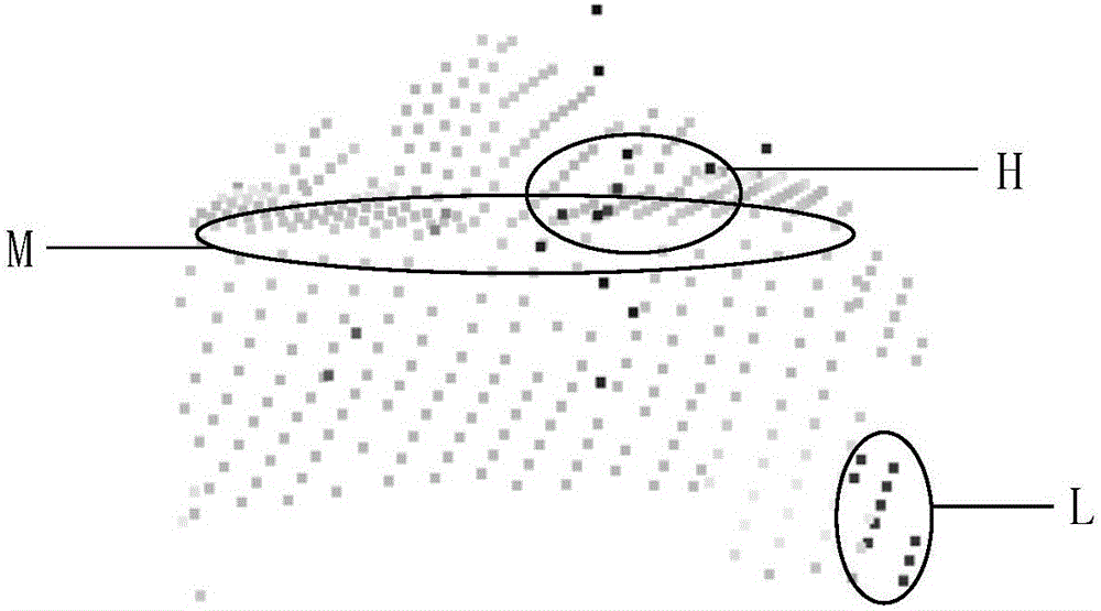
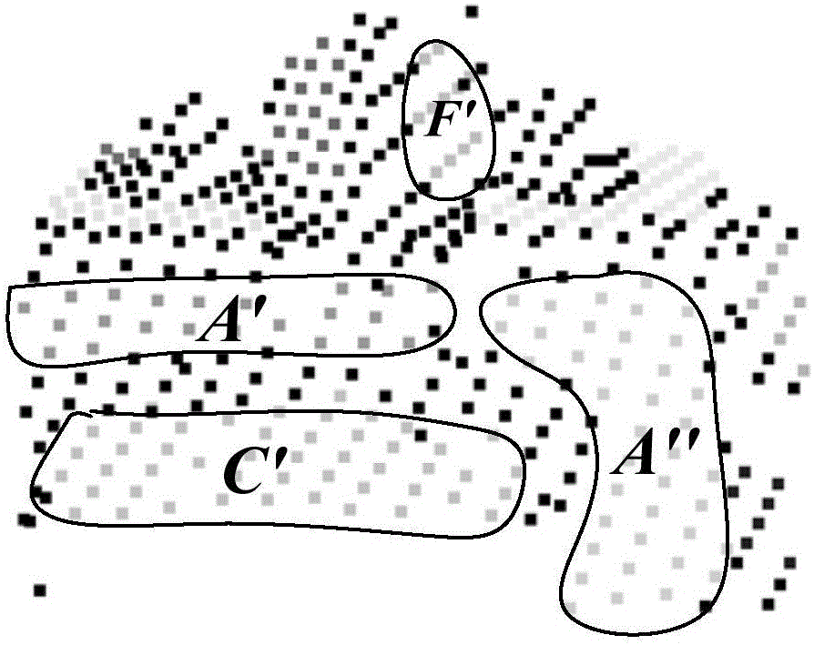
[0060] This example uses the Lidar point cloud data of a real building. The building contains 12 areas of varying sizes, including A, B, C, D, E, F, G, H, I, J, L, and Q. The top surface, and the angle between the top surfaces also varies in size. For example, the four top surfaces of Q, L, I, and J have a small area (the number of sampling points on them is only 5, 6, 6, and 5), and the angle between the two top surfaces of D and C Very small. At the same time, there is an erect slender chimney above the building and two horizontal wires passing through it, which will cause the lidar point cloud data of the building to contain noise points.

[0061] The original lidar point cloud data of the building is as follows figure 2 As shown, it gives the original point cloud data of the building collected by the airborne Lidar system, where the dark black point in the L area is the point on the lowest top surface of the building; the dark black point in the H area is The point on the ...


PUM


Abstract

The present invention discloses an airborne Lidar point cloud building top surface gradual extraction method based on classifying and laying. The method comprises the steps: firstly classifying top surfaces of a building; according to the size of top surface area, dividing the top surface into a "big top surface" and a "small top surface", and according to the size of an angle between the top surface, dividing the top surfaces into different levels. On this basis, the method adopts the principle of "from big to small", "from rough to fine" and "classified process", gradual extracting the top surface of building from LiDAR point cloud. The method comprises: firstly, combining a region growing method based on normal and a region growing method based on distance, segmenting the big top surface from point cloud; then performing clustering to the remaining points, and segmenting the small top surface from each cluster by using a random sample consensus method; and by constantly improving the determination condition of angles between the top surfaces, and gradually segmenting the finer angle between the top surface. and finally, achieving automatic and accurate segmentation for various top surfaces of buildings, thereby laying a foundation for automatic modeling of three-dimensional buildings.

Description

Technical field [0001] The invention relates to the technical field of automatic reconstruction of three-dimensional building models on the ground, and in particular to a method for progressively extracting the top surface of a building based on airborne Lidar point cloud. The method belongs to the field of LiDAR point cloud data processing, and particularly relates to a building based on Lidar point cloud. Object top surface extraction and 3D model reconstruction of buildings. Background technique [0002] Realizing the automatic reconstruction of three-dimensional building models on the ground is of great significance in many fields, such as three-dimensional digital city construction, urban planning and management, virtual tourism, and even risk assessment, emergency management, etc. Using traditional surveying and mapping techniques and methods, although it is also possible to obtain geometric data of buildings and reconstruct their 3D models, due to the slow data acquisition...

Claims


Application Information

Patent Timeline
Patent Type & Authority Applications(China)
IPC IPC(8): G06T7/00
CPCG06T2207/10044G06T2207/20016G06T2210/04
Inventor 赵瑞斌张燕玲王继东
Owner CHUZHOU UNIV
Why Eureka
Try Eureka