A UAV reconnaissance image data management and visual display method

A technology of image data and display method, which is applied in the field of unmanned aerial vehicle reconnaissance image data management and visual display, can solve the problems of huge data volume, multiple overlapping images, and complex original image data, so as to achieve efficient retrieval, improve retrieval efficiency, and meet The effect of visualizing requirements

Active Publication Date: 2018-07-17
BEIHANG UNIV
View PDF13 Cites 0 Cited by
  • Summary
  • Abstract
  • Description
  • Claims
  • Application Information

AI Technical Summary

Problems solved by technology

Due to the characteristics of UAV reconnaissance data collection, the image database has more overlapping images, and the data volume is relatively large.
Moreover, the original image data collected is relatively complex, with strong timeliness, more coordinate systems, and the fusion of various data, etc.

Method used


Image

  • A UAV reconnaissance image data management and visual display method
  • A UAV reconnaissance image data management and visual display method

Examples


Embodiment Construction

[0027] The specific implementation method of the present invention will be described in detail below in conjunction with the accompanying drawings.

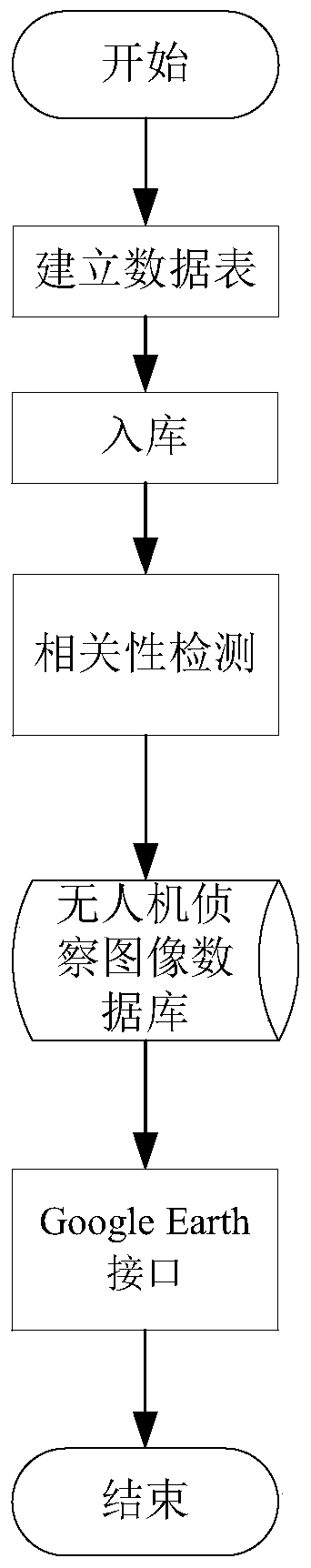
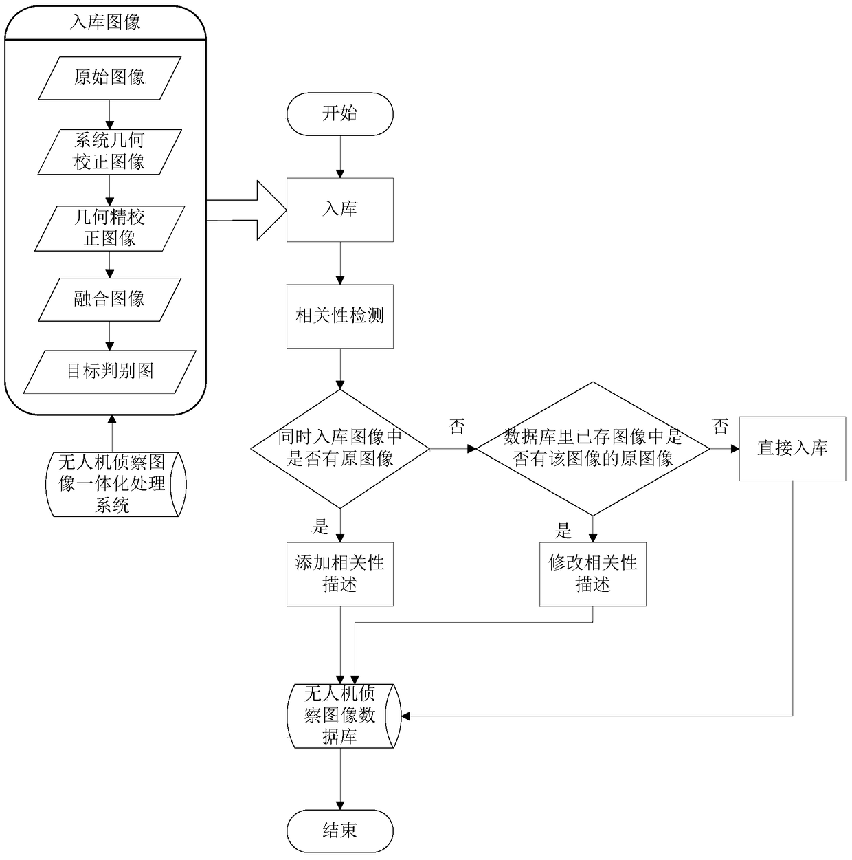
[0028] The main program flow of the UAV image database is to automatically obtain image metadata when entering the database, perform level-based correlation storage and content-based image retrieval, and finally realize the visual display of images.

[0029] A kind of unmanned aerial vehicle reconnaissance image data management and visual display method of the present invention, such as figure 1 As shown, it specifically includes the following steps:

[0030] The first step is to establish a data table based on the metadata of UAV reconnaissance images.

[0031] For higher execution efficiency and convenient and comprehensive retrieval, the UAV image database management method chooses a mixed management method of files and relational databases. Images and image sequence files are stored in the file system, and the file storage p...


PUM


Abstract

The invention discloses a UAV reconnaissance image data management and visual display method, which specifically includes the following steps: the first step is to establish a data table based on the metadata of the UAV reconnaissance image; Correlation storage design; the third step, GIS-based image geographic information visualization; the present invention can realize advanced retrieval by entering relevant metadata from the configuration file of the UAV image; the present invention adopts a correlation storage design based on level association , can realize the correlation retrieval for different levels of images stored in the database; the invention adopts the human-computer interaction retrieval based on Google Earth, which can meet the visualization requirements of the geographical information of the UAV reconnaissance image.

Description

technical field [0001] The invention belongs to the technical field of image retrieval, and specifically refers to a method for data management and visual display of unmanned aerial vehicle reconnaissance image data. Background technique [0002] UAV reconnaissance images, as the basic data of UAV reconnaissance, are similar to remote sensing images and have the characteristics of rich content information, large data volume and a large amount of metadata information. A large amount of different data is generated during the integrated processing of UAV reconnaissance images, which requires unified management. Therefore, the data management system is an important link. [0003] In terms of research and application of remote sensing image data management system, the most typical representative software at home and abroad are as follows: [0004] 1)Microsoft TerraServer [0005] Microsoft TerraServer is developed by Microsoft, based on Microsoft SQL Server server, and can be ...

Claims


Application Information

Patent Timeline
Patent Type & Authority Patents(China)
IPC IPC(8): G06F17/30
CPCG06F16/22G06F16/29Y02A90/10
Inventor 丁文锐黄宇晴李红光向锦武
Owner BEIHANG UNIV
Why Eureka
Try Eureka