GNSS-R (Global Navigation Satellite System-Reflection) sea surface information detection system

A detection system and detection equipment technology, applied in the field of remote sensing applications, can solve problems such as the inability to achieve immediate response and information sharing, and the inability to accurately describe changes in actual sea conditions.

Inactive Publication Date: 2016-02-03
北京航大泰科信息技术有限公司
View PDF6 Cites 8 Cited by
  • Summary
  • Abstract
  • Description
  • Claims
  • Application Information

AI Technical Summary

Problems solved by technology

Due to the limitations of monitoring methods, immediate response and information sharing cannot be achieved, providing direct and efficient services for offshore production and construction
Moreover, the current observation methods can only detect the status of the monitoring points. For regional detection, we can only rely on the traditional rough monitoring method of replacing the area with points, which cannot accurately describe the changes in the actual sea conditions in the area.

Method used


Image

  • GNSS-R (Global Navigation Satellite System-Reflection) sea surface information detection system
  • GNSS-R (Global Navigation Satellite System-Reflection) sea surface information detection system
  • GNSS-R (Global Navigation Satellite System-Reflection) sea surface information detection system

Examples


Embodiment Construction

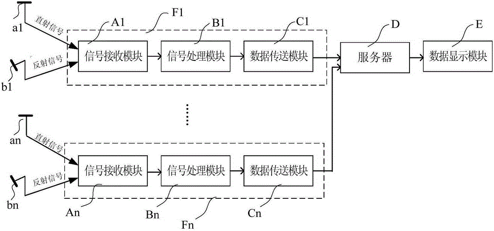
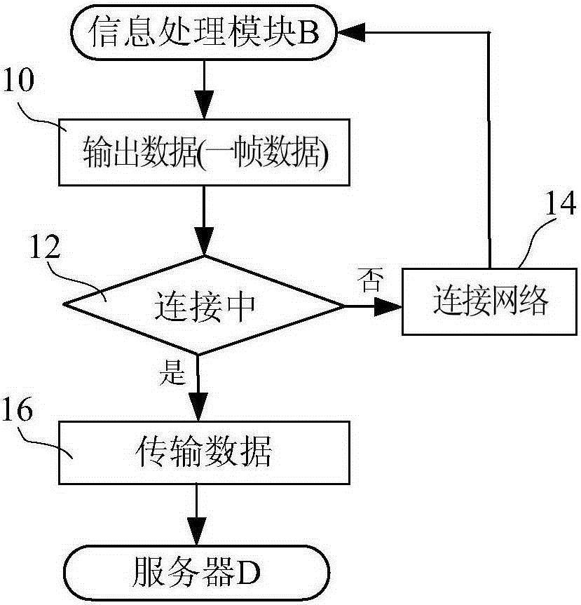
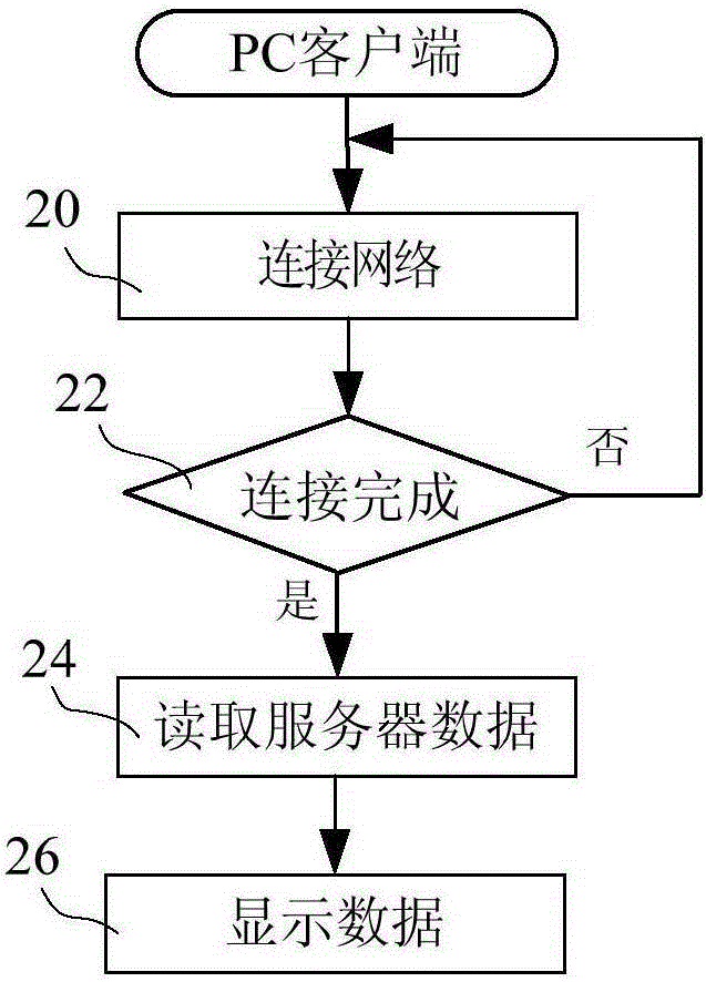
[0011] The following describes the GNSS-R sea surface information detection system of the present invention in the form of an embodiment. In the embodiment, the GNSS-R sea surface information detection system is mainly used to detect sea wind and waves.

[0012] Such as figure 1 As shown, the GNSS-R sea surface information detection system consists of detection equipment F, remote server D and data display module E. There are multiple detection devices F (F1-Fn), which are respectively set up on the shore of the detection sea area to detect different sea areas. The detection areas of each detection device F (F1-Fn) are seamlessly connected or partially overlapped to form a wide-area detection sea area. Each detection device F (F1-Fn) has the same structure. The number n of detection equipment F (F1-Fn) is set according to the size of the detection sea area. The larger the detection sea area is, the more the number n is, as long as the entire detection sea area is covered. ...


PUM


Abstract

The invention discloses a GNSS-R (Global Navigation Satellite System-Reflection) sea surface information detection system. The GNSS-R sea surface information detection system comprises a plurality of sets of detection equipment F, a far-end server D and a data display module E, wherein the plurality of sets of detection equipment are arranged at different positions and are used for detecting sea surface information of different regions; each set of detection equipment comprises a signal receiving module A, a signal processing module B and a data transmission module C; each signal receiving module A is used for receiving a direct signal emitted by a GNSS satellite and a reflection signal reflected by a sea surface; each signal processing module B is used for processing the direct signal and the reflection signal and inverting the sea surface information of the detected regions; and each data transmission module C is used for transmitting the detected sea surface information to the far-end server D in real time. By using the plurality of sets of detection equipment F, a sea surface condition of a wide sea area can be monitored in real time.

Description

technical field [0001] The present invention relates to a GNSS-R (Global Navigation Satellite system-Reflection) sea surface information detection system, specifically a terminal that receives direct signals and reflected signals from satellites and performs corresponding processing on the signals, and can display sea surface conditions in real time , belonging to the field of remote sensing application technology. Background technique [0002] GNSS not only provides users with precise navigation, positioning and precise time, but also provides global microwave signal sources with high stability and security all day and all day. Since the 1990s, GNSS-R technology is a new branch gradually developed in the field of GNSS, and it is one of the research hotspots in the field of remote sensing detection and navigation technology at home and abroad. This technology receives and processes the navigation satellite signals reflected by the ocean surface through shore-based, airborne...

Claims


Application Information

Patent Timeline
Patent Type & Authority Applications(China)
IPC IPC(8): G01C13/00
CPCG01C13/00
Inventor 高洪兴
Owner 北京航大泰科信息技术有限公司
Why Eureka
Try Eureka