A gis-based vehicle active speed limit system and its operating method
An automotive and active technology, applied to vehicle components, transportation and packaging, and external condition input parameters, etc., can solve the problems of not being able to implement speed limit or active braking in advance, not fully considering collaborative interaction, and adjusting values accordingly, to achieve Strong real-time performance, high precision, and improved intelligent effect
- Summary
- Abstract
- Description
- Claims
- Application Information
AI Technical Summary
Problems solved by technology
Method used
Image
Examples
Embodiment 1
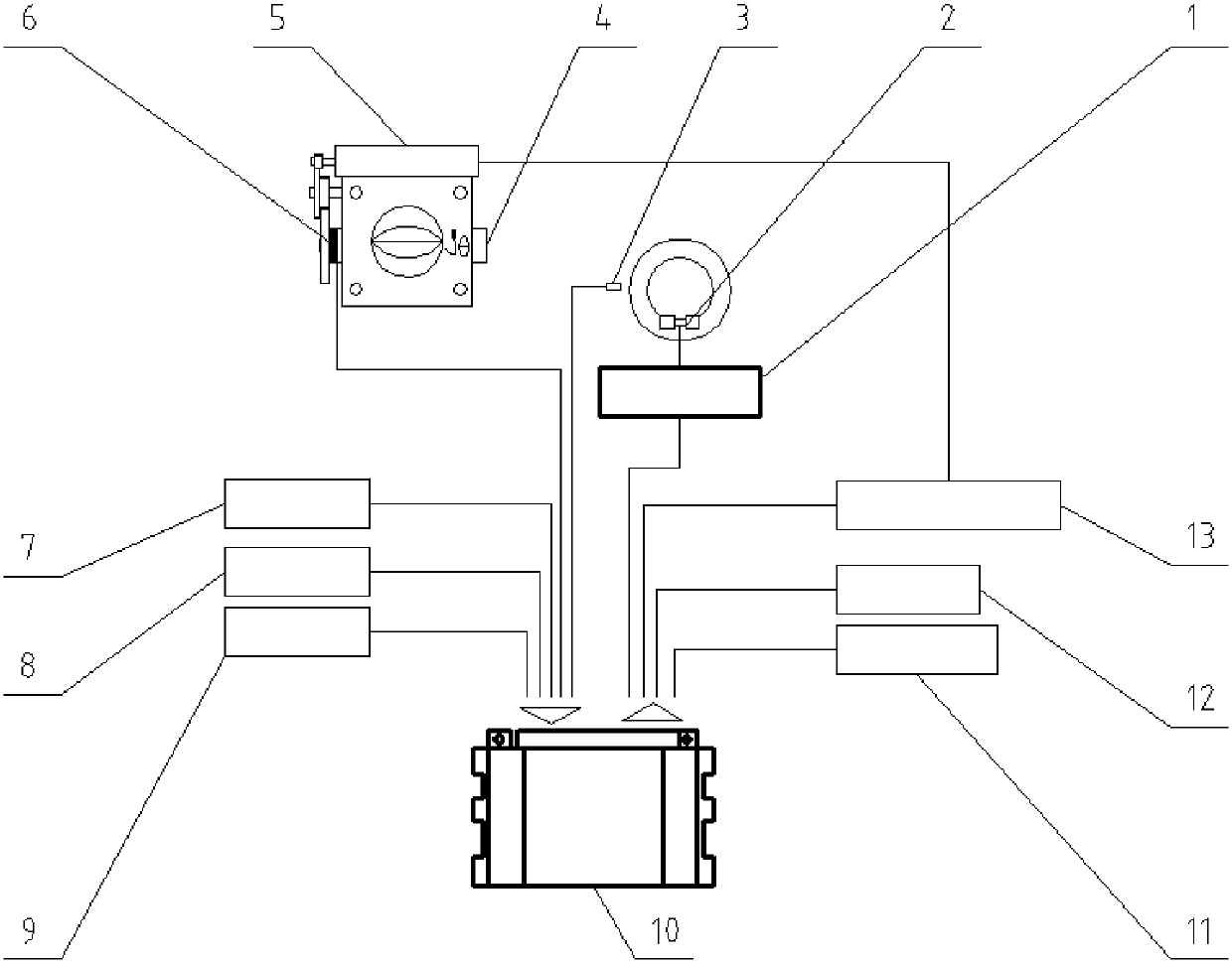
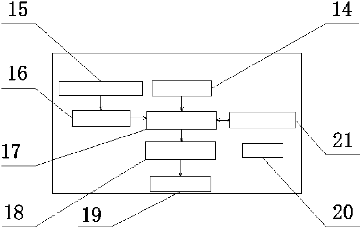
[0051] A GIS-based automobile active speed limit system, comprising information collection equipment, a GIS speed limit value control unit 10, an output display terminal, and an actuator, the input end of the GIS speed limit value control unit 10 is connected to the information collection device, The output end of the GIS speed limit value control unit 10 is respectively connected to the output display end and the actuator;
[0052] The information collection device is used to: perceive the distance to the vehicle in front, the current vehicle speed, and the current vehicle throttle position information; collect the current vehicle positioning information; display and update the static road network information in time;
[0053] The GIS speed limit value control unit 10 is used to: extract the initial speed limit value and road characteristic parameters of the current road section according to the current vehicle positioning information and static road network information, combi...
Embodiment 2
[0071] The operating method of the GIS-based automobile active speed limiting system described in embodiment 1, the specific steps include:
[0072] (1) The GPS receiver 7 collects the current vehicle positioning information in real time, the navigator 8 displays in real time and updates the static road network information in time, and the current vehicle positioning information and the static road network information are sent to the GIS data storage unit 15, Simultaneously, the current vehicle positioning information is sent to the map display screen 12 for display; the ultrasonic sensor 9 senses the distance d with the vehicle ahead in real time; the throttle position sensor 6 senses the current vehicle throttle position information α in real time; the wheel speed sensor 3 Real-time perception of the running speed v of the current vehicle, the analog signals sent by the ultrasonic sensor 9, the throttle position sensor 6, and the wheel speed sensor 3 are sent to the signal ac...
PUM
 Abstract
Description
Claims
Application Information
 - R&D
- Intellectual Property
- Life Sciences
- Materials
- Tech Scout
- Unparalleled Data Quality
- Higher Quality Content
- 60% Fewer Hallucinations
Browse by: Latest US Patents, China's latest patents, Technical Efficacy Thesaurus, Application Domain, Technology Topic, Popular Technical Reports.
© 2025 PatSnap. All rights reserved.Legal|Privacy policy|Modern Slavery Act Transparency Statement|Sitemap|About US| Contact US: help@patsnap.com


