Use of map data difference tiles to iteratively provide map data to a client device

A technology for client devices and map tiles, applied in the field of map rendering systems, can solve the problems of high loading delay, high rendering delay, data detail reduction, etc.

Inactive Publication Date: 2016-02-24
GOOGLE LLC
View PDF2 Cites 26 Cited by
  • Summary
  • Abstract
  • Description
  • Claims
  • Application Information

AI Technical Summary

Problems solved by technology

This fact can cause a number of problems, including high loading latencies, high rendering latencies on client devices, high serialization latencies on the server, and forced reduction of data details to avoid these problems

Method used


Image

  • Use of map data difference tiles to iteratively provide map data to a client device
  • Use of map data difference tiles to iteratively provide map data to a client device
  • Use of map data difference tiles to iteratively provide map data to a client device

Examples


Embodiment Construction

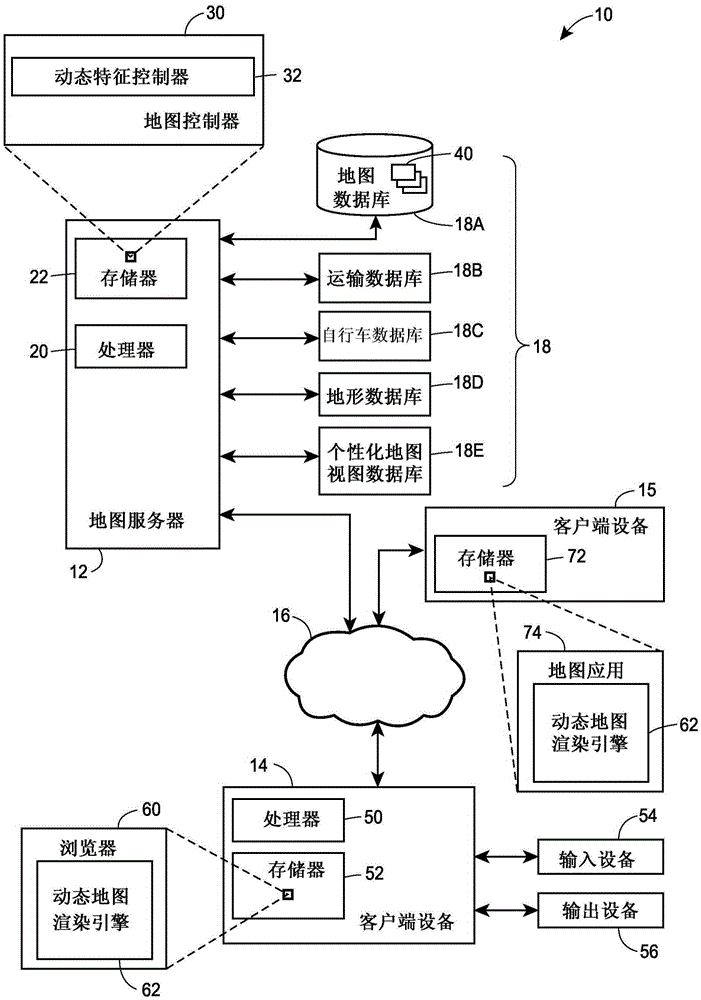
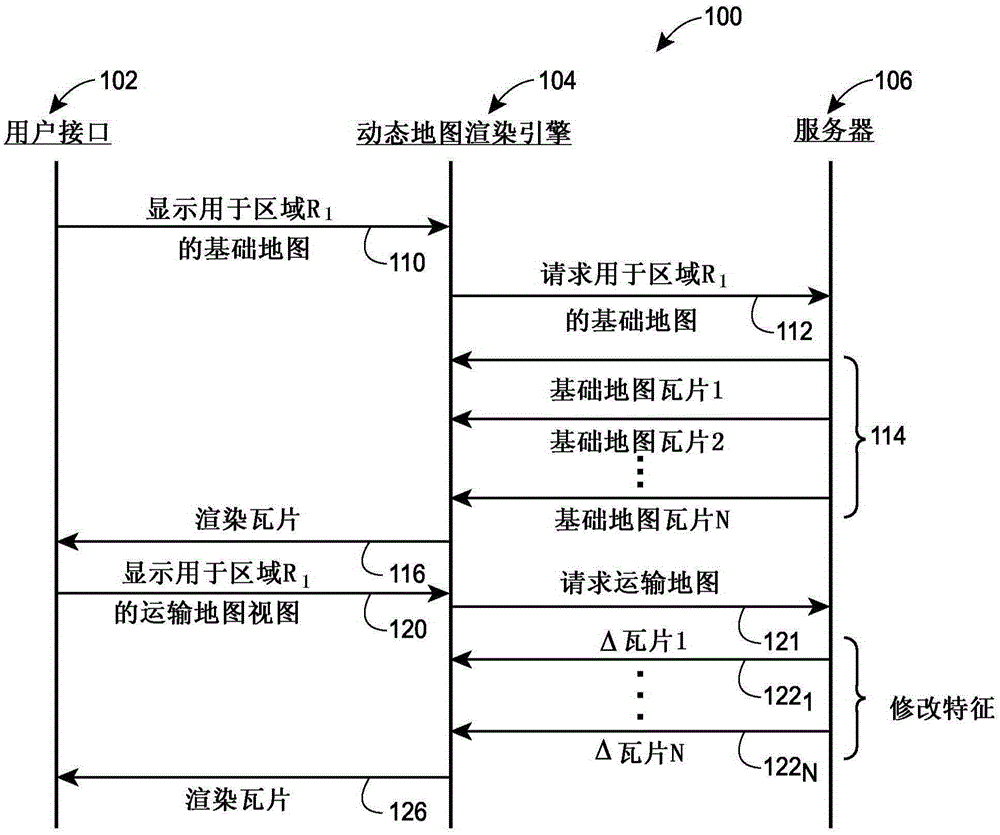
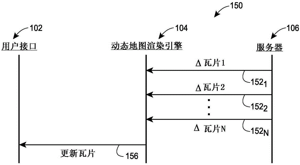
[0023] The map server device communicates with the map client device to efficiently use a set of base map tiles and a set of difference tiles having base map feature data to provide map data for rendering a map image on the client device, the set of A group difference tile defines the changes that will be made to the base map feature data within the base map tile when the map is rendered at the client device. In some cases, a map server first provides map data to a client device such as a desktop computer, laptop computer, tablet device, mobile phone, etc. to render a first map image corresponding to a region or geographic area as a set of One or more base map tiles, and then provide modification data to the client device in the form of difference tiles in order to render a second, different map image corresponding to the same geographic area (for example, a traffic map image, a transportation map image, etc. ). The client device can then render the second map image using the...


PUM


Abstract

To provide map data for rendering map images corresponding to a selected geographic region at a client device, a map server generates a set of base map tiles having vector descriptors, each of which indicates a geometry of a respective map element, in accordance with a non-raster format for rendering a first map image. The map server, at some point, provides the base map tiles to the client device. Upon receiving an indication that a specific map image for the selected geographic region is to be rendered at the client device, the map server further generates a set of difference map tiles that indicate changes to be made to the set of base map tiles and sends the difference map tiles to the client device for use, along with the set of base map tiles, in rendering the requested specific map image.

Description

technical field [0001] The present disclosure relates to map rendering systems, such as electronic map display systems, and more particularly to map rendering in which a map image is rendered using map data provided iteratively as a set of base map tiles and one or more difference map tiles system. Background technique [0002] The background description provided herein is for the purpose of generally presenting the context of the disclosure. To the extent described in the Background section, the work of the named inventors and other aspects of this description that may not have been considered suitable as prior art at the time of filing are neither expressly nor implicitly admitted as Published prior art. [0003] Maps of geographic areas can now be displayed by software applications running on a variety of devices, including desktop computer devices, mobile phones, car navigation systems, handheld Global Positioning System (GPS) units, tablet or laptop computers Wait. ...

Claims


Application Information

Patent Timeline
Patent Type & Authority Applications(China)
IPC IPC(8): G06T9/00
CPCG06T9/00G01C21/3667G06T1/00
Inventor 丹尼尔·奥特罗尼古拉斯·李詹姆斯·达尔皮尼安珍妮弗·毛雷尔
Owner GOOGLE LLC
Why Eureka
Try Eureka