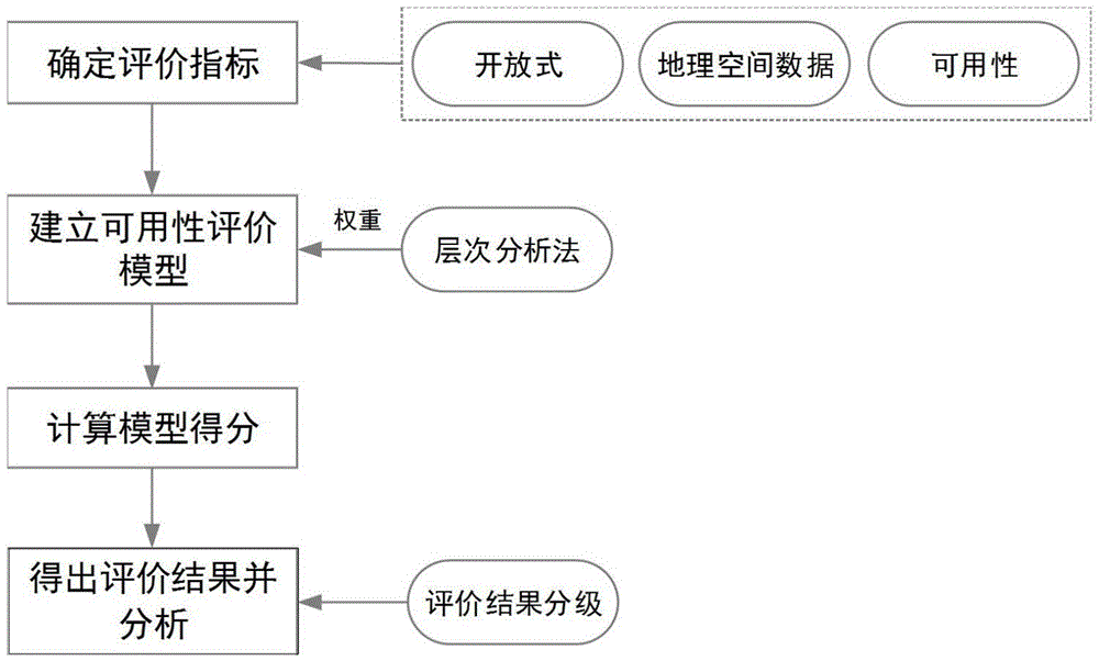
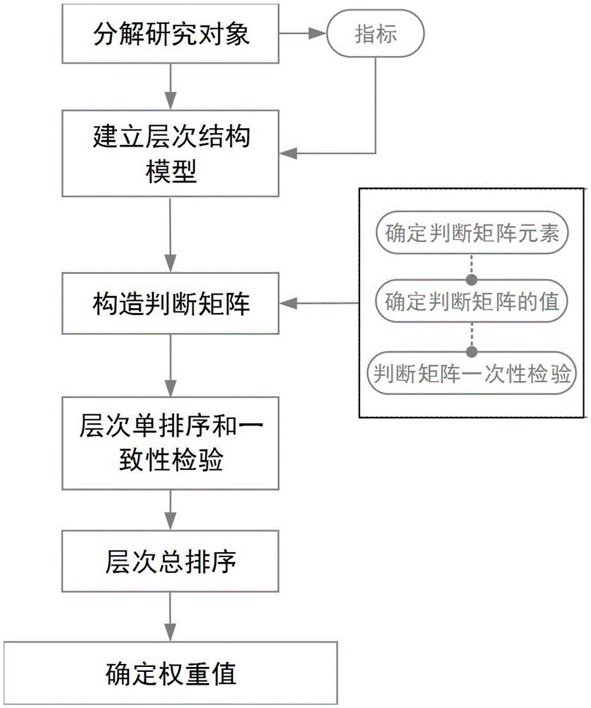
Usability evaluation method for open geographic space data
A technology of geospatial data and evaluation methods, applied in geographic information databases, special data processing applications, electronic digital data processing, etc., can solve problems such as shortages, and achieve optimal utilization and good current performance
- Summary
- Abstract
- Description
- Claims
- Application Information
AI Technical Summary
Problems solved by technology
Method used
Image
Examples
Embodiment Construction
[0027] In order to facilitate those of ordinary skill in the art to understand and implement the present invention, the present invention will be described in further detail below in conjunction with the accompanying drawings and embodiments. It should be understood that the implementation examples described here are only used to illustrate and explain the present invention, and are not intended to limit this invention.
[0028] For the convenience of explaining the specific implementation method, take the 2014 OSM road data of Xi'an City including 13 jurisdictions as an example. The data comes from the official website of OpenStreetMap (http: / / www.openstreetmap.org), and the data mainly includes new urban areas 13 districts and counties including Beilin District, Lianhu District, Baqiao District, Weiyang District, Yanta District, and Yanliang District, with a total area of 10,108 square kilometers. The reference data is the navigation data of Xi'an City in 2014.
[0029] pl...
PUM
 Abstract
Description
Claims
Application Information
 - R&D
- Intellectual Property
- Life Sciences
- Materials
- Tech Scout
- Unparalleled Data Quality
- Higher Quality Content
- 60% Fewer Hallucinations
Browse by: Latest US Patents, China's latest patents, Technical Efficacy Thesaurus, Application Domain, Technology Topic, Popular Technical Reports.
© 2025 PatSnap. All rights reserved.Legal|Privacy policy|Modern Slavery Act Transparency Statement|Sitemap|About US| Contact US: help@patsnap.com


