
Geological map database establishing device and geological map database establishing device method based on geological database

A database and geological map technology, applied in geographic information database, electronic digital data processing, structured data retrieval, etc., can solve problems such as unreasonable processing, difficult management, unclear classification level, etc., to reduce the workload of data collection, Confidentiality work is convenient and safe, and the effect of simplifying the attribute entry process

Inactive Publication Date: 2016-07-13
DEV RES CENT OF CHINA GEOLOGICAL SURVEY
View PDF2 Cites 18 Cited by
  • Summary
  • Abstract
  • Description
  • Claims
  • Application Information

AI Technical Summary

Problems solved by technology

The storage management method in the form of files has shortcomings such as easy to be restricted by file names, too many files, and unclear classification levels, which makes management inconvenient
For example, the MapGIS platform puts annotations and point symbols into point files, which is confusing and difficult to manage
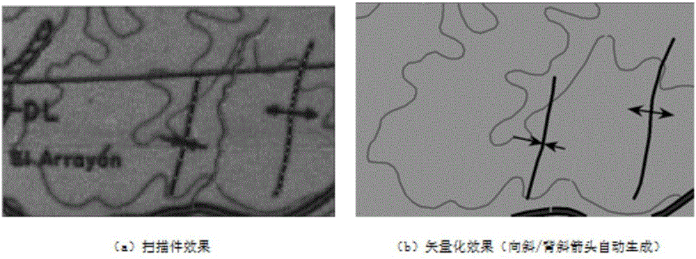
[0006] 2. The main purpose of MapGIS data collection is cartography, that is, "what you see is what you draw". For example, in MapGIS, the anticline and syncline symbols in the folds are collected as elements alone, and a line element is processed into a point element and The combination of line elements is obviously unreasonable
[0007] 3. MapGIS uses the graphic editing function of the system itself to treat the point, line, and surface units of the symbol as ordinary graphic blocks, and add description items such as symbol codes and store them in the system library (point-sub-library, line-line type library) , surface-pattern library), but because the size and shape of dot, line, and surface symbols are not only affected by the technical level of the creator, but also limited by the imperfection of the library itself, when making pictures with different themes and different scales When using the software, any operator can make supplementary subgraphs, line types, patterns, etc. according to the needs, so that each data set has its own system library, that is to say, if the user only has the data set but no system library, then The data set is of little use value
In addition, it is not possible to make too complex symbol primitives
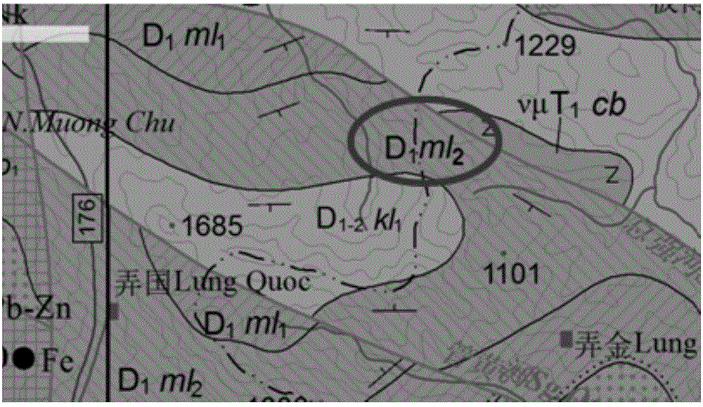
For geological maps, it is necessary to use a large number of various symbols of different colors, sizes, shapes, and filling patterns. The use of this symbol library brings inconvenience to users
[0008] 4. The electronic data is only stored in the form of data sets on optical discs and disk media, which is not conducive to subsequent application, reprocessing and confidentiality work

Method used


Image

  • Geological map database establishing device and geological map database establishing device method based on geological database
  • Geological map database establishing device and geological map database establishing device method based on geological database
  • Geological map database establishing device and geological map database establishing device method based on geological database

Examples


Embodiment Construction

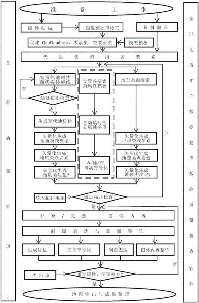
[0052] The technical solution of the process invention is mainly divided into four aspects: vectorization of raster images, supplement and improvement of attribute content, vector data representation and drawing finishing and quality inspection work, basic technical solutions and process steps such as figure 1 Shown.

[0053] According to the actual situation, the work sequence of the four processes in the geodatabase-based geological map database construction process will be adjusted and overlapped. Among them, the data quality management runs through the entire production process, and the data quality is automatically checked by the software.

[0054] 1. Vectorization of raster maps

[0055] In the process of vectorization, this process vectorizes, stores, and manages different topics according to surface, line, and point elements. By setting different feature class attribute templates, the classification attributes of corresponding feature classes can be automatically collected d...


PUM


Abstract

The invention discloses a geological map database establishing device based on a geological database. The geological map database establishing device comprises a grid map vectorization module, an automatic attribute content acquisition and improvement module, a vector data mapping expression and map face finishing module and a quality inspection working module. The core characteristics of the process technology are as follows: a geological database management model, attribute recording and automatic acquisition, object-oriented vectorization, geological lettering and automatic code generation and updating, symbol management and mapping expression and quality inspection software. The geological map database establishing device disclosed by the invention has the advantages that the technical problems of low database establishing efficiency and difficult application of the geological mineral map are solved, the data quality of the geological map is improved, and the storage space of result data is less than the original storage space; the problem of disconnection between data acquisition of the geological mineral map at the earlier period and management of a relational database at the later period is solved, so that the database of the geological mineral map has good succession and integrity; and the current situation of low-efficiency management of the current geological special map data set by the traditional document type database is broken through, high-efficiency management of the relational database is realized, and the current situation that the geological special map data set is large so as to be difficult to manage is changed.

Description

Technical field [0001] The invention belongs to the technical field of basic geological map spatial data database building and mapping technology, and particularly relates to a geological map database building and mapping device and method based on a geographic database. Background technique [0002] The macro technical background of the present invention is that the domestic geological industry is facing increasing platform performance requirements for massive data integration and network publishing, and the industry urgently needs to integrate with the international industry, and gradually transition from MAPGIS software to ArcGIS software platform. This technology is based on the construction of a global geological map spatial database. The micro background is that in the course of the work of this subject, a new set of methods and models of geological professional database construction have been gradually formed for the convenience of future data application. The domestic ge...

Claims


Application Information

Patent Timeline
Patent Type & Authority Applications(China)
IPC IPC(8): G06F17/30
CPCG06F16/56G06F16/211G06F16/29
Inventor 王杨刚李娜向运川王春宁何翠云刘国王小宁于芳赵军张大可
Owner DEV RES CENT OF CHINA GEOLOGICAL SURVEY
Learn More