Cloud cluster height measuring method based on dual foundation cloud atlas

A technology of height measurement and ground-based cloud image, which is applied in height/horizontal measurement, measuring devices, surveying and navigation, etc., can solve the problem of lack of cloud height information extraction and calculation, and achieve the effect of wide coverage and high calculation accuracy

Active Publication Date: 2016-07-20
STATE GRID CORP OF CHINA +1
View PDF4 Cites 3 Cited by
  • Summary
  • Abstract
  • Description
  • Claims
  • Application Information

AI Technical Summary

Problems solved by technology

[0004] Since the existing irradiance prediction methods based on ground-based cloud images lack the extraction and calculation of cloud height information, it is urgent for those skilled in the art to develop a method that can get ri

Method used


Image

  • Cloud cluster height measuring method based on dual foundation cloud atlas
  • Cloud cluster height measuring method based on dual foundation cloud atlas
  • Cloud cluster height measuring method based on dual foundation cloud atlas

Examples


Embodiment Construction

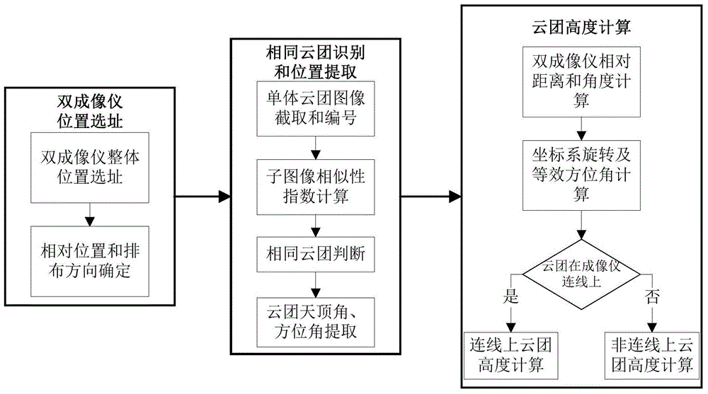
[0031] The observation method of the present invention will be further described in detail below in conjunction with the accompanying drawings.

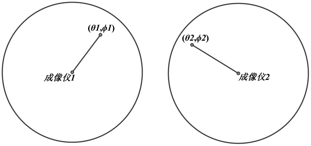
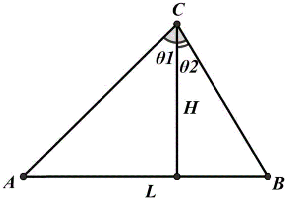
[0032] The invention proposes a method for taking sky images simultaneously by using two ground-based all-sky imager equipment, and calculating the height of the local sky cloud base. Such as figure 1 As shown, the measurement method in this example mainly includes the following steps:

[0033] Step 1) Determine the location and arrangement direction of the dual imagers

[0034] Step1: Site selection for the overall location of the dual imagers

[0035] In the process of site selection for the overall location of the dual imager, the following principles need to be followed:

[0036] 1) The observation area of ​​the all-sky imager should be able to cover all photovoltaic power plants. If full coverage cannot be achieved, the area with the largest grid-connected capacity should be taken into account;

[0037] 2) Choose a terrain t...


PUM


Abstract

The invention provides a cloud cluster height measuring method based on a dual foundation cloud atlas. The method comprises the following steps: step A, determining the relative distance and relative direction between two imagers; step B, recognizing the identical cloud clusters in the cloud atlases of two imagers and extracting the position information of the identical cloud cluster; step C, determining the height of the cloud cluster based on the position information. According to the measuring method, the observation images of dual foundation cloud imager are used, the same cloud clusters are recognized, the position angles are extracted, and thus the height of the bottom of the cloud clusters above a region can be accurately calculated. Compared with the conventional ceilometer, which can only measure the heights of bottoms of clouds that are right above the ceilometer, the provided method can measure the height of clouds that are right above the imagers and is capable of measuring the height of clouds in other positions in the observation range of the imagers; and the method has the advantages of wide coverage and high calculation precision.

Description

technical field [0001] The invention belongs to the field of prediction of new energy power generation power, and in particular relates to a cloud height measurement method based on a double-ground cloud image. Background technique [0002] With the rapid increase of large-scale photovoltaic power grid-connected capacity, the randomness and volatility of photovoltaic power generation have increasingly serious impacts on the safe operation, dispatch and control of power systems. In order to reduce the harm caused by photovoltaic uncertainty to the power grid and improve the utilization efficiency of solar energy, it is first necessary to accurately predict the photovoltaic power generation. [0003] A prerequisite for photovoltaic power prediction is accurate prediction of surface irradiance. In recent years, the academic community has proposed a method for predicting surface radiation and photovoltaic power based on ground-based cloud images. This method performs cloud clust...

Claims


Application Information

Patent Timeline
IPC IPC(8): G01C5/00
Inventor 丁宇宇周海陈梅朱想程序陈志宝崔方丁煌王知嘉曹潇谭志萍周强于炳霞
Owner STATE GRID CORP OF CHINA
Why Eureka
Try Eureka