Cloud Height Measurement Method Based on Two Ground-Based Cloud Images
A technology of height measurement and ground-based cloud image, applied in height/horizontal measurement, measuring devices, surveying and navigation, etc., can solve the problem of lack of cloud height information extraction and calculation, and achieve the effect of wide coverage and high calculation accuracy
- Summary
- Abstract
- Description
- Claims
- Application Information
AI Technical Summary
Problems solved by technology
Method used
Image
Examples
Embodiment Construction
[0031] The observation method of the present invention will be further described in detail below in conjunction with the accompanying drawings.
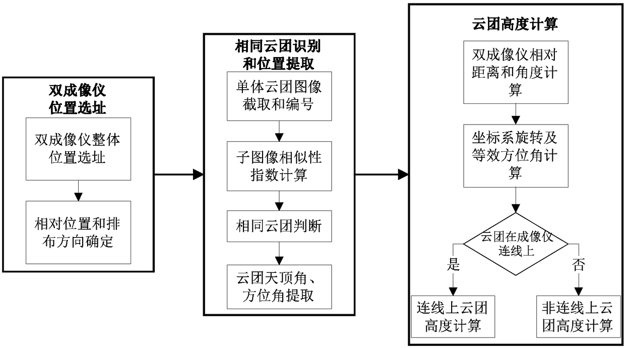
[0032] The invention proposes a method for taking sky images simultaneously by using two ground-based all-sky imager equipment, and calculating the height of the local sky cloud base. Such as figure 1 As shown, the measurement method in this example mainly includes the following steps:
[0033] Step 1) Determine the location and arrangement direction of the dual imagers
[0034] Step1: Site selection for the overall location of the dual imagers
[0035] In the process of site selection for the overall location of the dual imager, the following principles need to be followed:
[0036] 1) The observation area of the all-sky imager should be able to cover all photovoltaic power plants. If full coverage cannot be achieved, the area with the largest grid-connected capacity should be taken into account;
[0037] 2) Choose a terrain t...
PUM
 Abstract
Description
Claims
Application Information
 - R&D
- Intellectual Property
- Life Sciences
- Materials
- Tech Scout
- Unparalleled Data Quality
- Higher Quality Content
- 60% Fewer Hallucinations
Browse by: Latest US Patents, China's latest patents, Technical Efficacy Thesaurus, Application Domain, Technology Topic, Popular Technical Reports.
© 2025 PatSnap. All rights reserved.Legal|Privacy policy|Modern Slavery Act Transparency Statement|Sitemap|About US| Contact US: help@patsnap.com


