

Mid-and-low-latitude region target non-along-track strip dividing and observing method
A technology of regional targets and strips, applied in the field of satellite observation, can solve problems such as short observation completion time
- Summary
- Abstract
- Description
- Claims
- Application Information
AI Technical Summary
Problems solved by technology
Method used
Image

Examples
Embodiment Construction
[0069] The present invention uses C# language programming for verification and analysis. Because the division in a multi-track lap is the same as the division of a regional target in a single lap, a regional target is divided in a single lap below. The division uses the following parameter information .
[0070] Table 1 Satellite orbit element number table
[0071]
[0072] Table 2 Satellite Capability Table
[0073]
[0074] Table 3 Partition parameter table
[0075]
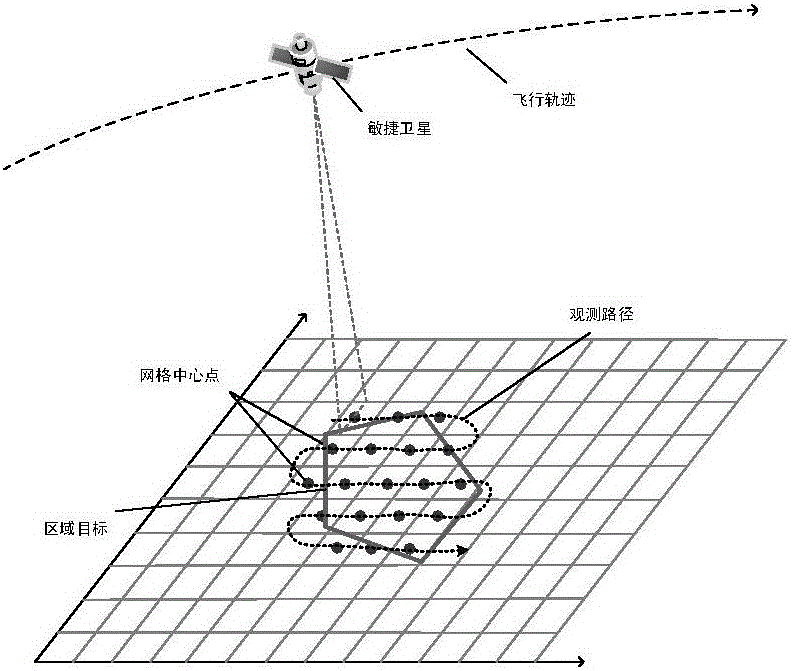
[0076] Table 4 Regional target information
[0077] Vertex
Latitude / (°)
Longitude / (°)
Height / (km)
1
50.761
-23.214
0
2
50.236
-22.209
0
3
49.918
-22.280
0
4
49.949
-24.040
0
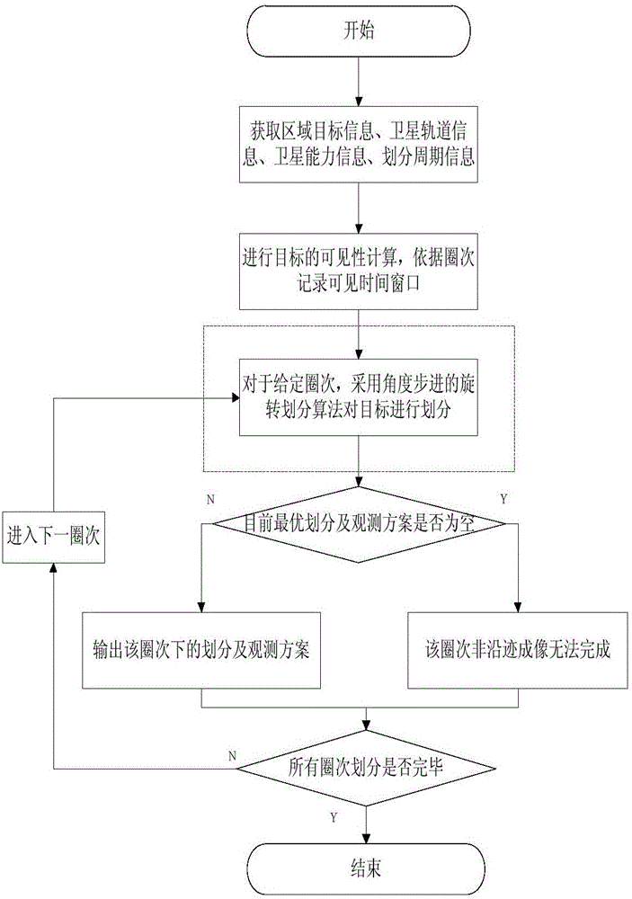
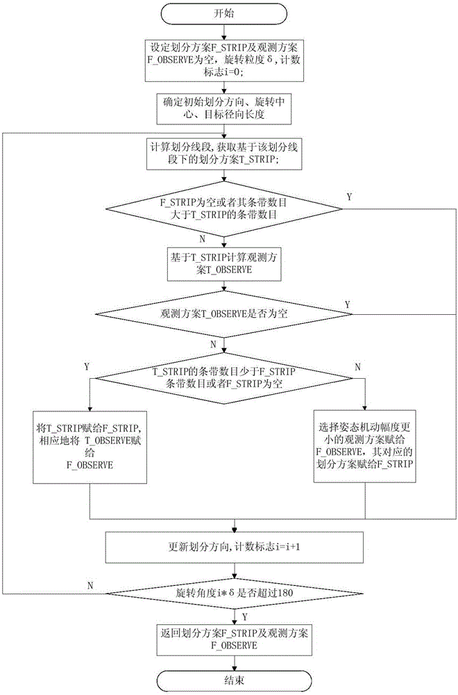
[0078] figure 2 It is the system flow chart of the present invention, and the regional targets are divided according to the performance parameters of the satellites. Step 1: Obtain regional target information, satellite orbit information, satellite capability information, and division period information. Step 2: According to the sate...
PUM
 Abstract
Description
Claims
Application Information