

Map query area rendering method, server and system
A server and area technology, applied in the field of map rendering, can solve the problems of unresponsive map query program, stuck, and no positioning of objects in the query area, so as to avoid overlapping layers, avoid errors, and make query convenient and fast
- Summary
- Abstract
- Description
- Claims
- Application Information
AI Technical Summary
Problems solved by technology
Method used
Image

Examples
Embodiment Construction
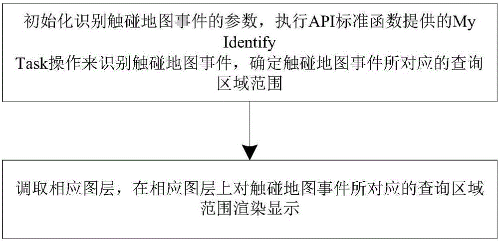
[0042] The technical solutions in the embodiments of the present invention will be clearly and completely described below in conjunction with the drawings in the embodiments of the present invention. Take the mouse to select the map query area as an example: select a point on the map to limit the point query area; select a line on the map to limit the linear query area; select a surface on the map to To limit the surface query area.
[0043] Wherein, the linear query area includes linear areas such as rivers, roads and railway lines in the map.
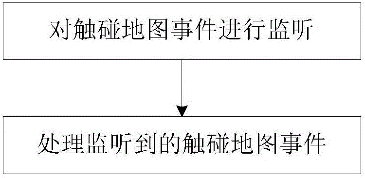
[0044] figure 1 It is the rendering method of the map query area of the present invention, the method is implemented in the map data server, and specifically includes the following steps:
[0045] Monitor the touch map event; among them, the touch map event includes limiting the point query area, limiting the line query area and limiting the area query area; the point query area, line query area and area query area are associated ...
PUM
 Abstract
Description
Claims
Application Information