

Method for identifying vehicles from GPS (global positioning system) data
A technology of GPS data and vehicles, applied in the field of data mining and urban computing, can solve problems such as redundant road sections, less obvious feature effects, and low accuracy of transfer points, so as to improve recognition rate, accuracy rate, and detection rate effect of effect
- Summary
- Abstract
- Description
- Claims
- Application Information
AI Technical Summary
Problems solved by technology
Method used
Image

Examples
Embodiment Construction
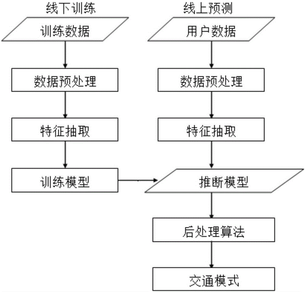
[0029] The present invention will be further described below in conjunction with the accompanying drawings and specific embodiments. The method of the invention includes data preprocessing, feature extraction and postprocessing methods.
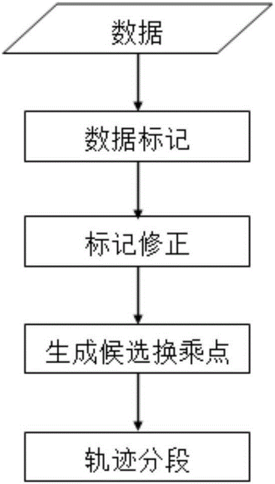
[0030] Data preprocessing mainly includes two aspects, GPS data point marking and generation of single traffic mode road sections, including:
[0031] (1) Preliminary marking of GPS data points. If the velocity value of the GPS data point is less than 1.8m / s and the acceleration value of the point is less than 0.6m / s 2 , mark the type of the point as walk-point, otherwise, mark the type of the data point as non-walk-point.
[0032] (2) Carry out mark correction on GPS data points. For the above markers, due to the existence of noise, the present invention adopts a greedy idea to correct the markers of the GPS data points. That is, an iterative method is adopted. If the mark type of 80% of the 10 points in front and behind a GPS data point...
PUM
| Property | Measurement | Unit |
|---|---|---|
| Length | aaaaa | aaaaa |
Abstract
Description
Claims
Application Information