Three-dimensional terrain curved surface optimization method based on local curvature entropy and quadtree structure

A local curvature and three-dimensional terrain technology, applied in image data processing, 3D modeling, instruments, etc., can solve the problems of discontinuous terrain model browsing process, uneven distribution of terrain surfaces, and far-ranging levels of detail, etc., to achieve good results Continuity and stability, algorithm efficiency guarantee, and the effect of reducing sensitivity

Active Publication Date: 2017-01-11
CHINA UNIV OF GEOSCIENCES (WUHAN)
View PDF4 Cites 16 Cited by
  • Summary
  • Abstract
  • Description
  • Claims
  • Application Information

AI Technical Summary

Problems solved by technology

However, since the curvature can only represent the terrain details of a certain point, the sensitivity is high
If the curvature is directly used as the subdivision evaluation standard, the transition between terrain hierarchical grids will be very jumpy, and the level of detail of adjacent grid blocks may be very different, especially in flat areas, which are prone to oversimplification. The distribution of the simplified terrain surface is uneven, resulting in discontinuity and incompleteness in the browsing process of the terrain model

Method used


Image

  • Three-dimensional terrain curved surface optimization method based on local curvature entropy and quadtree structure
  • Three-dimensional terrain curved surface optimization method based on local curvature entropy and quadtree structure
  • Three-dimensional terrain curved surface optimization method based on local curvature entropy and quadtree structure

Examples


Embodiment Construction

[0048] The present invention will be further described below with reference to the accompanying drawings and embodiments.

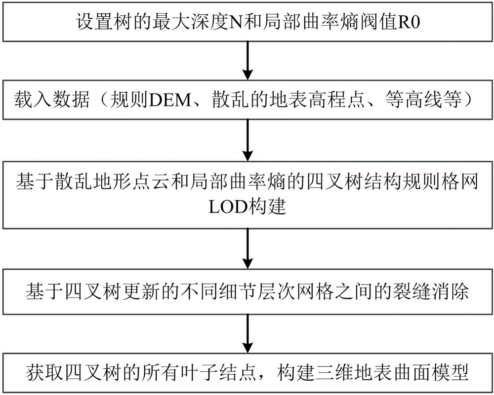
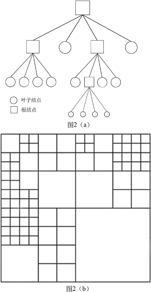
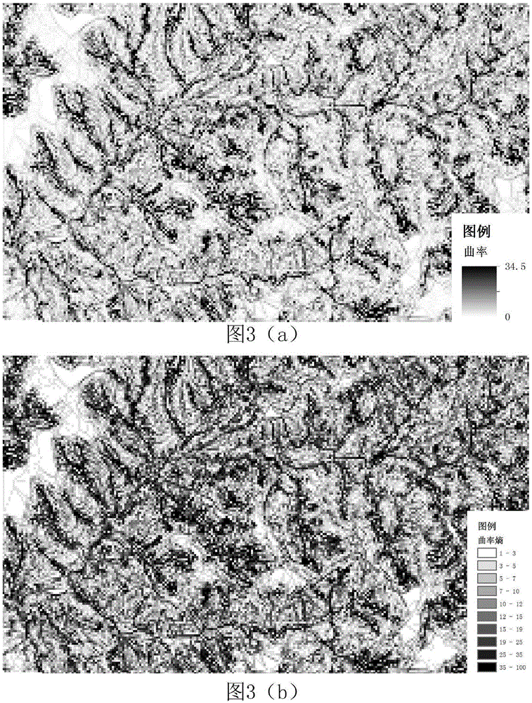
[0049] The invention provides a three-dimensional terrain surface optimization method based on local curvature entropy and quadtree structure. The method uses scattered point cloud data with surface elevation attributes (regular DEM, surface survey points, contour lines, etc.) as For data source, the IDW method is used to interpolate the elevation attributes of the subdivided grid nodes, the local curvature entropy is used as the measurement basis for grid subdivision, and the maximum bounding rectangular grid of the input data is used as the root node of the quadtree. Perform the recursive judgment of the quadtree according to the depth-first method, divide all the grids that meet the conditions, and use them as the child nodes of the current node until all the nodes that meet the subdivision conditions are judged. Then, the LOD multi-level-of-detail mod...


PUM


Abstract

The invention provides a three-dimensional terrain curved surface optimization method based on the local curvature entropy and a quadtree structure, and the method comprises the steps: taking scattered point cloud data with the ground surface elevation attributes as a data source; carrying out the subdividing of regular grid node elevation attributes through employing an IDW method, and carrying out the interpolating calculation; taking the local curvature entropy as the measurement basis for the subdividing of a grid; taking a largest boundary grid of input data as the root nodes of a quadtree; carrying out the recursion judgment of the quadtree in a depth-first mode; carrying out the quartering of the grid which meets the conditions; enabling the quartered grid to serve as child nodes of a current node and to be added to the quadtree, and obtaining an LOD model based on the quadtree structure until all nodes meeting the subdividing condition are completely judged; making the most of the advantages of rapid traversal of the quadtree structure, updating the tree structure through judging the relation between the father and child nodes on a tree, and achieving the elimination of gaps between adjacent grids with different details.

Description

technical field [0001] The invention relates to a three-dimensional terrain surface optimization method based on local curvature entropy and quadtree structure, and belongs to the field of three-dimensional graphics and three-dimensional digital terrain modeling. Background technique [0002] Terrain 3D visualization modeling and real-time expression technology is one of the core technologies in the field of geographic information technology, as well as one of the key and basic technologies for the construction of 3D geographic information systems. The digital expression of terrain usually adopts Digital Elevation Model (DEM), which is a solid ground model that represents ground elevation in the form of a set of ordered numerical arrays, and is a mathematical expression of terrain fluctuations. [0003] DEM can be divided into two categories according to the way the subdomains are divided: regular grid and irregular triangulation. The regular grid data structure is simple, ...

Claims


Application Information

Patent Timeline
IPC IPC(8): G06T17/05G06T17/00
CPCG06T17/005G06T17/05
Inventor 刘刚陈麒玉张志庭何珍文田宜平蒋亚男
Owner CHINA UNIV OF GEOSCIENCES (WUHAN)
Why Eureka
Try Eureka