

Winter wheat plantation area calculation method based on winter wheat area index
An area index, winter wheat technology, applied in the field of agricultural remote sensing, to achieve the effect of a high degree of automation
Active Publication Date: 2017-02-01
INST OF AGRI RESOURCES & REGIONAL PLANNING CHINESE ACADEMY OF AGRI SCI
View PDF4 Cites 21 Cited by
- Summary
- Abstract
- Description
- Claims
- Application Information
AI Technical Summary
Problems solved by technology
[0004] The purpose of the present invention is to provide a solution to the problem of how to use multi-temporal, medium and high-resolution remote sensing images to extract the winter wheat area at the regional scale and at the same time make the remote sensing monitoring of the winter wheat area have a higher automatic operation capability
Method used
View moreImage
Smart ImageViewing Examples

Examples
Embodiment 1
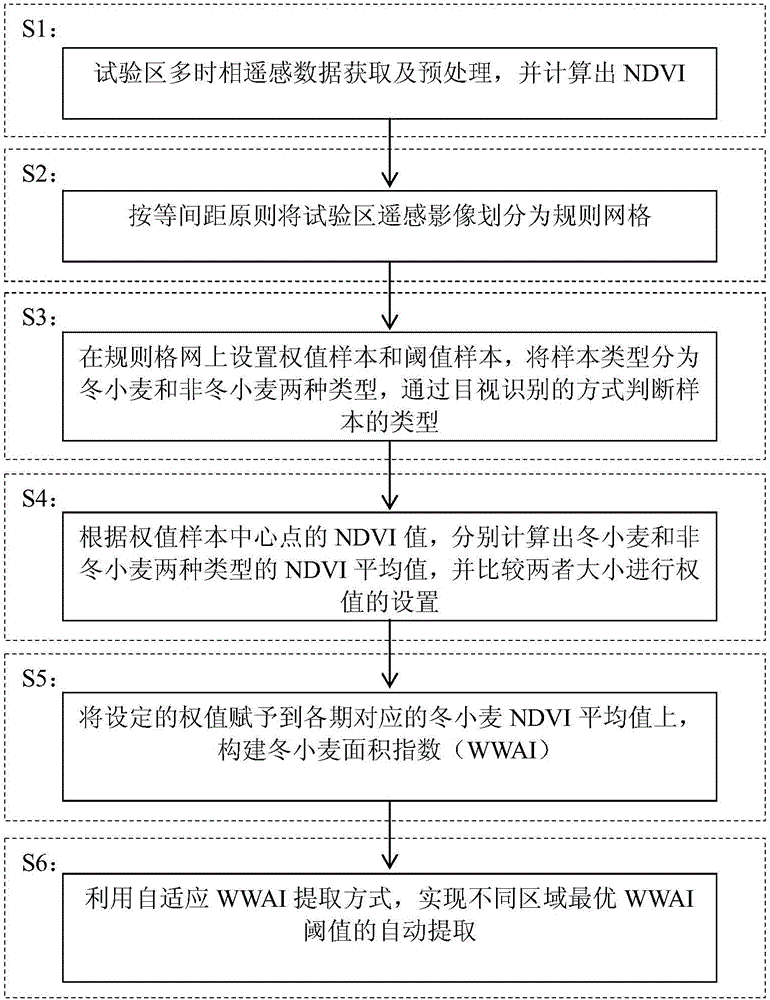
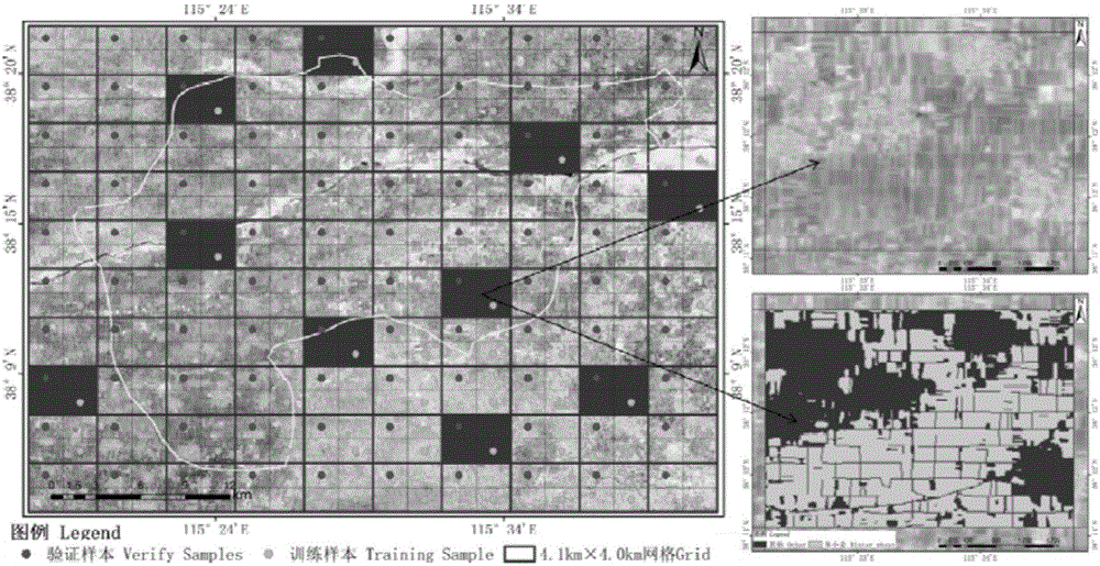
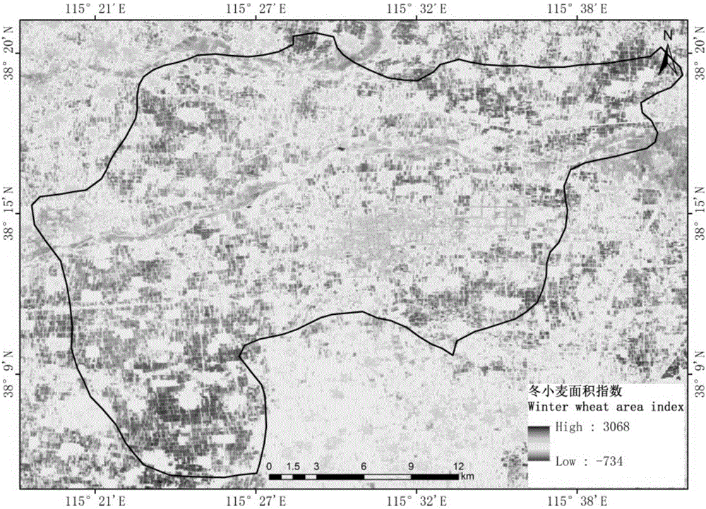
[0046] The technical scheme of the present invention is further described by taking the extraction of winter wheat area in Anping County and surrounding areas as an example. The flow of this embodiment is as follows figure 1 shown, including:
[0047] Step S1, acquisition and preprocessing of multi-temporal remote sensing data in the test area, and calculating the NDVI of each temporal phase.
Login to View More PUM
 Abstract
The present invention relates to a winter wheat plantation area calculation method based on a winter wheat area index. The comprises: performing preprocessing of multi-date remote sensing image, and obtaining the NDVI data in a winter wheat growth period; dividing the multi-date remote sensing image into regular nets, setting weight sample central points on the regular girds, and employing a visual interpretation mode to determine the types of the samples in the girds as winter wheat and non-winter wheat; obtaining the NDVI values corresponding to the weight sample central points in the multi-date gird data, respectively calculating the NDVI mean values of the winter wheat and non-winter wheat, comparing the size of the two and setting the weight; performing weight operation of the NDVI mean values according to the weight setting result to obtaining the winter wheat area index; and employing a self-adaptive mode to extract the winter wheat area index optimal threshold value, and obtaining the plantation area of the winter wheat. The winter wheat plantation area calculation method based on the winter wheat area index can realize the high-precision calculation of the winter wheat area of the area scale of the multi-date high resolution images, the degree automation of the method is high, and the consistency of the identification result is high.
Description
technical field [0001] The invention relates to the technical field of agricultural remote sensing, in particular to a method for extracting winter wheat area from multi-temporal national or provincial scale remote sensing images based on area index. Background technique [0002] Accurate acquisition of the spatial distribution data of the sown area of bulk crops is an important basis for national and provincial governments to formulate food policies and ensure food security. As a national staple crop, winter wheat accounts for a large proportion of the country's total grain. Since the sown area is a key step in crop yield estimation, it is of great significance to develop the current regional-scale winter wheat area extraction method for agricultural monitoring. With the rapid development of remote sensing technology, it provides an effective means for quickly and accurately obtaining the spatial distribution of crop planting. The main methods for extracting and identifyi...
Claims
Login to View More Application Information
Patent Timeline
 Patent Type & AuthorityApplications(China)
IPC IPC(8): G06K9/00G06K9/34G01C11/06G06K9/62
CPCG01C11/06G06V20/188G06V10/267G06F18/2431
Inventor王利民刘佳邵杰杨福刚滕飞杨玲波
OwnerINST OF AGRI RESOURCES & REGIONAL PLANNING CHINESE ACADEMY OF AGRI SCI