
Outdoor activity, game and tourist map generation method, device and equipment

A technology for outdoor activities and map generation, which is applied to maps/plans/charts, educational tools, geographic information databases, etc. It can solve problems such as inconvenient portability, unclear instructions, and maps that cannot meet individual needs, achieving good intuitiveness, Widely promote the effect of application value, easy interaction and sharing

Active Publication Date: 2017-05-10
HUNAN JIANCHENG INFORMATION TECH
View PDF7 Cites 4 Cited by
  • Summary
  • Abstract
  • Description
  • Claims
  • Application Information

AI Technical Summary

Problems solved by technology

[0004] The present invention provides a method, device and equipment for generating a map for outdoor activities, games and tourism, to solve the problems caused by the need for directional equipment such as maps and compasses in existing outdoor activities such as directional movement and radio direction finding movement, outdoor games or scenic spot tourism. Technical problems such as inconvenient portability, unclear directions, and maps that cannot meet individual needs

Method used


Image

  • Outdoor activity, game and tourist map generation method, device and equipment
  • Outdoor activity, game and tourist map generation method, device and equipment
  • Outdoor activity, game and tourist map generation method, device and equipment

Examples


Embodiment 2

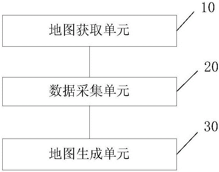
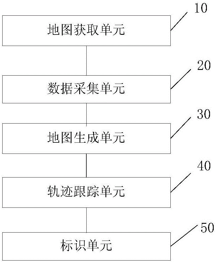
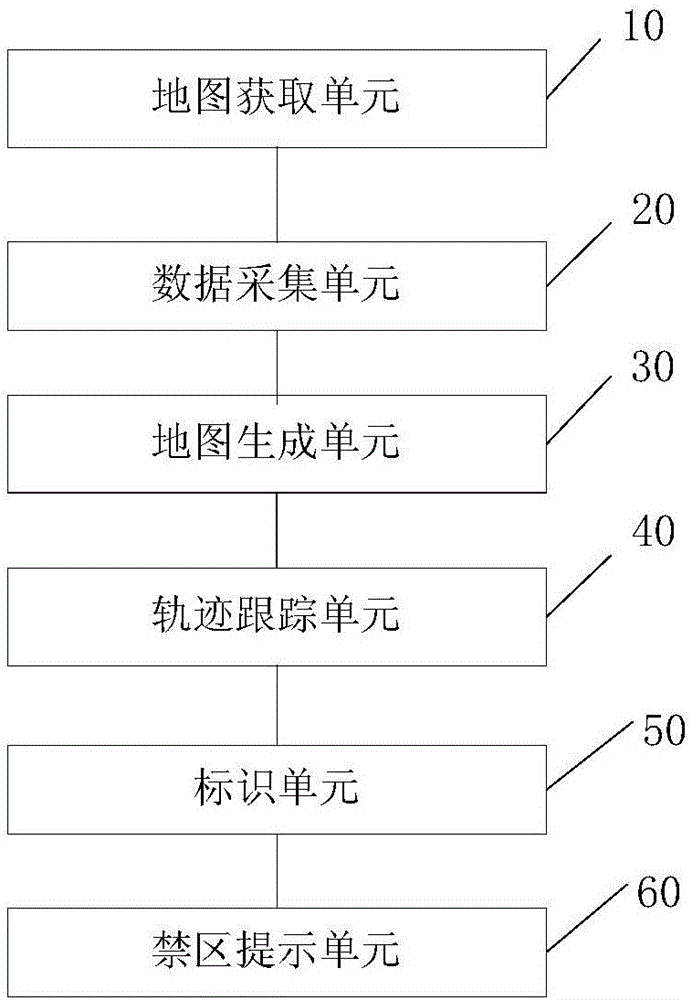
[0062] Embodiment 2 By adding a trajectory tracking unit 40, it is possible to store the longitude and latitude information of each point during the dynamic movement of the user and display its movement trajectory on the second map picture of the electronic device, that is, the movement trajectory of the corresponding athlete / user, It is convenient to analyze its movement trajectory afterwards to provide data support, and it is beneficial for participants to study the competition strategy of orienteering sports, etc. For the second map picture on the smart mobile terminal, by saving the latitude and longitude coordinates corresponding to the user's movement, the purpose of displaying its movement track during the activity or after the activity is over can be realized; for the second map picture on the electronic computer, by receiving And store the positioning data corresponding to the intelligent positioning device corresponding to the user, and convert the longitude and latit...

Embodiment 1

[0072] According to another aspect of the present invention, a method for generating a map for outdoor activities, games and tourism is also provided, which is used on an electronic computer or an intelligent mobile terminal with storage and display functions. The map for outdoor activities, games and tourism of the present invention The generation method corresponds to the above-mentioned map generation device, refer to Figure 5 , Embodiment 1 of the method of the present invention specifically includes:

[0073]Step S101, receiving the picture data corresponding to the original map for outdoor activities, outdoor games or tourism and converting it into the first map picture displayed on the computer or smart mobile terminal;

[0074] Step S102, acquire at least two points on the first map picture and display the corresponding first coordinate value on the electronic computer or smart mobile terminal and the second coordinate value corresponding to the actual geographic loca...


PUM


Abstract

The invention discloses an outdoor activity, game and tourist map generation method, device and equipment. The method comprises the following steps: receiving picture data corresponding to an original map and converting the picture data into a first map picture which is displayed on an electronic computer or an intelligent mobile terminal; acquiring corresponding first coordinate values of at least two points on the first map picture which are displayed on the electronic computer or the intelligent mobile terminal and second coordinate values corresponding to actual geographical positions; and according to a mapping relation of the first coordinate values and the second coordinate values, converting the first map picture into a second map picture which takes the geographical position as a coordinate system, and displaying the second map picture on the electronic computer or the intelligent mobile terminal. According to the outdoor activity, game and tourist map generation method provided by the invention, by combining the positioning technology, the display technology and traditional maps, the first map picture is converted into the second map picture and the second map picture is displayed on the equipment, so that users can conveniently carry out targeted directional guidance, and the method can be applied to outdoor activities, outdoor games or tourism and other fields.

Description

technical field [0001] The present invention relates to the field of outdoor sports, in particular to a method, device and equipment for generating a map for outdoor activities, games and tourism. Background technique [0002] Orienteering is to use the map and compass to visit each point indicated on the map, and the one who reaches all the points in the shortest time wins. Orienteering is usually carried out in forests, suburbs and city parks, and can also be carried out on university campuses. The development of orienteering itself as a sports project began in Northern Europe at the beginning of the 20th century, and it had gained a foothold in Finland, Norway, Sweden, and Denmark by the 1930s. In 1932 the first world orienteering competition was held. In 1961, the International Orienteering Federation (IOF) was established in Copenhagen, Denmark, and currently has 63 member countries. Orienteering is also an internationally recognized Olympic sport. Orienteering is a...

Claims


Application Information

Patent Timeline
IPC IPC(8): G06F17/30G09B29/00
CPCG06F16/29G09B29/003
Inventor 张戈零李卫军
Owner HUNAN JIANCHENG INFORMATION TECH
Learn More