
UAV navigation method, UAV and management center based on FM data broadcasting

A technology for data broadcasting and management centers, applied in radio wave measurement systems, satellite radio beacon positioning systems, instruments, etc., can solve the problem of huge network traffic consumption, achieve economical use, reduce traffic costs, and save use Effect

Active Publication Date: 2019-07-09
TSINGHUA UNIV
View PDF5 Cites 0 Cited by
  • Summary
  • Abstract
  • Description
  • Claims
  • Application Information

AI Technical Summary

Problems solved by technology

[0003] Based on this, it is necessary to address the problem of huge network traffic consumption when the management center provides route planning for UAVs, and provide a UAV navigation method based on frequency modulation data broadcasting, UAVs and management centers, wherein the method includes :

Method used


Image

  • UAV navigation method, UAV and management center based on FM data broadcasting
  • UAV navigation method, UAV and management center based on FM data broadcasting
  • UAV navigation method, UAV and management center based on FM data broadcasting

Examples


Embodiment Construction

[0055] In order to make the object, technical solution and advantages of the present invention clearer, the present invention will be further described in detail below in conjunction with the accompanying drawings and embodiments. It should be understood that the specific embodiments described here are only used to explain the present invention, not to limit the present invention.

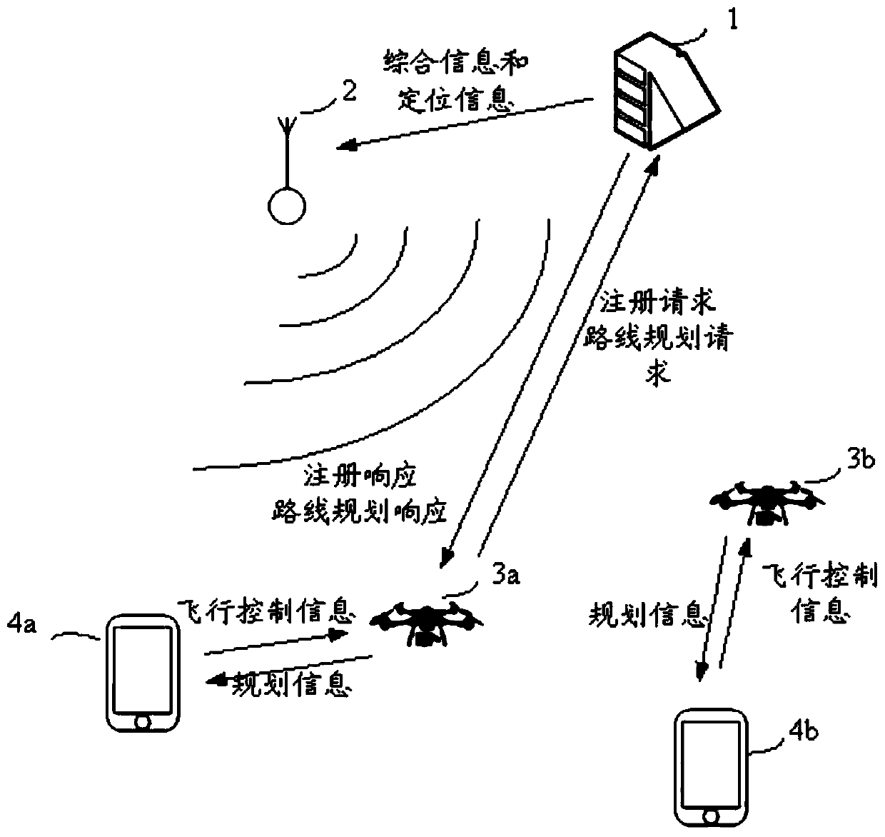
[0056] In order to solve the problem of large consumption of network resources in the traditional UAV navigation system, the present invention uses frequency modulation data broadcasting to send positioning information, which saves network connection resources and reduces user download traffic costs.

[0057] The principle of using FM radio to send UAV navigation information is as follows: In the FM frequency band, the available spectrum resources are 88-108Mhz, and this frequency band is further divided into channels of integer multiples of 100KHz, which are allocated to each radio station. In our...


PUM


Abstract

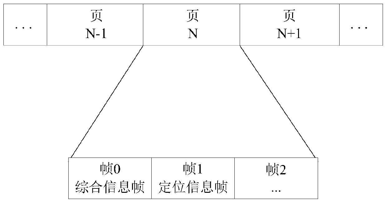
The invention provides an unmanned aerial vehicle navigation method based on frequency modulation data broadcasting, an unmanned aerial vehicle and a management center. The method comprises steps that the unmanned aerial vehicle receives and demodulates a modulation data broadcasting signal, wherein the modulation data broadcasting signal a positioning information frame and a comprehensive information frame, and the comprehensive information frame carries identification information of the management center; own flight state information of the unmanned aerial vehicle is calculated according to the positioning information frame; according to received navigation terminal position information, the own flight state information and the comprehensive information frame, a route planning request message is sent to the management center, and the received navigation terminal position information is sent by a control terminal; and a route planning response message sent by the management center is received, and the route planning response message and the own flight state information are sent to the operation terminal. According to the invention, usage of mobile communication network resources in unmanned aerial vehicle navigation is reduced and traffic cost of users is reduced.

Description

technical field [0001] The present invention relates to the technical field of UAV flight management, in particular to a UAV navigation method based on FM data broadcast, UAV and management center. Background technique [0002] The rapid development of drones has made data collection in agriculture, construction, exploration, mining, real estate, and many other industries easier and more convenient. However, while the number of UAVs in the air is increasing, huge problems have gradually arisen in terms of flight safety, management control and data processing of UAVs. In the traditional UAV management system, when the management center provides route planning services for the UAV, the UAV needs to know its own precise location information in real time, and the system uses the wireless communication network to distribute the positioning information to each and the system in real time. Connected UAVs, the amount of information interaction between UAVs and the management system...

Claims


Application Information

Patent Timeline
Patent Type & Authority Patents(China)
IPC IPC(8): G01S19/42
CPCG01S19/42
Inventor 陈曦王梦璐郑成功匡麟玲
Owner TSINGHUA UNIV
Learn More