Construction method of archaeological geophysical data visualization platform based on webgis
A technology of geophysical data and construction methods, applied in the construction of archaeological geophysical data visualization platform, can solve problems such as lack of union, achieve rapid sharing, achieve unified and effective management, and facilitate interpretation
- Summary
- Abstract
- Description
- Claims
- Application Information
AI Technical Summary
Problems solved by technology
Method used
Image

Examples
Embodiment Construction
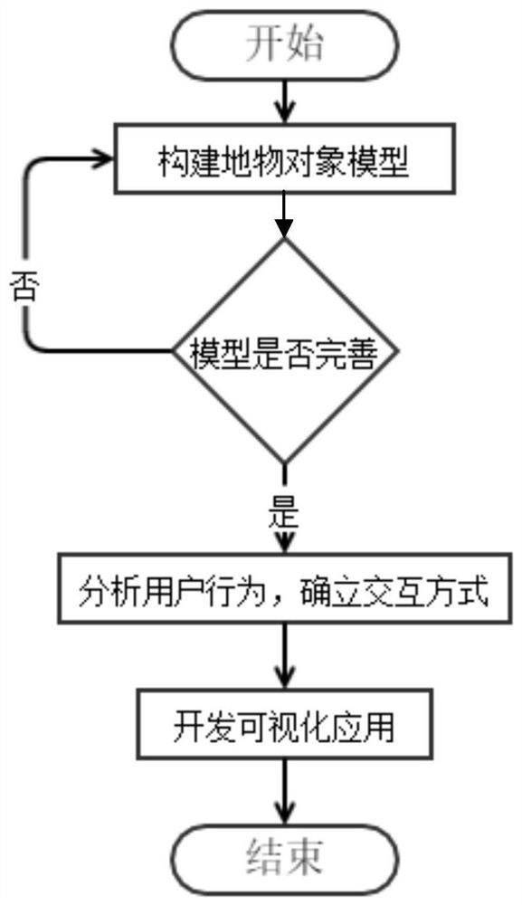
[0020] In order to make the object, technical solution and advantages of the present invention clearer, the implementation manners of the present invention will be further described below in conjunction with the accompanying drawings.
[0021] A construction method of a WebGIS-based archaeological geophysical data visualization platform of the present invention. It realizes the visual management of archaeological geophysical data through the secondary development of WebGIS, and improves the sharing and management capabilities of archaeological geophysical data.
[0022] The method specifically includes the following steps:
[0023] The models mainly include: GeophysicsMethod model, used to describe geophysical prospecting method; GeophysicsProject model, used to describe geophysical engineering; GeophysicsSurveyArea model, used to describe object detection area; GeophysicsSurveyLine model, used to describe object detection line and its profile; GeophysicsSlice model, used Use...
PUM
 Abstract
Description
Claims
Application Information
 - R&D
- Intellectual Property
- Life Sciences
- Materials
- Tech Scout
- Unparalleled Data Quality
- Higher Quality Content
- 60% Fewer Hallucinations
Browse by: Latest US Patents, China's latest patents, Technical Efficacy Thesaurus, Application Domain, Technology Topic, Popular Technical Reports.
© 2025 PatSnap. All rights reserved.Legal|Privacy policy|Modern Slavery Act Transparency Statement|Sitemap|About US| Contact US: help@patsnap.com