An Automatic Classification Method for Layered Rock Slope Types
A technology for automatic division of rocky slopes, applied in the field of geographic information technology applications, can solve problems such as difficult to meet the needs of large-scale slope type division, low degree of automation, time-consuming and labor-intensive, etc.
- Summary
- Abstract
- Description
- Claims
- Application Information
AI Technical Summary
Problems solved by technology
Method used
Image
Examples
Embodiment
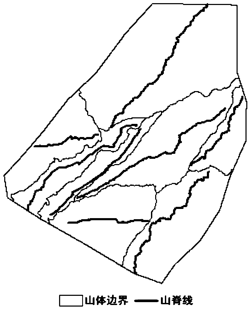
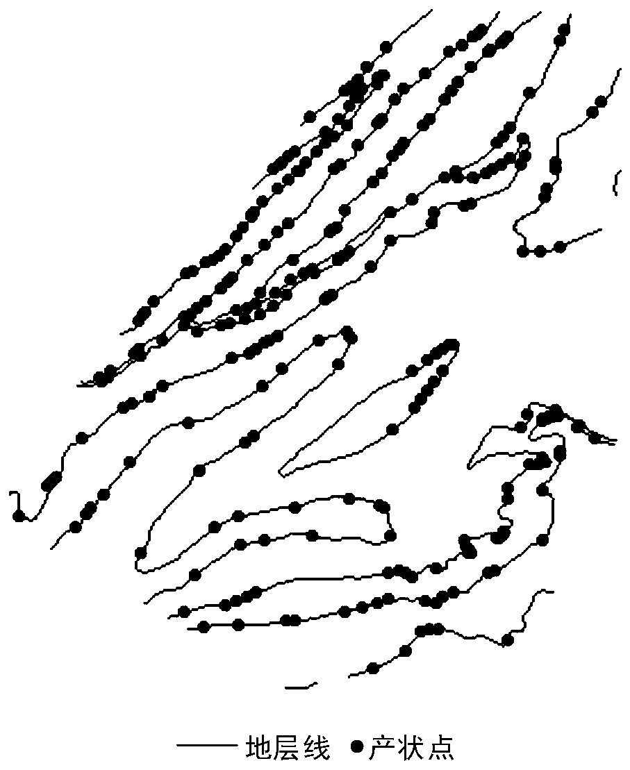
[0066] The experimental data of this example comes from the DEM data of the northern mountainous area of Lushan Mountain, and the grid size is 2162×2260. Based on the DEM data source, extract the ridgeline (such as figure 2 ), valley line and contour line data; then extract basin boundary surface data with inverse terrain DEM, and then automatically extract mountain boundary surface data based on ridge lines and valley lines (such as figure 2 ); Finally, combine the contour line and geological surface data to calculate the occurrence information of rock formations (such as image 3 ). The effects of the present invention will be further illustrated below by describing an example of automatically classifying layered rock slope types in conjunction with the accompanying drawings.
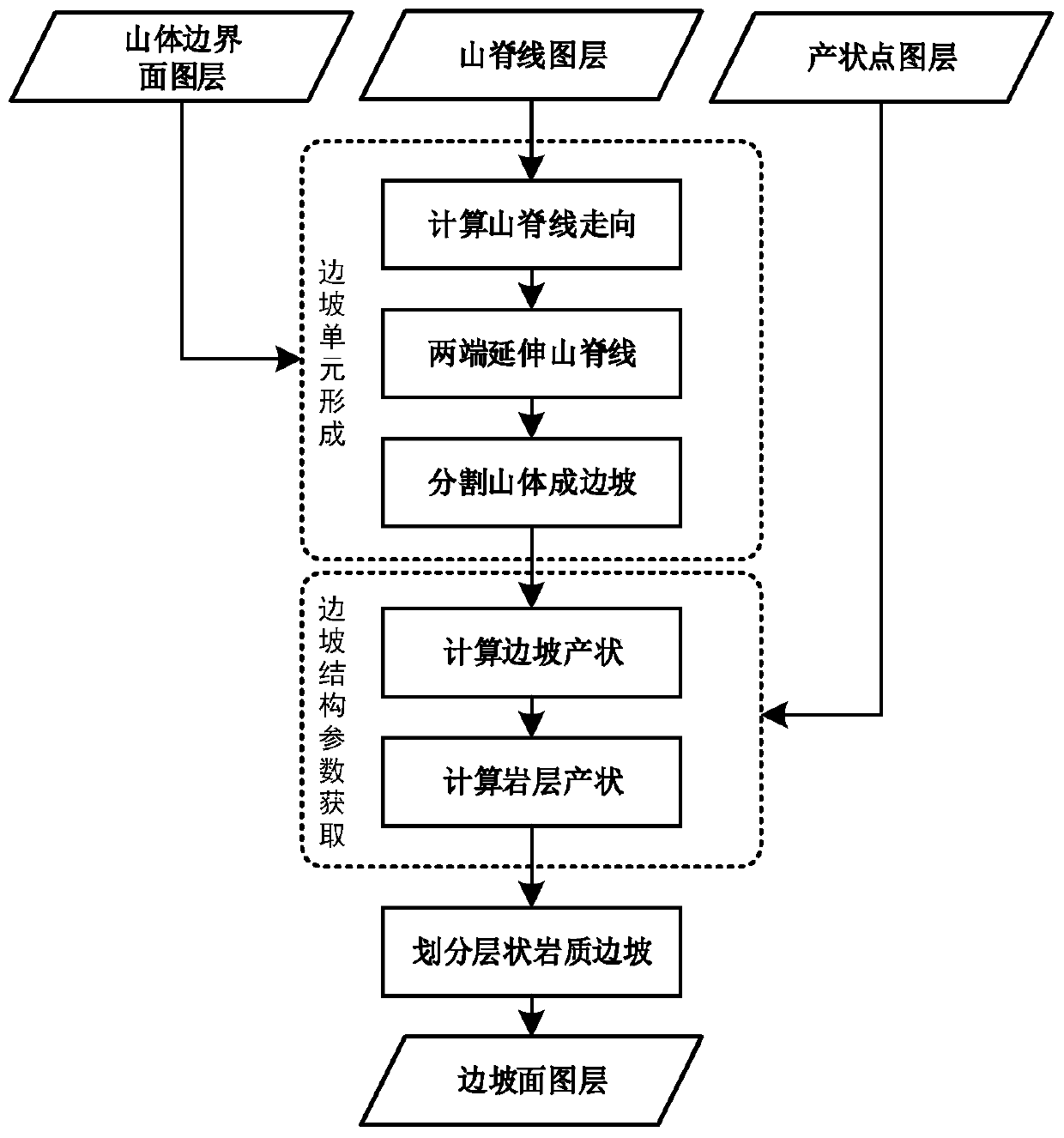
[0067] Such as figure 1 As shown, in this embodiment, the automatic division method of layered rock slope type includes the following steps:
[0068] Step (1), specifically includes:
[0069]...
PUM
 Abstract
Description
Claims
Application Information
 - R&D
- Intellectual Property
- Life Sciences
- Materials
- Tech Scout
- Unparalleled Data Quality
- Higher Quality Content
- 60% Fewer Hallucinations
Browse by: Latest US Patents, China's latest patents, Technical Efficacy Thesaurus, Application Domain, Technology Topic, Popular Technical Reports.
© 2025 PatSnap. All rights reserved.Legal|Privacy policy|Modern Slavery Act Transparency Statement|Sitemap|About US| Contact US: help@patsnap.com


