Gyroscope-based GPS packet capture time interval determination method during curve driving process

A technology of time interval and determination method, applied in the directions of instruments, satellite radio beacon positioning systems, measuring devices, etc., can solve the problem of discrepancy between the drawn path of the CD segment and the actual path, and achieve the effect of ensuring driving safety and obtaining accurate positioning data.

Active Publication Date: 2017-12-22
小花网络科技(深圳)有限公司
View PDF4 Cites 2 Cited by
  • Summary
  • Abstract
  • Description
  • Claims
  • Application Information

AI Technical Summary

Problems solved by technology

It can be seen that in the three cases of AB (straight line), BC (large radius turn), and CD (small radius turn), there is basically no error in the AB and BC segments, and the drawn path of the CD segment is seriously inconsistent with the actual path

Method used


Image

  • Gyroscope-based GPS packet capture time interval determination method during curve driving process
  • Gyroscope-based GPS packet capture time interval determination method during curve driving process
  • Gyroscope-based GPS packet capture time interval determination method during curve driving process

Examples


Embodiment Construction

[0047] The technical solutions of the present invention will be described in further detail below with reference to the accompanying drawings and embodiments.

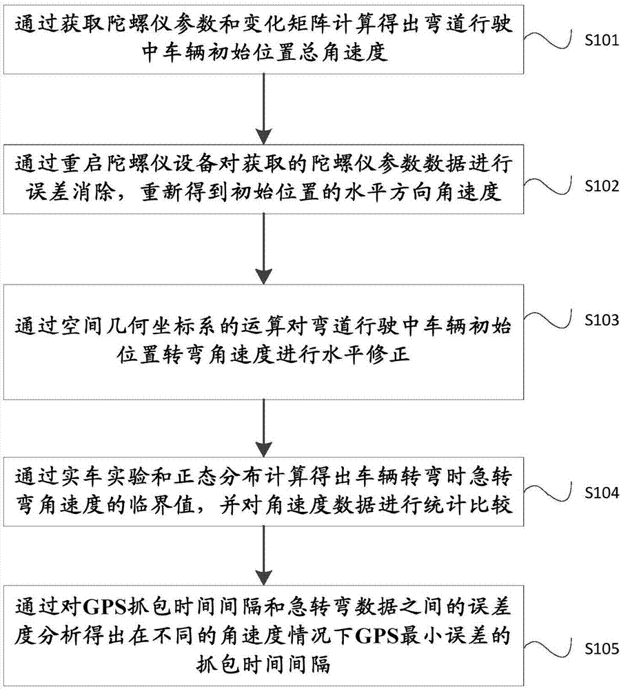
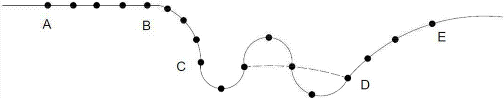
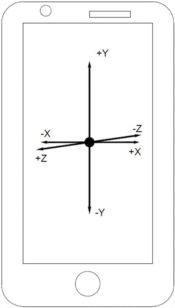
[0048] The present invention provides a method for determining the time interval of GPS capturing packets based on the gyroscope in the curve driving process, such as figure 1 , Figure 3 ~ Figure 7 As shown, a preferred embodiment of the present invention is shown therein. Specifically, the method for determining the time interval of GPS packet capture includes the following steps:

[0049] In step S101, the total angular velocity of the initial position of the vehicle during the curve is calculated by obtaining the gyroscope parameters and the change matrix.

[0050] Step S102, by restarting the gyroscope device, performing error elimination on the acquired gyroscope parameter data, and obtaining the horizontal angular velocity at the initial position again.

[0051] Step S103, perform horizontal correction on th...


PUM


Abstract

The present invention relates to a gyroscope-based GPS packet capture time interval determination method during a curve driving process. The method comprises the steps of obtaining the parameters of a gyroscope and a change matrix to calculate the total angular velocity at a vehicle initial position during the curve driving; restarting the gyroscope to eliminate the error of the obtained gyroscope parameter data, and obtaining the horizontal direction angular velocity at the initial position again; carrying out the horizontal correction on the turning angular velocity at the vehicle initial position during the curve driving by the operation of a spatial geometric coordinate system; obtaining the critical value of the sharp turning angular velocity at vehicle turning by a real vehicle experiment and the normal distribution calculation, and gathering and comparing the angular velocity data; analyzing the degree of error between the GPS packet capture time interval and sharp turning data to obtain the packet capture time interval of a GPS minimum error on different angular velocity conditions. The method of the present invention can remind the users to decelerate timely during the driving process, guarantees the curve driving safety, at the same time, enables a mobile phone APP to obtain the positioning data more accurately.

Description

technical field [0001] The invention relates to a method for determining the time of capturing packets by GPS, in particular to a method for determining the time interval of capturing packets by GPS in the process of driving on a curve based on a gyroscope. Background technique [0002] With the rapid development of modern society, there are more and more vehicles on the road. At the same time, the requirements for vehicle positioning and humanized safe driving are also getting higher and higher. During normal driving, vehicles sometimes make sharp turns, and they will also connect to GPS satellites. Locate navigation. When the vehicle is turning sharply, we can humanize prompt the user to slow down and inform the user that it is making a sharp turn. At present, in the actual market, the time for GPS positioning and packet capture is 5s to obtain vehicle location information once. When the vehicle is going straight at a constant speed, the drawn route is generally closer t...

Claims


Application Information

Patent Timeline
IPC IPC(8): G01S19/37
CPCG01S19/37
Inventor 鄢栋云
Owner 小花网络科技(深圳)有限公司
Why Eureka
Try Eureka