Horizontal plane identifying and real-time water level measuring method based on image processing

An image processing and real-time measurement technology, applied in image data processing, image enhancement, image analysis and other directions, can solve the problems of being easily disturbed by the surrounding environment, difficult to determine the position of the horizontal plane, and labor-intensive, and achieve high numerical robustness and reliability. The effect of real-time interactivity

Inactive Publication Date: 2018-03-23
NANJING UNIV OF POSTS & TELECOMM
View PDF3 Cites 18 Cited by
  • Summary
  • Abstract
  • Description
  • Claims
  • Application Information

AI Technical Summary

Problems solved by technology

However, due to the influence of external factors such as light and environment, most of the video monitoring methods only use the real-time browsing of video, video recording and playback of historical records. It consumes a certain amount of manpower and material resources, and does not maximize the role of the existing monitoring system
The water level sensor has disadvantages such as high cost, difficult maintenance and being easily disturbed by the surrounding environment, which cannot meet the current needs
[0003] When using the traditional method to measure the water level, the position of the horizontal plane is often determined by human eye observation. When the daytime is backlit or the evening light is insufficient, there are often situations where the measurement benchmark and its reflection in the water are blurred and difficult to distinguish. This makes it difficult to determine the position of the horizontal plane

Method used


Image

  • Horizontal plane identifying and real-time water level measuring method based on image processing
  • Horizontal plane identifying and real-time water level measuring method based on image processing
  • Horizontal plane identifying and real-time water level measuring method based on image processing

Examples


Embodiment Construction

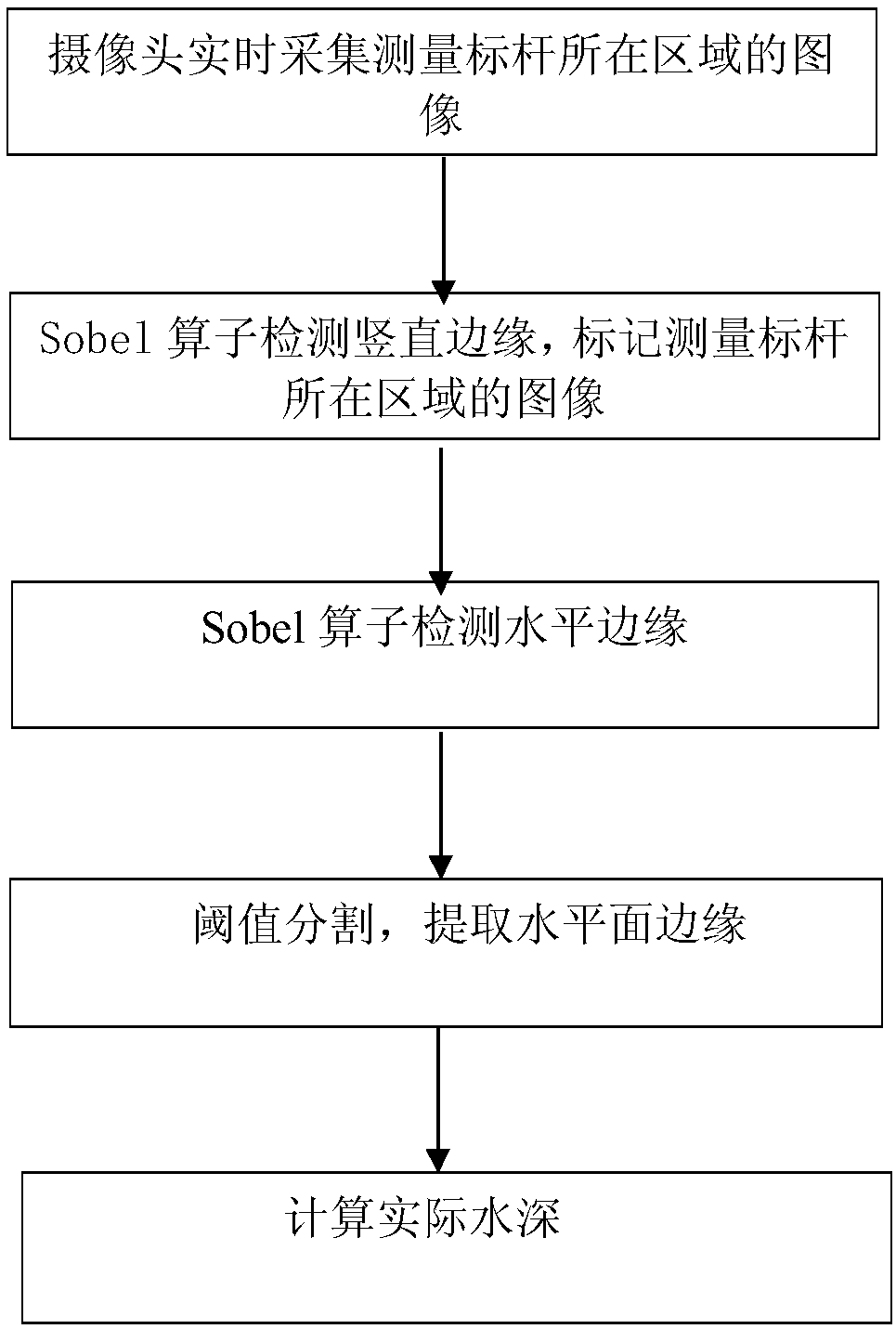
[0033] The invention discloses a horizontal plane detection method based on computer vision and image processing technology. The invention will be further described below in conjunction with the accompanying drawings. Such as figure 1 Shown mainly includes several steps:

[0034] step one:

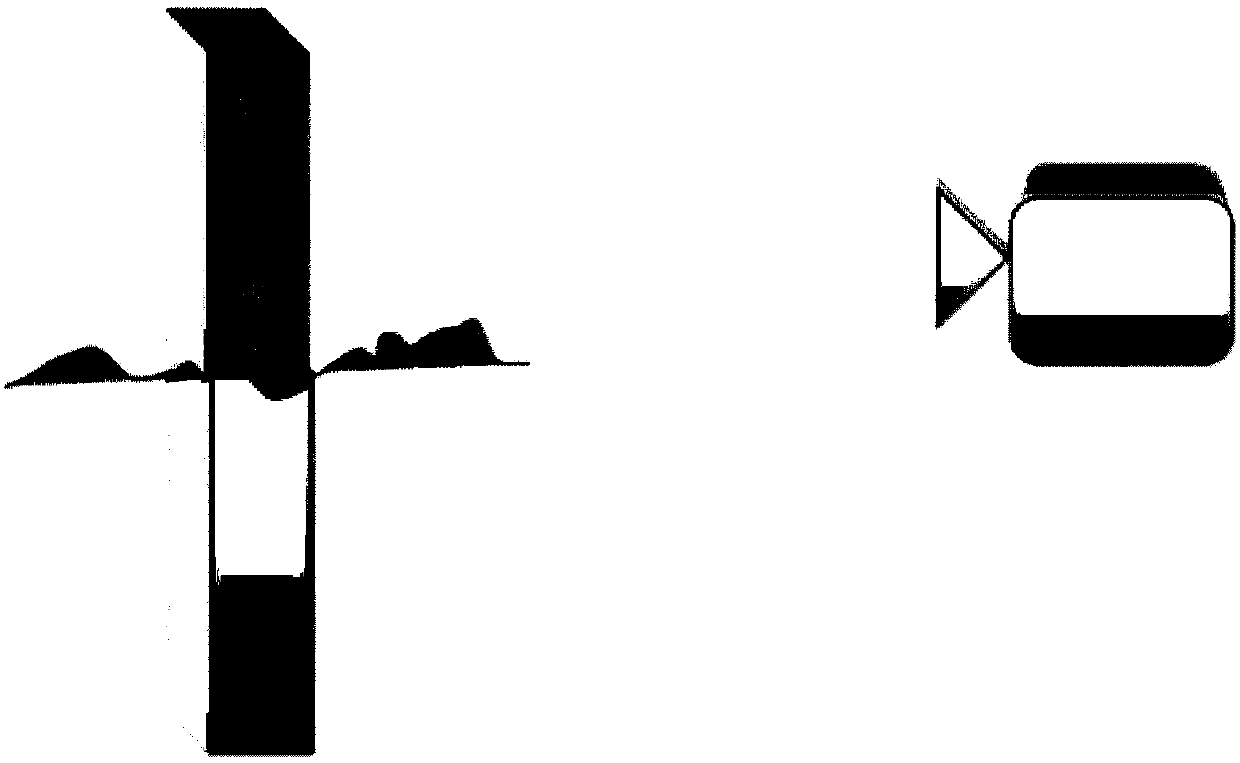
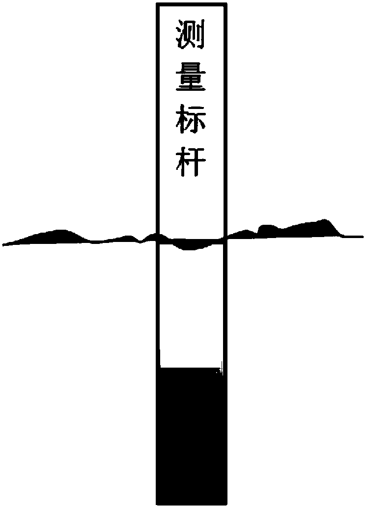
[0035] Such as figure 2 As shown in , fix a rectangular mark without scale in the water area to be tested, and collect the image A of the area where the mark is located in real time through the camera, as shown in image 3 shown;

[0036] Step two:

[0037] Use the Sobel horizontal edge detection operator to filter the collected image A, extract the coordinates of the vertical edge line of the measurement benchmark, and mark the image of the area where the measurement benchmark is located; Figure 4 as shown,

[0038] 2.1: Use the Sobel vertical edge detection operator to filter the collected image A to obtain the gradient image Gx in the vertical direction:

[0039]

[0040] 2....


PUM


Abstract

The invention discloses a horizontal plane identifying and real-time water level measuring method based on image processing. The method aims at detecting the horizontal plane, an image vertical edge detection technology in an image processing technology is used to detect a water level measuring scale, the water level is detected via an image vertical edge detection technology, and real-time waterdepth data is calculated according to pixel values of the water plane and practical length and width information of a mark post. Thus, the position of a water line can be determined accurately, the real-time water depth can be measured, the problems that the horizontal plane is hard to detect, detection tends to be influenced by natural environment, the measuring precision is not high and the likein traditional schemes are solved, and the method has application values in the process of water resource management. The scale which is inserted into the water body is detected correctly to determine the water level, and the problems that the horizontal plane is hard to distinguish, operation is inconvenient and measuring errors are large due to weather, light and the like in traditional image processing based methods are solved.

Description

technical field [0001] The invention belongs to the field of computer vision image processing, in particular to a water level recognition and water level real-time measurement method based on image processing. Background technique [0002] Due to the importance of water security and water resources to social and economic development, domestic water conservancy departments need to take measures to monitor local water level safety. The current main measures include: establishing video surveillance systems in rivers, lakes, reservoirs and other areas; A water level sensor is used to automatically obtain the water level. However, due to the influence of external factors such as light and environment, most of the video monitoring methods only use the real-time browsing of video, video recording and playback of historical records. It takes a certain amount of manpower and material resources, and the effect of the existing monitoring system is not maximized. The water level senso...

Claims


Application Information

Patent Timeline
Patent Type & Authority Applications(China)
IPC IPC(8): G06T7/00G06T7/13G06T7/136
CPCG06T7/0004G06T7/13G06T7/136G06T2207/30181G06T2207/30208
Inventor 董恒樊亚萍桂冠熊健范山岗杨洁陆智鹏
Owner NANJING UNIV OF POSTS & TELECOMM
Why Eureka
Try Eureka