Real-time level monitoring method based on image processing

An image processing and real-time monitoring technology, which is applied to level indicators, instruments, characters, and pattern recognition of level members, can solve problems such as large errors and inconvenient operations, and achieve high numerical robustness and real-time interactivity.

Inactive Publication Date: 2017-09-05
NANJING UNIV OF POSTS & TELECOMM
View PDF4 Cites 20 Cited by
  • Summary
  • Abstract
  • Description
  • Claims
  • Application Information

AI Technical Summary

Problems solved by technology

[0005] The invention overcomes the disadvantages of inconvenient operation and relatively large error of the traditional detection method with a scaled benchmark, and provides a real-time water level monitoring method based on image processing

Method used


Image

  • Real-time level monitoring method based on image processing
  • Real-time level monitoring method based on image processing
  • Real-time level monitoring method based on image processing

Examples


Embodiment Construction

[0036] Below in conjunction with accompanying drawing, technical scheme of the present invention is described in further detail:

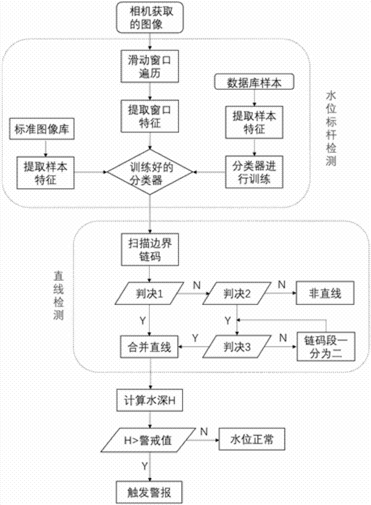
[0037] The invention discloses a real-time monitoring method of water level based on image processing, such as figure 1 As shown, the specific steps are as follows:

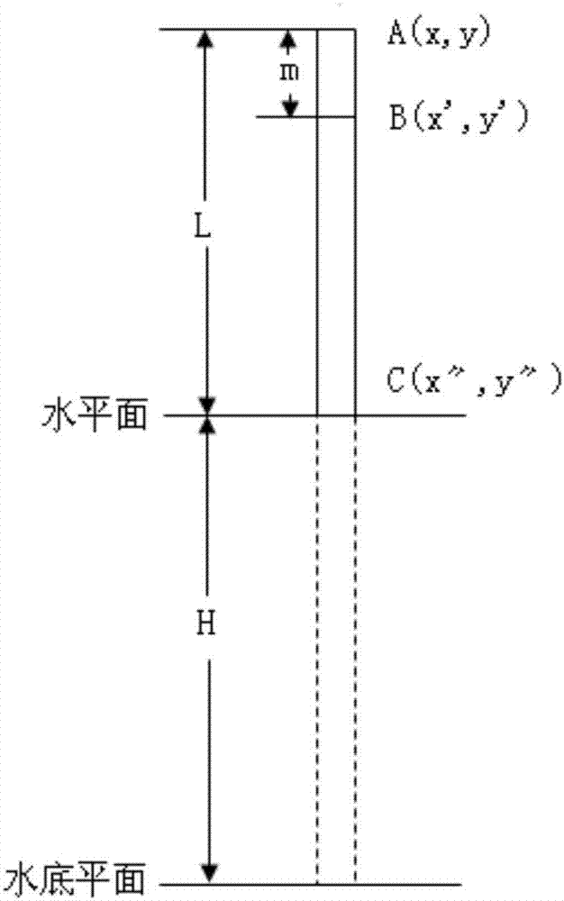
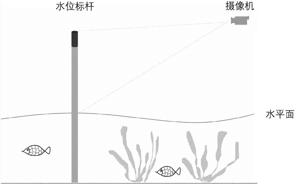
[0038] One, such as figure 2 As shown, fix a pole in the watershed to be measured, and make a red mark on the top of the pole. The image of the area where the landmark is located is collected in real time by the camera, such as image 3 shown.

[0039] 2. Use the object automatic detection technology in image processing to detect the images collected in (1), and extract the benchmark images exposed to the water surface, such as Figure 4 shown.

[0040] 1): Preprocess the benchmark image collected by the camera, perform color space conversion (LUV conversion) to obtain each image channel, calculate the integral map, and perform feature construction and extraction on the channel....


PUM


Abstract

The invention discloses a real-time level monitoring method based on image processing; by combining the image processing technique in computer vision and the traditional method of measuring water depth by a marker post, the problems of the traditional methods, such as the need for manual checkout of graduation on the marker post, inconvenience of operation, great errors, and susceptibility of the marker post to abrasion. An acquired image is simplified into a mathematical model by means of object detection and line detection techniques in image processing, length ratio of segments in the model is calculated, a height of the marker post above the water surface is attained according to a reserved reference length of the marker post, and accordingly real-time water depth is acquired. The problems of the traditional schemes are solved, and the method has higher numerical robustness and real-time interactivity.

Description

technical field [0001] The invention relates to a real-time water level monitoring method based on image processing, in particular to a real-time water level monitoring method using object detection technology and a line detection algorithm through image processing, belonging to the field of computer vision image processing. Background technique [0002] The contact distance measurement adopted by the traditional distance measurement system is affected by external factors such as installation and environment, and its measurement accuracy is far behind that of the non-contact distance measurement system. At present, non-contact underwater ranging is mainly completed by traditional ranging technologies such as ultrasonic ranging, laser ranging, and electromagnetic ranging. According to different measurement ranges and accuracy requirements, surveyors select corresponding distance measurement tools for distance measurement work in specific environments. However, due to the inf...

Claims


Application Information

Patent Timeline
Patent Type & Authority Applications(China)
IPC IPC(8): G01F23/04G06K9/00
CPCG01F23/04G06V20/10
Inventor 桂冠朱颖熊健杨洁华文韬
Owner NANJING UNIV OF POSTS & TELECOMM
Why Eureka
Try Eureka