

Ground elevation three-dimensional laser scanner and scanning method
A three-dimensional laser and ground elevation technology, applied in the direction of instruments, height/level measurement, and measuring devices, can solve the problems of insufficient height measurement accuracy, no stable reference, and inconvenient use, so as to overcome instability, intuitive data, good stability effect
- Summary
- Abstract
- Description
- Claims
- Application Information
AI Technical Summary
Problems solved by technology
Method used
Image

Examples
Embodiment Construction
[0040] The present invention will be further described below in conjunction with the accompanying drawings.
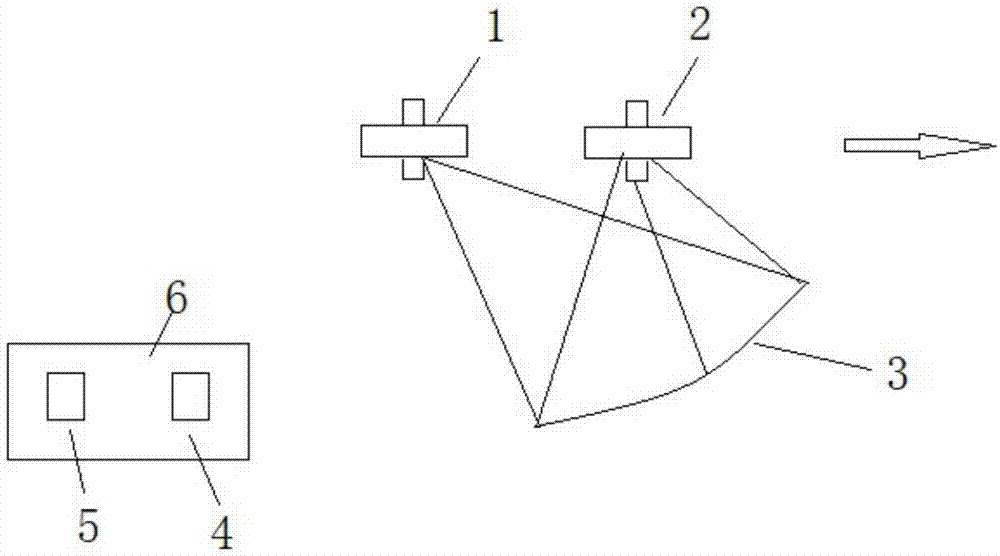
[0041] Such as figure 1 As shown, a ground elevation three-dimensional laser scanner provided by the present invention includes an aerial flight scanning component, a ground control component, and a latitude and longitude collector.
[0042] The aerial flight scanning assembly includes a No. 1 aircraft 1 and a No. 2 aircraft 2. The aircraft selected in this embodiment are unmanned aerial vehicles, wherein the No. 1 aircraft 1 is equipped with a laser marking image acquisition device, and the No. 2 aircraft 2 is equipped with a laser marking image acquisition device. Equipped with a laser marking generator, the scanning directions indicated by the arrows in the figure 1 and 2 of the first aircraft 1 and the second aircraft 2 fly synchronously one after the other. quite high.
[0043] The laser marking generator projects laser light to the ground to be measured. In thi...
PUM
 Abstract
Description
Claims
Application Information