

A surveying and mapping method and system and a terminal device
A technology for surveying and mapping poles and plots, applied in the field of surveying and mapping, can solve the problems of low surveying and mapping accuracy and efficiency, and achieve the effect of improving the surveying and mapping accuracy and efficiency.
- Summary
- Abstract
- Description
- Claims
- Application Information
AI Technical Summary
Problems solved by technology
Method used
Image

Examples
Embodiment 1
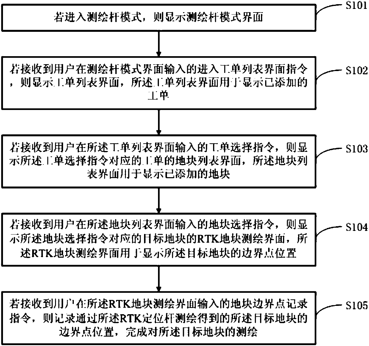
[0031] like figure 1 As shown, this embodiment provides a surveying and mapping method. The method can be specifically applied to smart terminals such as mobile phones, tablet computers, personal digital assistants, and PC clients. software program.
[0032] In a specific application, the surveying and mapping method can be used for surveying and mapping of the plant protection operation plot of the drone, and can also be applied to the surveying and mapping of any object that needs to be surveyed and mapped.
[0033] The surveying and mapping method provided in this embodiment includes:
[0034] Step S101: If entering the surveying pole mode, display the surveying pole mode interface.
[0035] In a specific application, the surveying pole mode is specifically used to set the status information of the RTK positioning pole. The working mode entered after the software program is turned on depends on the working mode set before it was closed last time or the working mode corre...
Embodiment 2
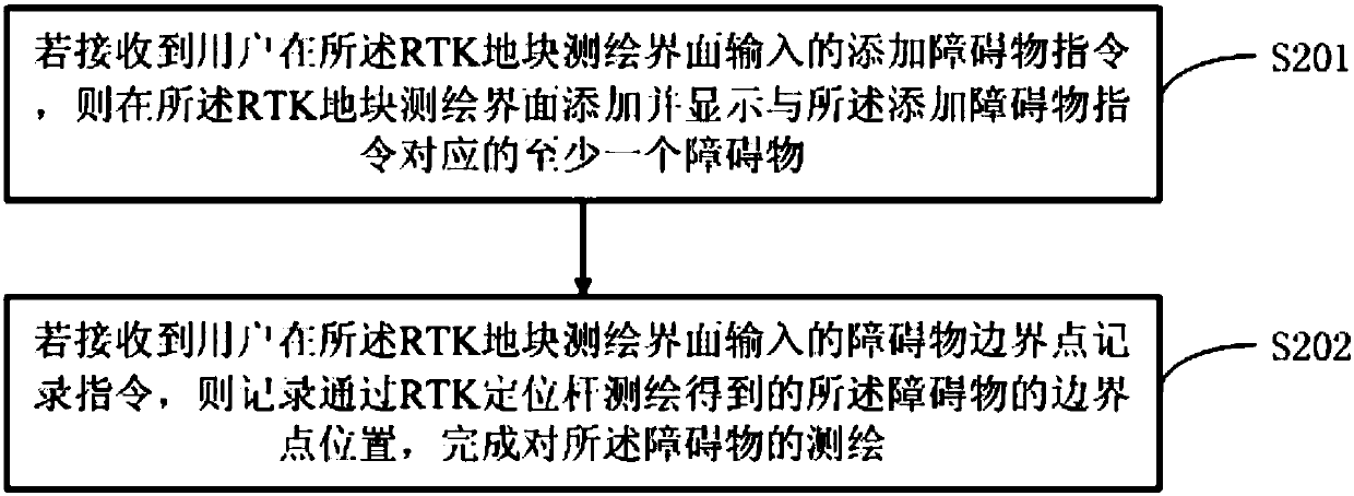
[0066] like figure 2 As shown, in this embodiment, after step S105 in Embodiment 1, it includes:
[0067] Step S201: If an instruction to add an obstacle input by the user on the RTK land plot surveying and mapping interface is received, then add and display at least one obstacle corresponding to the instruction to add an obstacle on the RTK land parcel surveying and mapping interface.
[0068] In a specific application, the RTK plot surveying and mapping interface is provided with a corresponding virtual button for inputting an instruction to add obstacles to add at least one obstacle to the obstacle list corresponding to the target plot. The obstacle list includes completed or unfinished Obstacles that have been mapped, the obstacle list can also be empty (that is, there are no obstacles). On the obstacle list, obstacles can be sorted in the order in which they are added and the number of obstacles can be displayed. For example, obstacles 001, 002, 003, etc. can be display...
Embodiment 3
[0074] In this embodiment, before step S101 in the first embodiment, it includes:
[0075] Step S301: If a communication connection relationship is established with the reference station set up by the user at the designated reference point position, enter the setting interface when receiving the setting instruction input by the user on the main interface.
[0076] In a specific application, after the user assumes a base station at a pre-recorded designated location, the current terminal is controlled by a software program to search and connect to the base station, and the user checks whether the current terminal is in the base station mode, if not, The user manually enters the setting command, enters the setting interface, sets the current working mode as the base station mode, and configures and saves the base station information according to actual needs; if the base station at the same specified location has been configured before, and If the relevant configuration informat...
PUM
 Abstract
Description
Claims
Application Information