Multi-aircraft cooperative high-precision mapping and positioning system for unmanned aerial vehicles

A positioning system and unmanned aerial vehicle technology, applied in control/adjustment system, vehicle position/route/height control, three-dimensional position/channel control, etc., to achieve the effect of high mapping accuracy, short planning time and accurate positioning

Pending Publication Date: 2020-11-27
HARBIN INST OF TECH
View PDF12 Cites 9 Cited by
  • Summary
  • Abstract
  • Description
  • Claims
  • Application Information

AI Technical Summary

Problems solved by technology

[0003] The present invention aims to solve the problem that the existing mapping and positioning process (simultaneous localization and mapping, SLAM)

Method used


Image

  • Multi-aircraft cooperative high-precision mapping and positioning system for unmanned aerial vehicles
  • Multi-aircraft cooperative high-precision mapping and positioning system for unmanned aerial vehicles

Examples


specific Embodiment approach 1

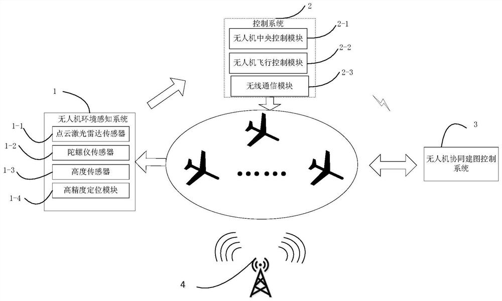
[0033] Specific implementation mode one: the following combination figure 1 and figure 2 This embodiment is described. A multi-machine cooperative high-precision mapping and positioning system for UAVs described in this embodiment includes a UAV environment perception system 1, a control system 2, a UAV cooperative mapping control system 3 and a communication system. System 4;

[0034] The communication system 4 includes a communication base station, and a wireless local area network is established through the wireless base station, and the wireless local area network covers the target area;

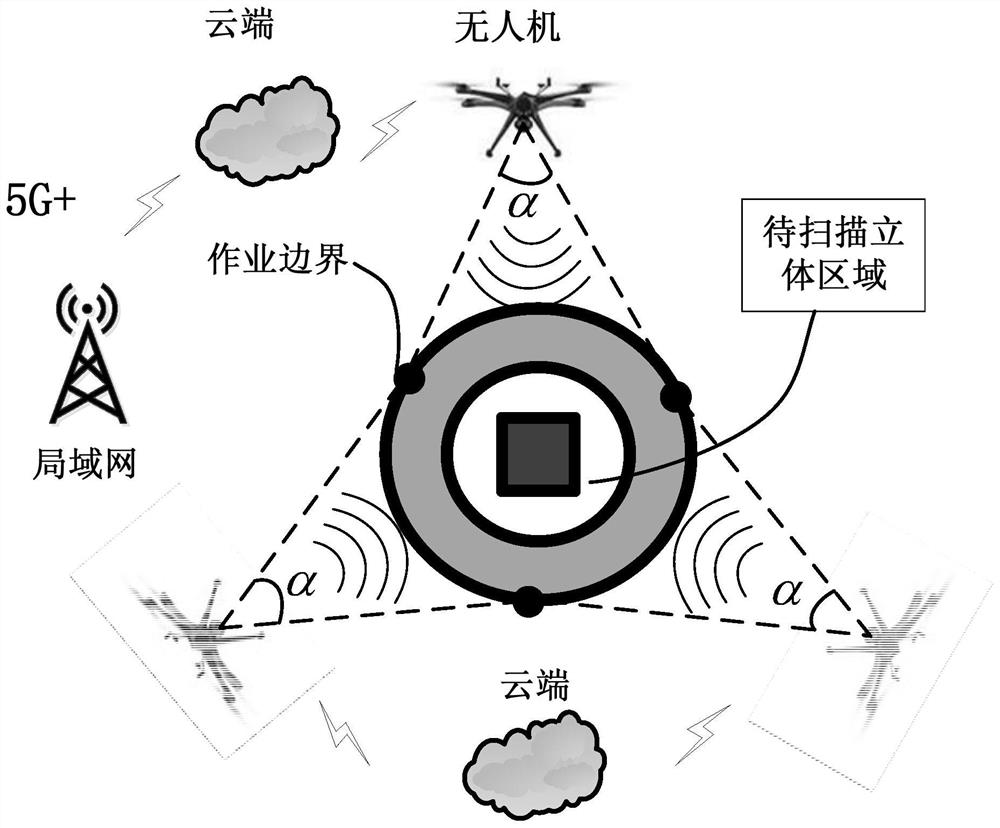
[0035] UAV environment perception system 1 adopts point cloud scanning to obtain point cloud data of the target area, UAV height data and UAV positioning data;

[0036] The control system 2 is used to control the flight speed, angle and pose of each drone according to the positions of multiple drones at different times;

[0037] UAV cooperative mapping control system 3 is used to pla...


PUM


Abstract

The invention discloses a multi-aircraft cooperative high-precision mapping and positioning system for unmanned aerial vehicles, belongs to the field of algorithms of unmanned aerial vehicle cluster control strategy planning, particularly relates to a multi-aircraft cooperative mapping and positioning system for the unmanned aerial vehicles, and solves the problem that in the existing mapping process, mapping of the dynamic environment cannot be achieved stereoscopically and rapidly. The multi-aircraft cooperative high-precision mapping and positioning system comprises a communication base station, a wireless local area network is established through utilizing the wireless base station, and the wireless local area network covers a target region; an unmanned aerial vehicle environment sensing system acquires target region point cloud data, unmanned aerial vehicle height data and unmanned aerial vehicle positioning data in a point cloud scanning mode; a control system is used for controlling the flight speed, angle and pose of each unmanned aerial vehicle according to the positions of the multiple unmanned aerial vehicles at different moments; and an unmanned aerial vehicle cooperative mapping control system plans flight paths of the unmanned aerial vehicles according to the target region, establishes a coordinate system, and fuses the point cloud data scanned by the multiple unmanned aerial vehicles to obtain a three-dimensional image of the target area. The multi-aircraft cooperative high-precision mapping and positioning system is suitable for mapping of unknown regions.

Description

technical field [0001] The invention belongs to the algorithm field of unmanned aerial vehicle cluster control strategy planning, and in particular relates to an unmanned aerial vehicle multi-machine collaborative mapping positioning system. Background technique [0002] As a new technology, UAV (Unmanned Aerial Vehicle, UAV) can play an important role in a variety of scenarios due to its flexible maneuverability, low cost, and less constraints on the ground terrain, especially in 3D point cloud mapping. Environmental impact is small. In order to quickly realize high-precision mapping in a complex 3D scene environment, the collaborative control of multiple UAVs and high-precision mapping are still a difficult point. For UAV multi-machine collaboration, it is still difficult to solve the overall coordination of collaborative mapping, task assignment and path planning in a specific area, so that the optimal allocation of UAV resources cannot be quickly realized. Contents of...

Claims


Application Information

Patent Timeline
IPC IPC(8): G05D1/10
CPCG05D1/104Y02T10/40
Inventor 孙光辉付金宇李晓磊刘越
Owner HARBIN INST OF TECH
Why Eureka
Try Eureka