Method for photography positioning by UAV rotary/high/top common digital camera cooperated with GPS/RTK/CORS

A digital camera and building roof technology, applied in photogrammetry/video metrology, measuring devices, instruments, etc., can solve the problems of complex field measurement operations and low measurement efficiency, so as to liberate field workload and improve measurement Efficiency, avoiding the effect of line of sight

Inactive Publication Date: 2018-05-29
北京地林远景信息技术有限公司
View PDF10 Cites 2 Cited by
  • Summary
  • Abstract
  • Description
  • Claims
  • Application Information

AI Technical Summary

Problems solved by technology

[0003] ① The field measurement operation is relatively complicated, and only single-point measurement can be realized, and multiple station relocations are required
[0004] ② Field measurement requires good visibility conditions, and there is nothing you can do if the line of sight is...

Method used


Image

  • Method for photography positioning by UAV rotary/high/top common digital camera cooperated with GPS/RTK/CORS
  • Method for photography positioning by UAV rotary/high/top common digital camera cooperated with GPS/RTK/CORS

Examples


Embodiment Construction

[0017] Compared with the existing coordinate point positioning method, a method using ordinary digital camera method combined with GPS / RTK / CORS photography positioning method in the case of UAV spinning in the sky / high ground / roof has made a greater effort in the operation process and calculation model. Improvements and innovations, specifically:

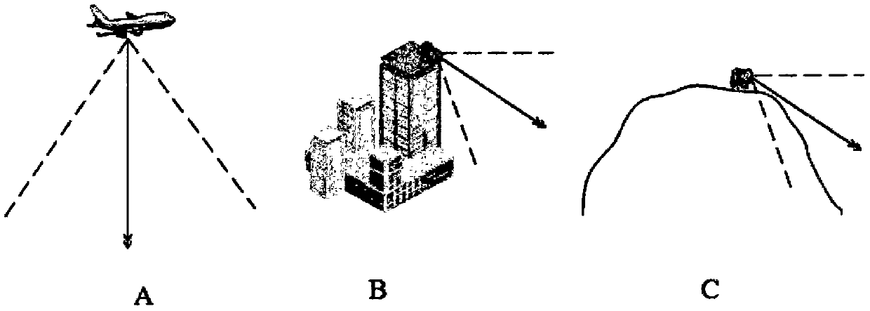
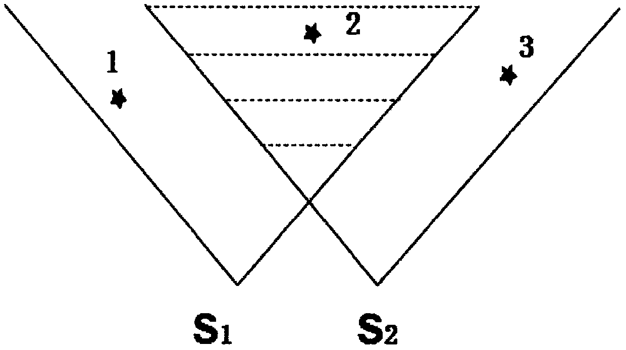
[0018] (1) if figure 1 As shown, for the three photogrammetry situations of UAV gyration / high ground / roof, first, determine the location of the measurement area, and select the high-level viewing point S 1 , S 2 As the shooting site, the three-dimensional object coordinates (X s1 , Y s1 ,Z s1 ) and (X s2 , Y s2 ,Z s2 );

[0019] (2) Use a fixed-focus ordinary digital camera (with a focal length of f) to take pictures of the target area to be measured, among which, it is necessary to ensure that there are more than 2 control points in each camera photo, and at the same time measure all control points with the help of GPS / RTK / ...


PUM


Abstract

The invention discloses a method for photography positioning by UAV rotary/highland/roof common digital cameras cooperated with GPS/RTK/CORS. According to the method, according to different photogrammetry conditions of UAV rotary/highland/roof and the like, by means of GPS / RTK / CORS, high intervisible points S1 and S2 are selected as camera sites, three-dimensional object space coordinates (Xs1, Ys1, Zs1) and (Xs2, Ys2, Zs2) of the two camera sites can be determined, three-dimensional coordinates of image control points can also be determined, two or more control points in each camera photographic image can be ensured, by cooperation of object space coordinates of the two or more control points in a photographing area, three Euler angles Phi, Omega and Kappa corresponding to the photographic image can be obtained by resection and least squares method, and finally, by use of a stereo image pair formed by photogrammetry, three-dimensional object space coordinates (X, Y, Z) of any image point in the photographing area are obtained, and any coordinate point in the photographing area can be positioned.

Description

1. Technical field [0001] The invention relates to a method for photographic positioning of ground points, in particular to a method for realizing photographic positioning by using an ordinary digital camera in cooperation with GPS / RTK / CORS when an unmanned aerial vehicle (UAV) spins in the air / high ground / roof of a building. 2. Technical background [0002] Judging from the development status at home and abroad, photogrammetry technology has been applied in all walks of life, including surveying and mapping and non-surveying and mapping fields. So far, point positioning generally adopts the method of ground surveying and mapping measurement, but this surveying and mapping method has more or less shortcomings and deficiencies, mainly reflected in: [0003] ① The field measurement operation is relatively complicated, and only single-point measurement can be realized, and multiple station relocations are required. [0004] ② Field measurement requires good conditions of visib...

Claims


Application Information

Patent Timeline
IPC IPC(8): G01C11/00
CPCG01C11/00
Inventor 冯仲科刘金成邱梓轩
Owner 北京地林远景信息技术有限公司
Why Eureka
Try Eureka