Distributed kalman filter architecture for carrier range ambiguity estimation

A Kalman filter, ambiguity technology, applied in the direction of instruments, radio wave measurement systems, measurement devices, etc.

Active Publication Date: 2018-07-03
U-BLOX
View PDF15 Cites 6 Cited by
  • Summary
  • Abstract
  • Description
  • Claims
  • Application Information

AI Technical Summary

Problems solved by technology

This poses a problem for implementation on GNSS receivers with limited processing resources

Method used


Image

  • Distributed kalman filter architecture for carrier range ambiguity estimation
  • Distributed kalman filter architecture for carrier range ambiguity estimation
  • Distributed kalman filter architecture for carrier range ambiguity estimation

Examples


Embodiment Construction

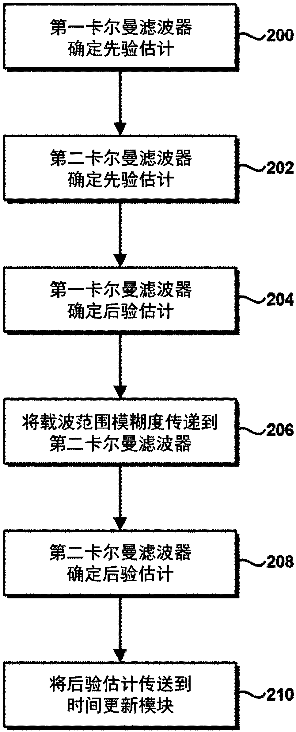
[0052] This paper describes methods for reducing the computational burden of Kalman filters that estimate carrier-wide ambiguities, allowing their implementation in resource-constrained environments.

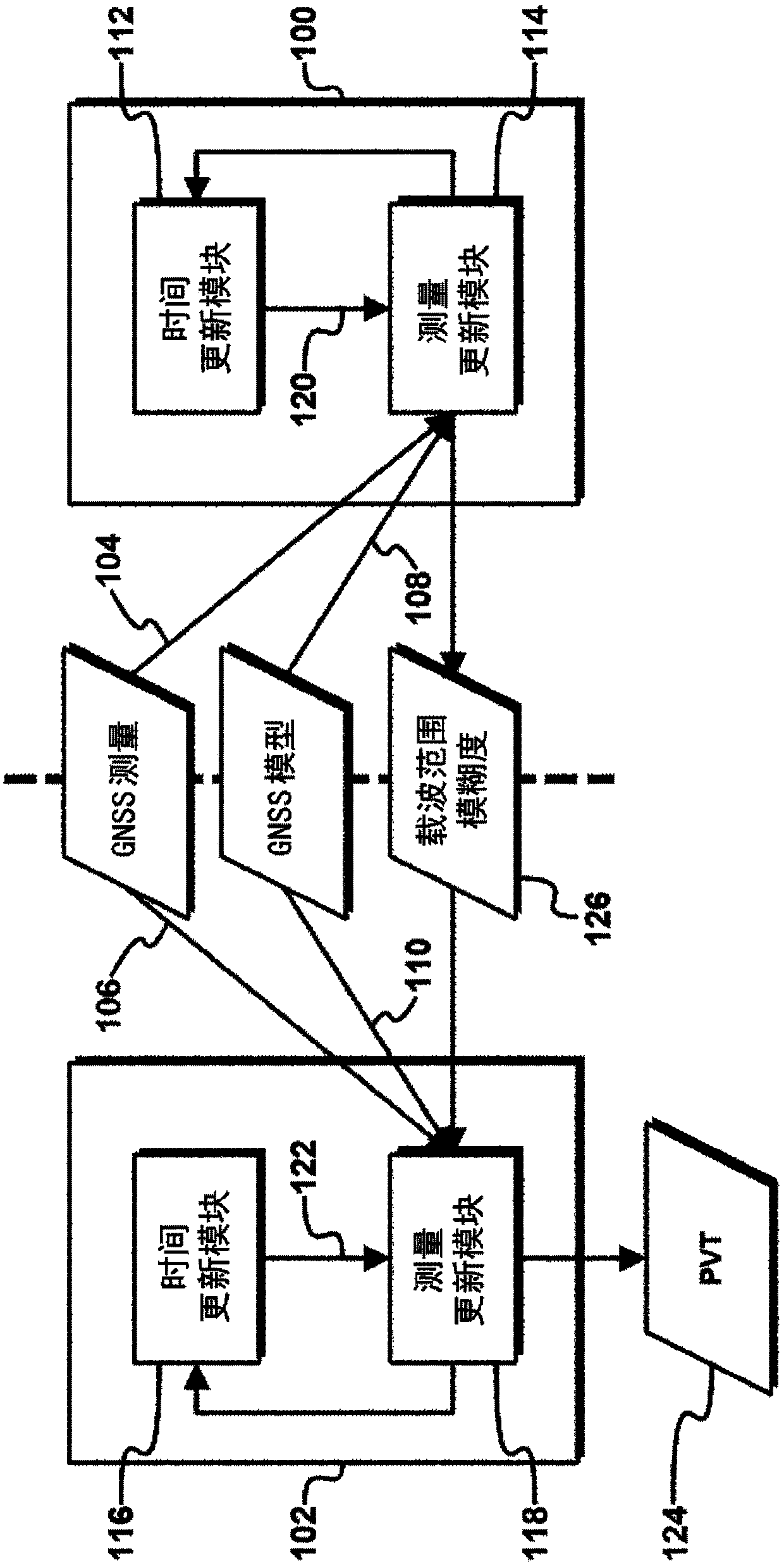
[0053] Separation of carrier range ambiguities

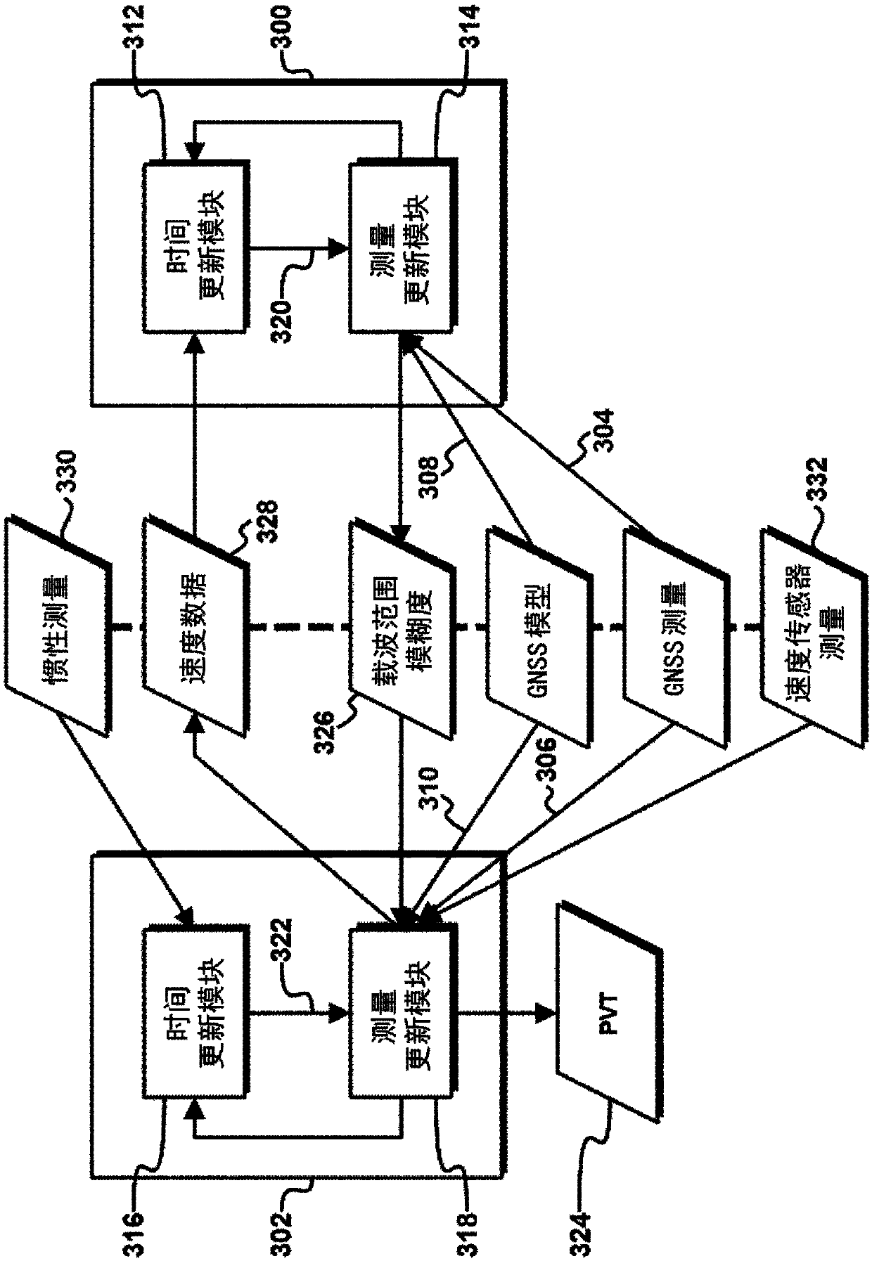
[0054] figure 1 is a block diagram of an exemplary apparatus capable of outputting a high precision navigation solution, eg, from GNSS measurements, without requiring computationally intensive implementation. The device comprises a first Kalman filter 100 and a second Kalman filter 102 . The first Kalman filter 100 and the second Kalman filter 102 receive GNSS measurements 104, 106 and GNSS model information 108, 110, respectively, and thus may enable the Kalman filters 100, 102 to estimate one or more states of the process, This will be discussed in this article.

[0055] The first Kalman filter 100 includes a time update module 112 and a measurement update module 114 , and the second Kalman filter 102 includes a time update m...


PUM


Abstract

Methods and apparatus for determining navigation data (124) using carrier range measurements obtained by a GNSS receiver for a plurality of GNSS satellites, the apparatus comprising: a first Kalman filter (100) configured to determine an a posteriori estimate of a first state vector based at least in part on a first set of GNSS measurements (104) obtained by the, and / or a further, GNSS receiver and an a priori estimate of the first state vector, the first state vector comprising carrier range ambiguity values relating to the plurality of GNSS satellites and a position of the, and / or the further, GNSS receiver; and a second Kalman filter (102) configured to determine an a posteriori estimate of a second state vector, which comprises the navigation data (124), based at least in part on a second set of GNSS measurements (106) obtained by the, and / or a further, GNSS receiver, an a priori estimate of the second state vector, and carrier range ambiguity data (126) based on the carrier rangeambiguity values determined in the a posteriori estimate of the first state vector.

Description

technical field [0001] The present invention relates to Kalman filters, in particular to a distributed Kalman filter architecture for carrier range ambiguity estimation. Background technique [0002] Global Navigation Satellite System (GNSS) receivers are capable of accurately determining a user's location by making measurements of radio signals emitted by at least four GNSS satellites. The distance to each satellite is determined by first measuring the time it takes for a radio signal to travel from the satellite to the receiver, and then converting this travel time to a corresponding "line-of-sight" distance by multiplying this travel time by the speed of light. [0003] Ranging measurements made on pseudorandom noise (PRN) codes modulated onto a radio frequency (RF) carrier (hereafter referred to as the carrier) of a satellite signal are known as pseudorange measurements and, if due consideration is given to bias and error sources, are The distance measurement can reach ...

Claims


Application Information

Patent Timeline
Patent Type & Authority Applications(China)
IPC IPC(8): G01S19/37G01S19/29
CPCG01S19/29G01S19/37G01S19/44G01S19/13
Inventor 克里斯托夫·大卫·海德亚历山大·詹姆斯·帕金斯
Owner U-BLOX
Why Eureka
Try Eureka