
A Land Approval Surveying and Mapping Data Processing Information System

A data processing and information system technology, applied in the field of surveying and mapping information processing, can solve problems such as frequent data format conversion, failure to realize map and attribute integration, unfavorable data analysis and application, etc., to improve network service capabilities and facilitate data analysis with the effect applied

Active Publication Date: 2021-07-27
珠海市测绘院
View PDF5 Cites 2 Cited by
  • Summary
  • Abstract
  • Description
  • Claims
  • Application Information

AI Technical Summary

Problems solved by technology

[0004] The invention provides a land approval surveying and mapping data processing information system, which is used to solve the problem of low integration in the land approval surveying and mapping processing system in the prior art, which needs to rely on multiple third-party platforms, frequent data format conversion and failure to realize The graph is integrated, which is not conducive to further data analysis and application.

Method used


Image

  • A Land Approval Surveying and Mapping Data Processing Information System
  • A Land Approval Surveying and Mapping Data Processing Information System
  • A Land Approval Surveying and Mapping Data Processing Information System

Examples


Embodiment Construction

[0026] The technical solutions of the present invention will be described in detail below through the accompanying drawings and specific embodiments. It should be understood that the embodiments of the present invention and the specific technical features in the embodiments are only descriptions of the technical solutions of the present invention, rather than limitations. , the embodiments of the present invention and specific technical features in the embodiments may be combined with each other.

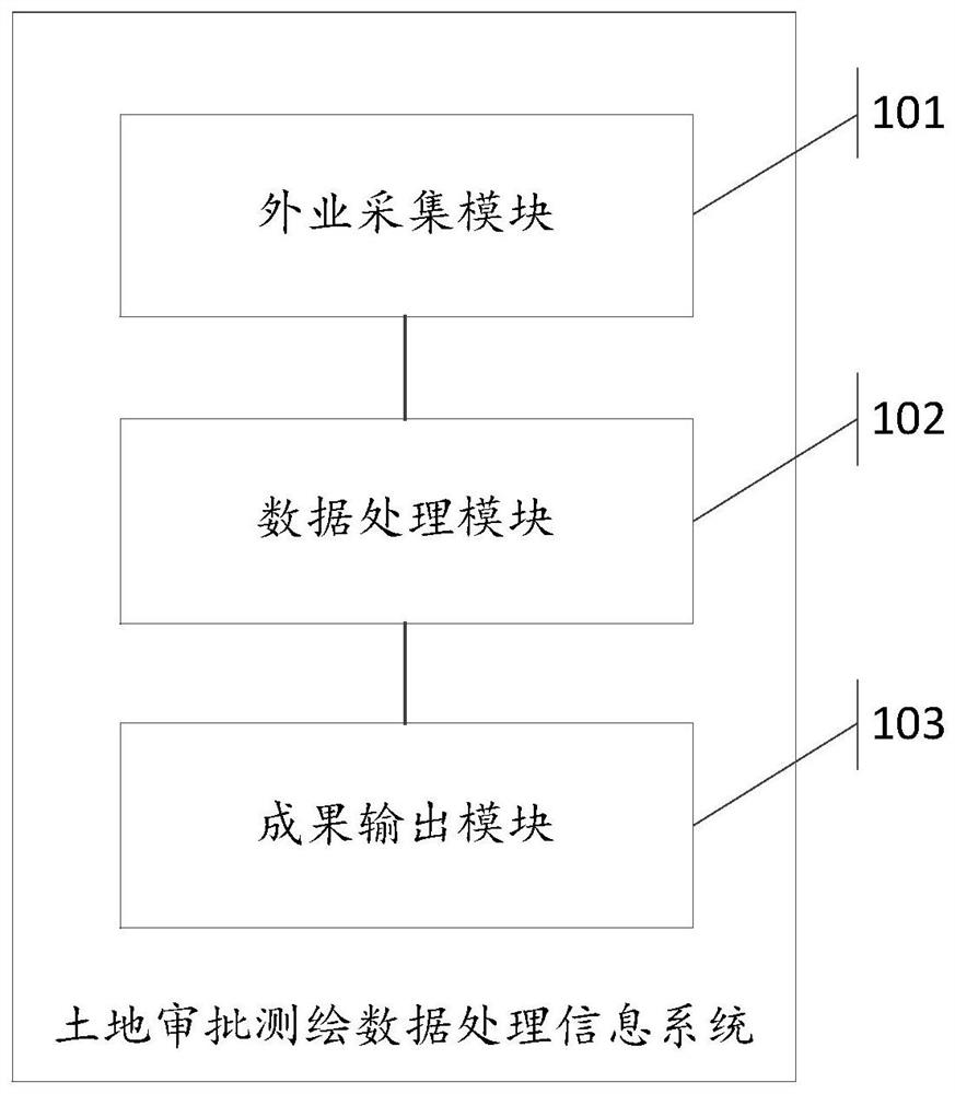
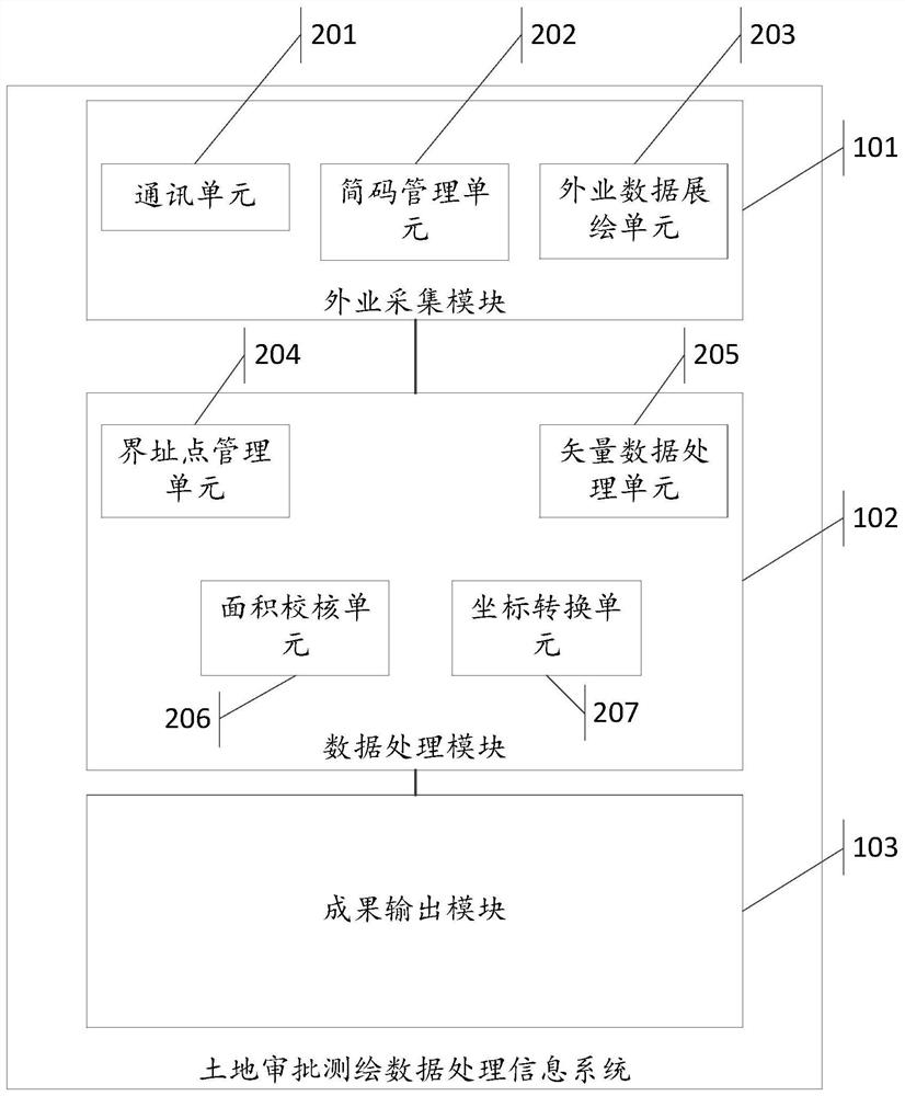
[0027] Such as figure 1 Shown is a land approval surveying and mapping data processing information system in an embodiment of the present invention, the system includes: a field collection module 101 , a data processing module 102 , and a result output module 103 .

[0028] The field acquisition module 101 is used to receive the measurement data of the total station, and establish the mapping relationship between the simple code and the EPS code, combine the simple code mapping tabl...


PUM


Abstract

The invention discloses a land approval surveying and mapping data processing information system. The system includes: a field acquisition module for receiving the measurement data of a total station, combined with a simple code mapping table defined by a user, to automatically compile and draw a topographic map; data processing The module is used for data processing of land approval surveying and mapping, including management of project land boundary point information, formation of boundary area vector data, and automatic calculation of land type information involved in the project through topological analysis of boundary area and land use spatial database. At the same time, it provides geographic analysis and processing of vector data; combines data conversion middleware to exchange data in multiple formats; uses different coordinate systems to perform polynomial interpolation on land red line coordinate point pairs to complete coordinate conversion; the achievement output module is used to output land approval Surveying and mapping results report, land approval map and attachments. The data processing information system of land surveying and mapping, such as land survey and demarcation, land pre-examination surveying and mapping, has achieved the goal of automation and high integration.

Description

technical field [0001] This application relates to the technical field of surveying and mapping information processing, in particular to a land approval surveying and mapping data processing information system. Background technique [0002] Land approval surveying and mapping is a technical service to provide scientific and accurate basic data for land management departments, including land pre-approval surveying and mapping, land survey and demarcation survey, etc. [0003] At present, domestic research on surveying and mapping for land approval mainly focuses on the work content of land surveying and delimitation measurement, including research on some work of surveying and delimitation such as automatic mapping of survey and delimitation, land use classification statistics, and coordinate data format conversion. The corresponding auxiliary tools or production systems, as well as the land survey and demarcation system developed based on AutoCad and ArcEngine. These two ty...

Claims


Application Information

Patent Timeline
Patent Type & Authority Patents(China)
IPC IPC(8): G06F16/29
CPCG06F16/29
Inventor 李旺民卢尚龙贠法长马德富黎彬何福久高春辉李进禄刘亚楠曾仕声
Owner 珠海市测绘院
Learn More