Agile imaging satellite task planning method considering drift angle constraint

A technology for mission planning and imaging satellites, applied in the aerospace field, can solve problems such as diversity and poor convergence in the later stage, low solution efficiency, and beyond the maneuverability of satellite platforms

Inactive Publication Date: 2018-08-17
NANJING UNIV OF AERONAUTICS & ASTRONAUTICS
View PDF3 Cites 17 Cited by
  • Summary
  • Abstract
  • Description
  • Claims
  • Application Information

AI Technical Summary

Problems solved by technology

[0004] However, due to the large variation of the drift angle, these methods exceed the maneuverability of the satellite platform, and finally cannot complete the observation task; The solut...

Method used


Image

  • Agile imaging satellite task planning method considering drift angle constraint
  • Agile imaging satellite task planning method considering drift angle constraint
  • Agile imaging satellite task planning method considering drift angle constraint

Examples


Embodiment

[0117] Follow the above steps to set the following calculation conditions and technical parameters:

[0118] (1) The orbit elements of agile remote sensing satellites are shown in Table 1:

[0119] Table 1 Orbit elements of agile remote sensing satellites

[0120]

[0121] (2) The radius of the earth is 6378.13655km, the radius of curvature of the earth is 1 / 298.25722, and the gravitational constant of the earth is 398600.44km 3 / s 2 .

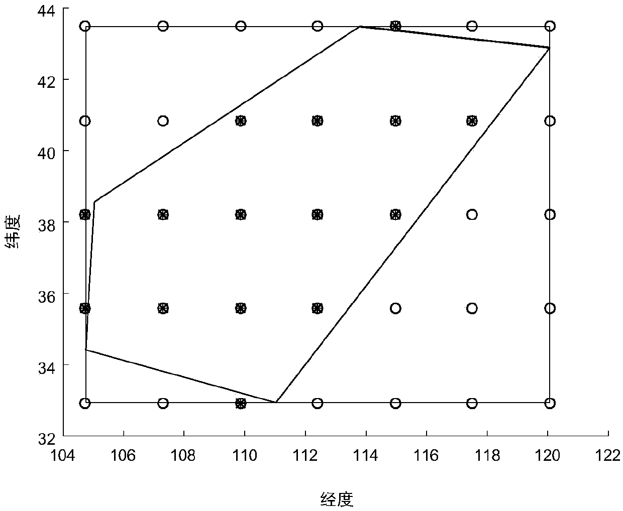
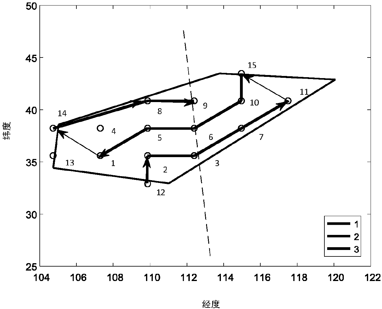
[0122] This algorithm takes a polygonal area in the central part of my country as the research object and selects two examples of regional targets. The geographical distribution of the area is as follows: figure 1 As shown, the longitude and latitude coordinates of the target boundary points in this area are shown in Table 2:

[0123] Table 2 Polygon area target information

[0124]

[0125] (3) Considering the task planning problem within a single orbital cycle, the time of one orbital cycle is selected as the simulation scene time...


PUM


Abstract

An agile imaging satellite task planning method considering a drift angle constraint belongs to the aerospace field. Under the condition that a current agile satellite is in a push-broom imaging mode,a lot of regional target observation paths can be selected, variability is high, and a camera-image in-plane image shift compensation factor is not considered during a planning process. Aiming at theabove problems, the invention provides the agile satellite region target task planning method considering the camera drift angle constraint based on an improved perception ant colony algorithm. In the invention, large-range polygon effective area coverage is taken as a research target, a constraint condition in the planning process is fully considered and the observation paths are planned, and the improved perception ant colony algorithm is adopted to solve a plan. The method is suitable for task planning of an agile imaging satellite for large-range region observation.

Description

technical field [0001] The invention relates to the field of aerospace, in particular to an agile imaging satellite mission planning method considering the constraint of drift angle. Background technique [0002] With the in-depth understanding of the earth and the study of the earth, human beings gradually expand their viewpoints from the ground and low altitudes to space. Earth observation satellites have unique advantages such as wide coverage area, long duration, good observation effect, not restricted by airspace and national boundaries, and no need to consider personnel safety issues. National defense construction and national security are indispensable. [0003] Because the new generation of agile imaging satellites has excellent characteristics such as continuity, rapidity, and accuracy. Compared with non-agile satellites, agile satellites provide stronger observation advantages, and can use their flexible attitude maneuvering capabilities to look forward, face up,...

Claims


Application Information

Patent Timeline
IPC IPC(8): G06Q10/06G06N3/00
CPCG06N3/006G06Q10/06312
Inventor 李爽杜彬龚柏春余萌杨洪伟
Owner NANJING UNIV OF AERONAUTICS & ASTRONAUTICS
Why Eureka
Try Eureka