
A fusion method and system of remote sensing images and geochemistry

A technology of geochemistry and remote sensing images, applied in the fusion method and system of remote sensing images and geochemistry, can solve the problems that remote sensing data is not as accurate as geochemical data, cannot truly reflect geochemical data, and remote sensing data cannot reflect geochemistry, etc.

Active Publication Date: 2020-05-12
INST OF MINERAL RESOURCES CHINESE ACAD OF GEOLOGICAL SCI
View PDF4 Cites 0 Cited by
  • Summary
  • Abstract
  • Description
  • Claims
  • Application Information

AI Technical Summary

Problems solved by technology

[0018] Existing technologies are mainly aimed at remote sensing to invert geochemistry or use high-resolution bands to fuse low-resolution bands, which cannot truly reflect the geochemical data itself. It is the geochemistry revealed by remote sensing, and the remote sensing data itself The fusion also does not reflect the geochemistry, the two are out of touch
Mainly manifested in (1) geochemistry is not as large as the amount of information reflected by remote sensing data itself; (2) remote sensing data is not as accurate as geochemical data

Method used


Image

  • A fusion method and system of remote sensing images and geochemistry
  • A fusion method and system of remote sensing images and geochemistry
  • A fusion method and system of remote sensing images and geochemistry

Examples


Embodiment Construction

[0084] The purpose of the present invention is to provide a remote sensing image and geochemical fusion method and system to realize the fusion of geochemical and remote sensing data, so that the fused image can not only reflect the accuracy of geochemistry, but also have the delicate image of remote sensing data. sex.

[0085] In order to make the above objects, features and advantages of the present invention more comprehensible, the invention will be further described in detail below in conjunction with the accompanying drawings and specific embodiments.

[0086] Such as Figure 5 As shown, the present invention provides a fusion method of remote sensing images and geochemistry, the fusion method comprising the steps of:

[0087] Step 501, acquiring a remote sensing image and a geochemical image corresponding to the remote sensing image; specifically including:

[0088] 1. Selection and preprocessing of remote sensing image data

[0089] Remote sensing data needs to choo...


PUM


Abstract

The invention discloses a remote sensing image and geochemical fusion method and system. The method includes: firstly, performing minimum noise transformation on the remote sensing image to obtain multi-dimensional image data; performing point-plane transformation on the geochemical image to obtain geochemical raster image data, that is, the geochemical image becomes raster data; and then matching the multidimensional image data with the geochemical raster image data to obtain similar image data; and using the geochemical raster image data to replace the similar image data in the multidimensional image data to obtain a replaced multidimensional Finally, the minimum noise inverse transformation is performed on the replaced multi-dimensional image data to obtain the fused remote sensing chemical image, which realizes the fusion of geochemical and remote sensing data.

Description

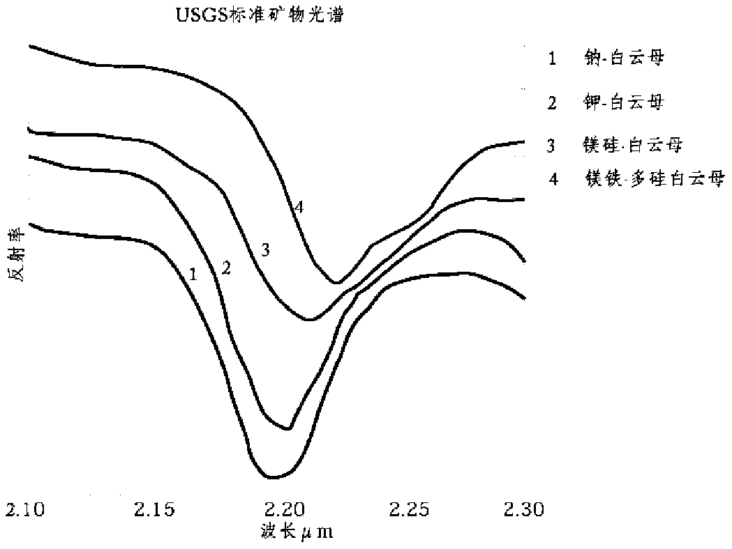
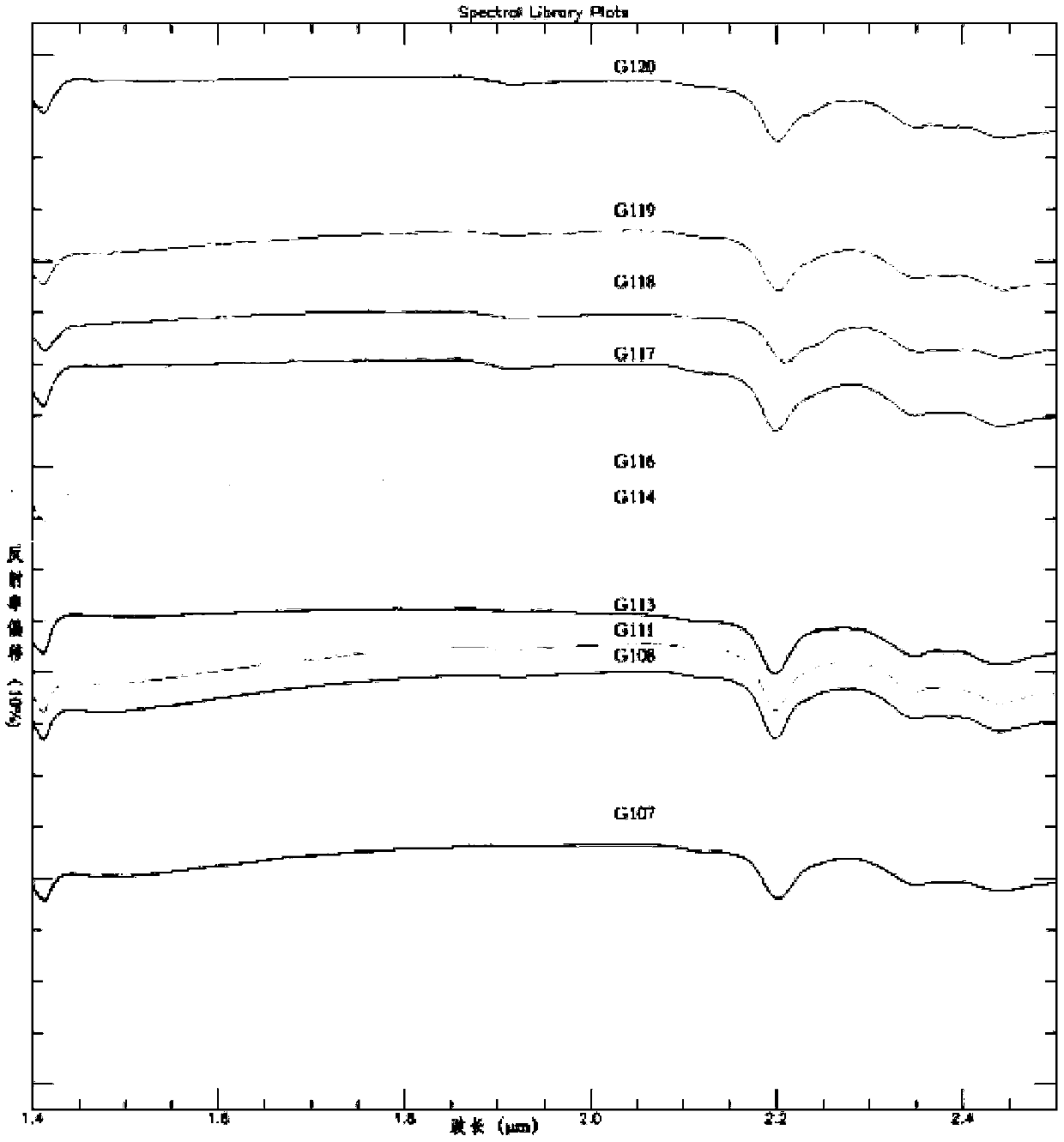
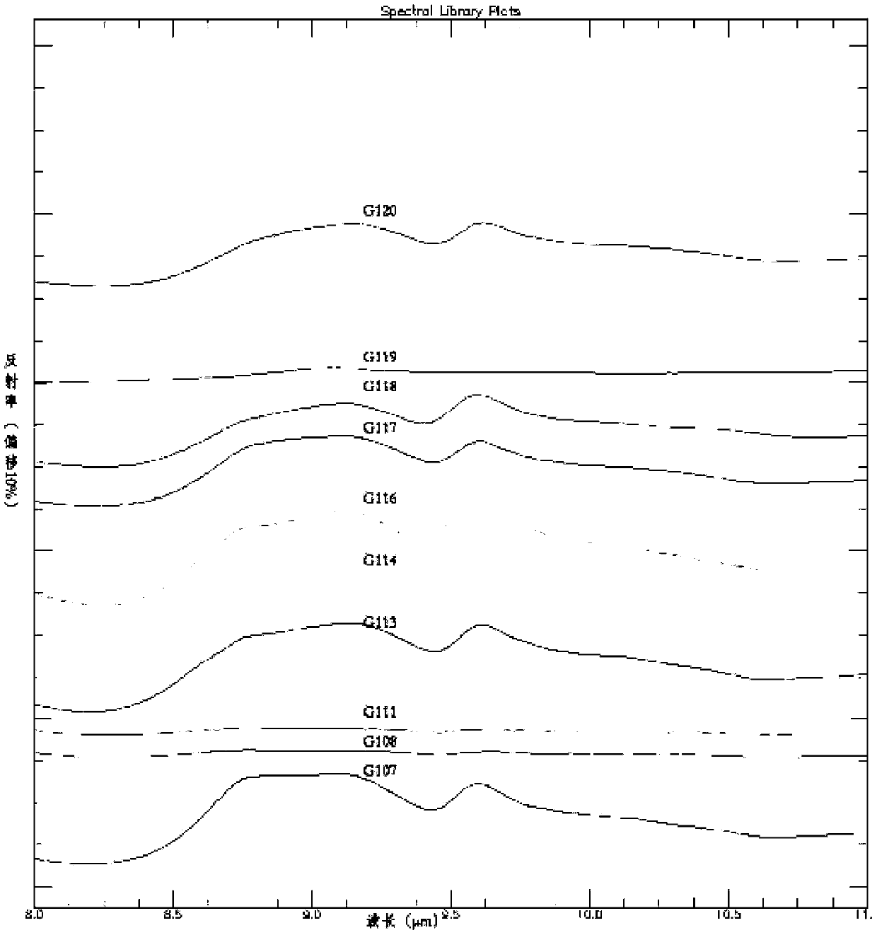
technical field [0001] The invention relates to the field of image processing, in particular to a fusion method and system of remote sensing images and geochemistry. Background technique [0002] Remote sensing images are raster data, while geochemistry is lattice data. Generally, the fusion of remote sensing images and geochemistry cannot be well realized, only the fusion of forms, such as the conventional main classification fusion method, color transformation fusion method, fusion The image of the is very poorly recognizable. [0003] Remote sensing geochemistry is to use remote sensing to invert element abundance characteristics, because the absorption characteristics of minerals are mainly the absorption characteristics formed by the vibration of molecular bonds or the absorption characteristics formed by electronic transitions. The main absorption characteristics (mainly referring to the wavelength of the absorption valley) are related to molecular vibration and elect...

Claims


Application Information

Patent Timeline
Patent Type & Authority Patents(China)
IPC IPC(8): G06K9/62G06K9/00
CPCG06V20/13G06F18/22G06F18/251
Inventor 耿新霞姚佛军杨建民吴胜华
Owner INST OF MINERAL RESOURCES CHINESE ACAD OF GEOLOGICAL SCI
Learn More