
Underwater topographic survey method suitable for shallow sea area of ​​radiant sand ridge group

A technology of underwater topography and measurement methods, which is applied to measurement devices, open-air water source surveys, radio wave measurement systems, etc. The effect of high efficiency and measurement accuracy

Active Publication Date: 2022-02-01
江苏省有色金属华东地质勘查局地球化学勘查与海洋地质调查研究院
View PDF3 Cites 0 Cited by
  • Summary
  • Abstract
  • Description
  • Claims
  • Application Information

AI Technical Summary

Problems solved by technology

In such an environment, it is inconvenient to use ordinary workboats for measurement, and it is also inconvenient to use artificial beaching methods
In many cases, it is often necessary to "catch the tide" and the construction is extremely difficult
In addition, the unique terrain may even produce disasters such as "strange tides", and the construction risk is also very high
[0005] (2) It is difficult to correct the water level
In the bathymetry of the radiant sand ridge sea area, there are two difficulties in water level correction. First, the tide level changes greatly, the correction amount is large, and the proportion of water depth is larger; second, the layout of tide gauge stations and elevation measurement are very difficult.
[0007] (3) Low sounding accuracy
However, this type of small measurement platform has poor stability and is greatly affected by sea conditions. At the same time, the limited space cannot be equipped with too many hardware devices, which directly affects the stability of the measurement signal.
Second, the impact of waves is large
Third, there are many obstacles
Part of the water surface and underwater nets on the survey line force the ship to change its course at any time or even terminate the survey. The measurement continuity is poor and the survey line is easy to be irregular.
[0009] (4) Many new methods are not applicable
The development of various projects usually only relies on some temporary tide survey data, which has a short data cycle and low accuracy

Method used


Image

  • Underwater topographic survey method suitable for shallow sea area of ​​radiant sand ridge group
  • Underwater topographic survey method suitable for shallow sea area of ​​radiant sand ridge group
  • Underwater topographic survey method suitable for shallow sea area of ​​radiant sand ridge group

Examples


Embodiment Construction

[0074] A typical embodiment of the present invention provides a seabed topographic survey method without tide gauge suitable for sea areas of radiant sand ridges, including the following steps: system installation, data collection, data processing, data matching and datum conversion.

[0075] The present invention is mainly a sounding part and a PPK observation part, and the main equipment that can be used to realize the method described in the present invention includes:

[0076] (1) Sps351 beacon DGPS system

[0077] GPS beacon signal: 12-channel GPS+SBAS, dual-channel automatic search for beacon signal; beacon receiving frequency range: 283.5KHz-325KHz; effective working distance: 500km at sea; positioning accuracy: 0.5m (1δ); manufacturer: United States Tianbao Company.

[0078] (2) Haixingda IRTK2 system

[0079] Multi-star multi-system kernel; channel number: 220; BDS: B1, B2, B3; GPS: L1C / A, L1C, L2C, L2E, L5; GLONASS: L1C / A, L1P, L2C / A, L2P, L3; positioning Output f...


PUM


Abstract

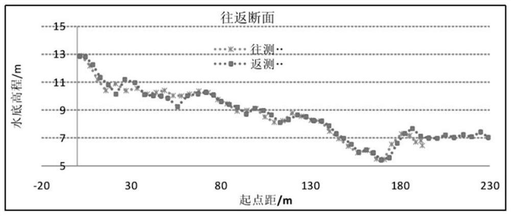
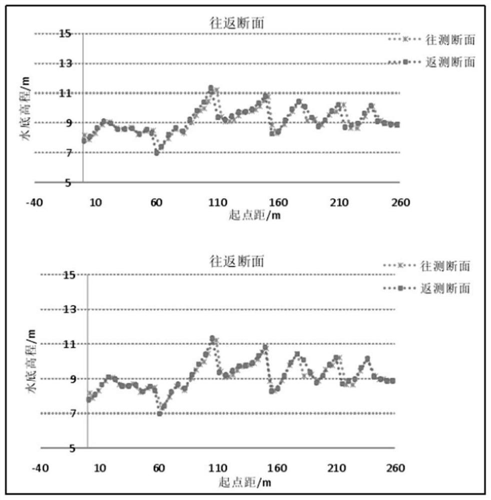
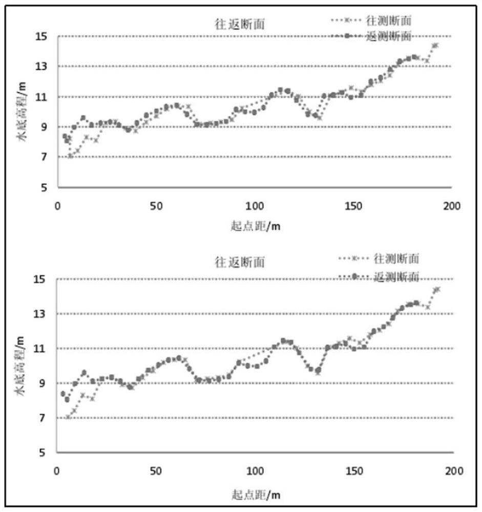
The invention relates to an underwater terrain measurement method suitable for shallow sea areas of radiant sand ridge groups, in which a sounding platform, a PPK reference station and a mobile station are set; positioning and navigation data are collected, as well as the sounding data and sounding data measured by the sounder Antenna height data measured by the GNSS receiver; basic processing and data fine processing of the acquired data; using feature point matching scheme or section overall translation scheme to correct the influence of time delay; corresponding time points for bathymetry data and GNSS receiver The antenna height data is matched to obtain the topographic ellipsoid height data of the sea area; the topographic water depth data of the sea area are obtained through datum conversion. This method is applied to the measurement environment with wide shallow water, avoids dependence on tidal data, and has high measurement accuracy and efficiency.

Description

technical field [0001] The invention belongs to the field of seabed topography measurement, in particular to an underwater topography measurement method suitable for shallow water sea areas of radiation sand ridge groups. Background technique [0002] The radiation sand ridge group is a general term for the sandbars exposed above the sea surface and the sand ridges hidden below the sea surface in a radial distribution, as well as their tidal channels. The radiation sand ridge sea area has always been a difficult area for bathymetry. The reasons can be summarized as follows: [0003] (1) The water shoal is wide, and it is difficult for people and boats to reach [0004] The most notable features of the radial sand ridge sea area are wide beaches, shallow water, and tidal creeks. In such an environment, it is inconvenient to use ordinary workboats for surveying, and it is also inconvenient to use artificial beaching methods. In many cases, it is often necessary to "catch t...

Claims


Application Information

Patent Timeline
Patent Type & Authority Patents(China)
IPC IPC(8): G01S19/14G01C13/00
CPCG01C13/008G01S19/14
Inventor 张颖闫玉茹杨轮凯梁飞刚李静姚才华张刚赵刚万凯超范彦斌张晓飞
Owner 江苏省有色金属华东地质勘查局地球化学勘查与海洋地质调查研究院
Learn More