
Unmanned aerial vehicle autonomous obstacle detection system and method based on binocular vision and unmanned aerial vehicle
A binocular vision system and obstacle detection technology, applied in the field of drones, can solve problems such as small size, low weight, and low power, and achieve the effects of low power consumption, low weight, and small volume
- Summary
- Abstract
- Description
- Claims
- Application Information
AI Technical Summary
Problems solved by technology
Method used
Image

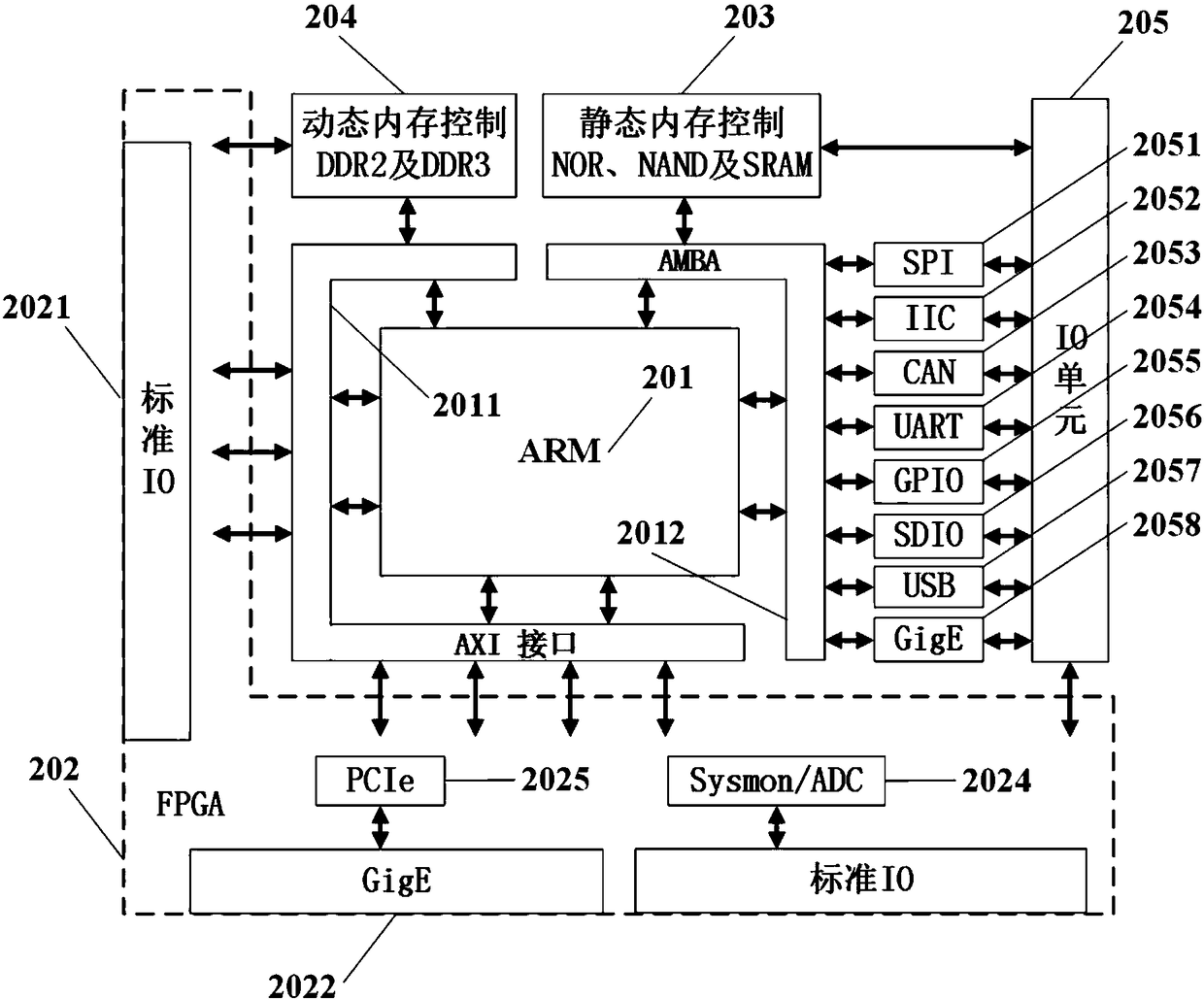
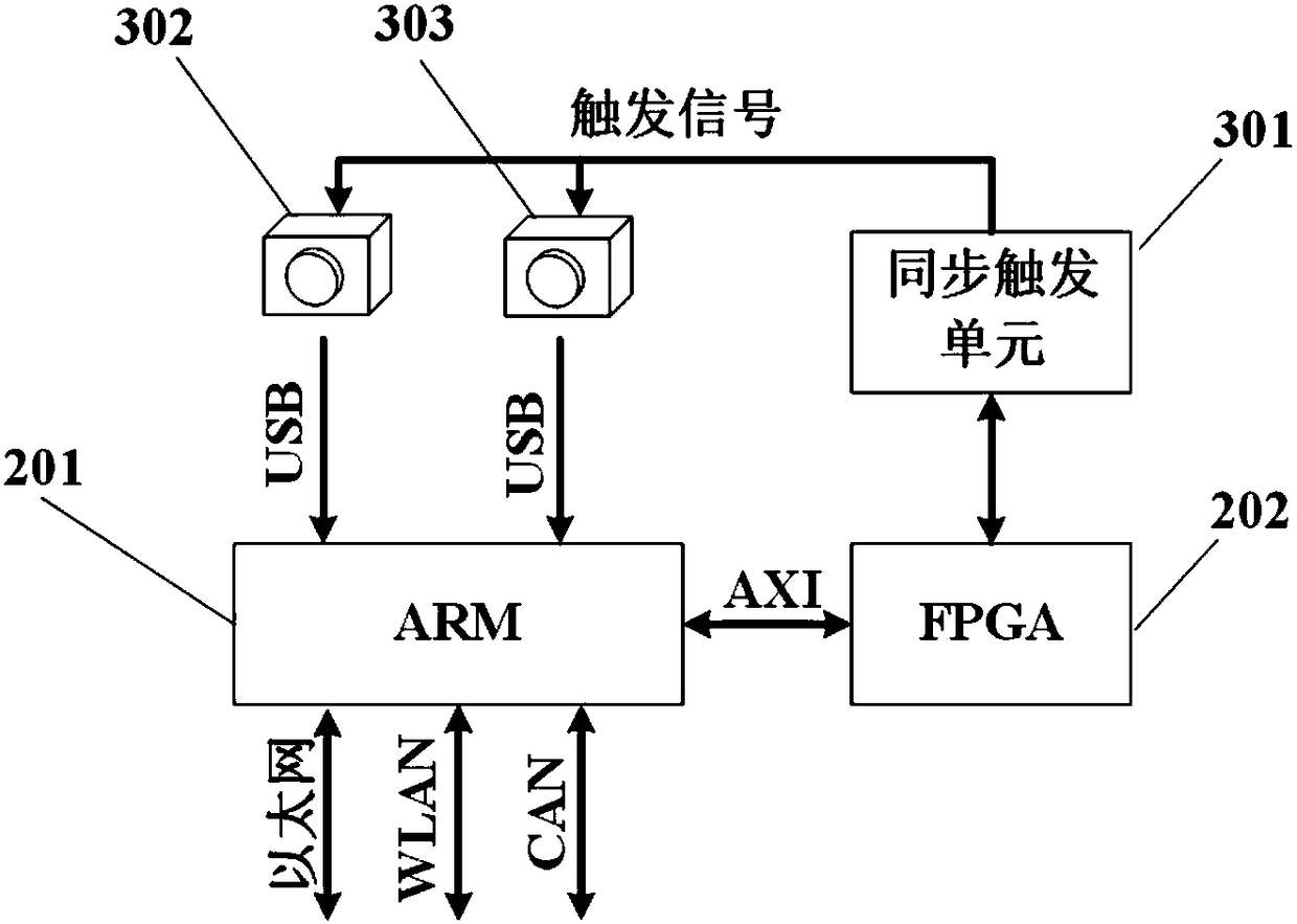
Examples
Embodiment Construction
[0056] The following describes the embodiments of the present invention in further detail with reference to the accompanying drawings:
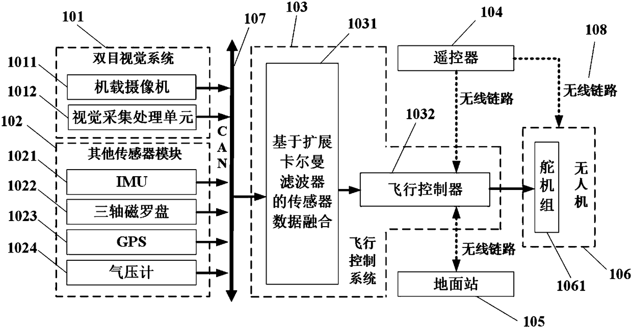
[0057] A UAV autonomous obstacle detection system based on binocular vision, such as figure 1 Shown, including:
[0058] Binocular vision system (101): includes two airborne cameras (1011) and a vision acquisition and processing unit (1012). The two airborne cameras (1011) obtain the environmental visual information of the drone (106), and combine The data is transmitted to the visual acquisition and processing unit (1012), the visual acquisition and processing unit (1012) understands and analyzes the visual information, and finally obtains environmental information, and at the same time judges and gives obstacle information, which is passed through the CAN bus (107) Send to the flight control system (103).
[0059] Other sensor units (102): including inertial measurement unit IMU (1021), global positioning system GPS (1022), magnetic compass (1023...
PUM
 Abstract
Description
Claims
Application Information