Eureka AIR delivers breakthrough ideas for toughest innovation challenges, trusted by R&D personnel around the world.

Method for testing calibration ground site for single image photogrammetry

A photogrammetry and ground point technology, which is applied in the field of single-chip photogrammetry to calibrate ground points, can solve the problems of unintuitive and convenient positioning, cumbersome cost of the total station, etc., and achieve the effect of improving work efficiency, reducing burden and reducing use cost.

Active Publication Date: 2018-10-19
BEIJING FORESTRY UNIVERSITY
View PDF5 Cites 2 Cited by
  • Summary
  • Abstract
  • Description
  • Claims
  • Application Information

AI Technical Summary

Problems solved by technology

[0002] Due to the real-time and high-precision characteristics of GPS-RTK positioning technology, it has been widely used in engineering stakeout, navigation and positioning, etc. To achieve high-precision ground point calibration, the traditional method requires carrying a total station. Using a total station is not only cumbersome but also expensive, and the positioning is not intuitive and convenient.

Method used


Image

  • Method for testing calibration ground site for single image photogrammetry
  • Method for testing calibration ground site for single image photogrammetry
  • Method for testing calibration ground site for single image photogrammetry

Examples


Embodiment Construction

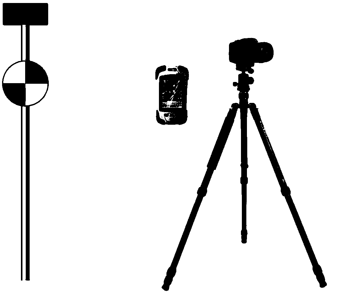
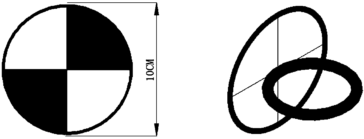
[0013] (1) will figure 2 Crosshair shown socketed on RTK centering rod (eg figure 1 shown), measure the height H from the cross bullseye to the bottom of the centering rod G .

[0014] (2) Set up the camera with a tripod and adjust the camera distance (the focal length is f), so that the image of the area to be calibrated completely appears in the camera viewfinder frame, and the camera remains motionless during the entire calibration period.

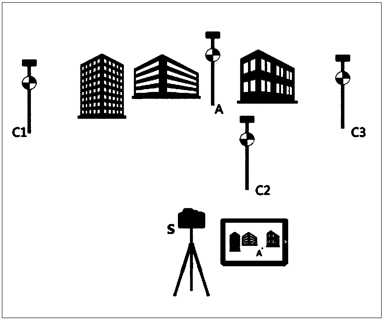
[0015] (3) if image 3 As shown, use RTK to measure the three points c1, c2 and c3 respectively in the open area with strong GPS signal (X c1 , Y c1 ,Z c1 ), (X c2 , Y c2 ,Z c2 ), (X c2 , Y c2 ,Z c3 ), try to make the line connecting the three points include the entire calibration area, and the three points cannot be in a straight line. It should be noted that the center of the cross target is facing the camera lens, and the RTK centering pole should be kept vertical (the bubble is in the middle); Tap while the camera takes...


PUM


Abstract

The invention discloses a method for testing a calibration ground site for single image photogrammetry. A digital camera connected with an RTK (Real-Time Kinetic) handbook and a cross target which isconnected with an RTK centering rod in a sleeving manner are adopted to form single image photogrammetry measurement calibration ground site equipment, and GPS (Global Positioning System)-RTK is assisted to work in regions such as forests, dense city building areas and indoor engineering with weak GPS signals or blind signal regions, and ground site calibration can be achieved.

Description

1. Technical field [0001] The invention relates to a method for calibrating ground points by single-chip photogrammetry 2. Technical background [0002] Due to the real-time and high-precision characteristics of GPS-RTK positioning technology, it has been widely used in engineering stakeout, navigation and positioning, etc. To achieve high-precision ground point calibration, the traditional method requires carrying a total station. Using a total station is not only cumbersome but also expensive, and the positioning is not intuitive and convenient. How to efficiently and accurately carry out ground point calibration in the GPS blind area through low-cost portable devices is of great significance to practical work. 3. Contents of the invention [0003] The invention provides a single-chip photogrammetry method for calibrating ground points, which is characterized in that: a digital camera connected to the RTK handbook, and a single-chip composed of a cross target that can b...

Claims


Application Information

Patent Timeline
Patent Type & Authority Applications(China)
IPC IPC(8): G01C11/02
CPCG01C11/02
Inventor 冯仲科申朝永
Owner BEIJING FORESTRY UNIVERSITY
Why Eureka
Eureka Blog
Learn More