

Vector geospatial data digital watermark method based on DFT coefficient combination
A spatial data and digital watermarking technology, applied in image data processing, image data processing, instruments, etc., can solve problems such as error and original data influence
- Summary
- Abstract
- Description
- Claims
- Application Information
AI Technical Summary
Problems solved by technology
Method used
Image

Examples
Embodiment Construction
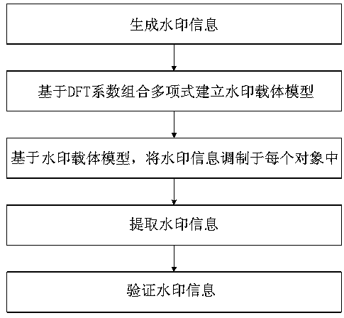
[0052] The present invention will be further described below in conjunction with the accompanying drawings and embodiments.
[0053] Such as figure 1 As shown, a digital watermarking method for vector geospatial data based on DFT coefficient combination, including:
[0054] 1) Generate watermark information. The specific steps are: read the original binary watermark image, apply the Logistic chaotic transformation to scramble the watermark image; then transform the scrambled watermark image into a one-dimensional sequence {w j =0,1|j=1,2,...,M}, M is the watermark length.
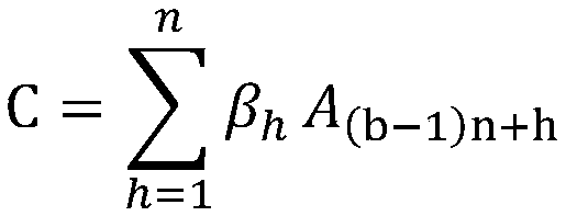
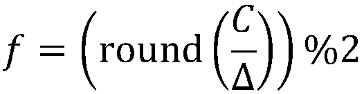
[0055] 2) With the map as the unit, the watermark carrier model is established based on the DFT coefficient combination polynomial. The specific steps are:
[0056] 2-1) Extract feature point set: Select all the curves in the map object, and for each curve, use the Douglas-Puke algorithm to extract the feature point set, the extracted feature point set is v, the feature point v in v k =(x k ,y k ), k...
PUM
 Abstract
Description
Claims
Application Information