Remote remote sensing estimation method and device for changes in surface temperature days
A surface temperature and remote sensing technology, which is applied in the field of remote sensing estimation of the intraday change process of the surface temperature, can solve the problems that the surface temperature is no longer satisfied, the cloudy conditions cannot be applied, and the effect of solving the estimation difficulty is achieved.
- Summary
- Abstract
- Description
- Claims
- Application Information
AI Technical Summary
Problems solved by technology
Method used
Image
Examples
Embodiment 1
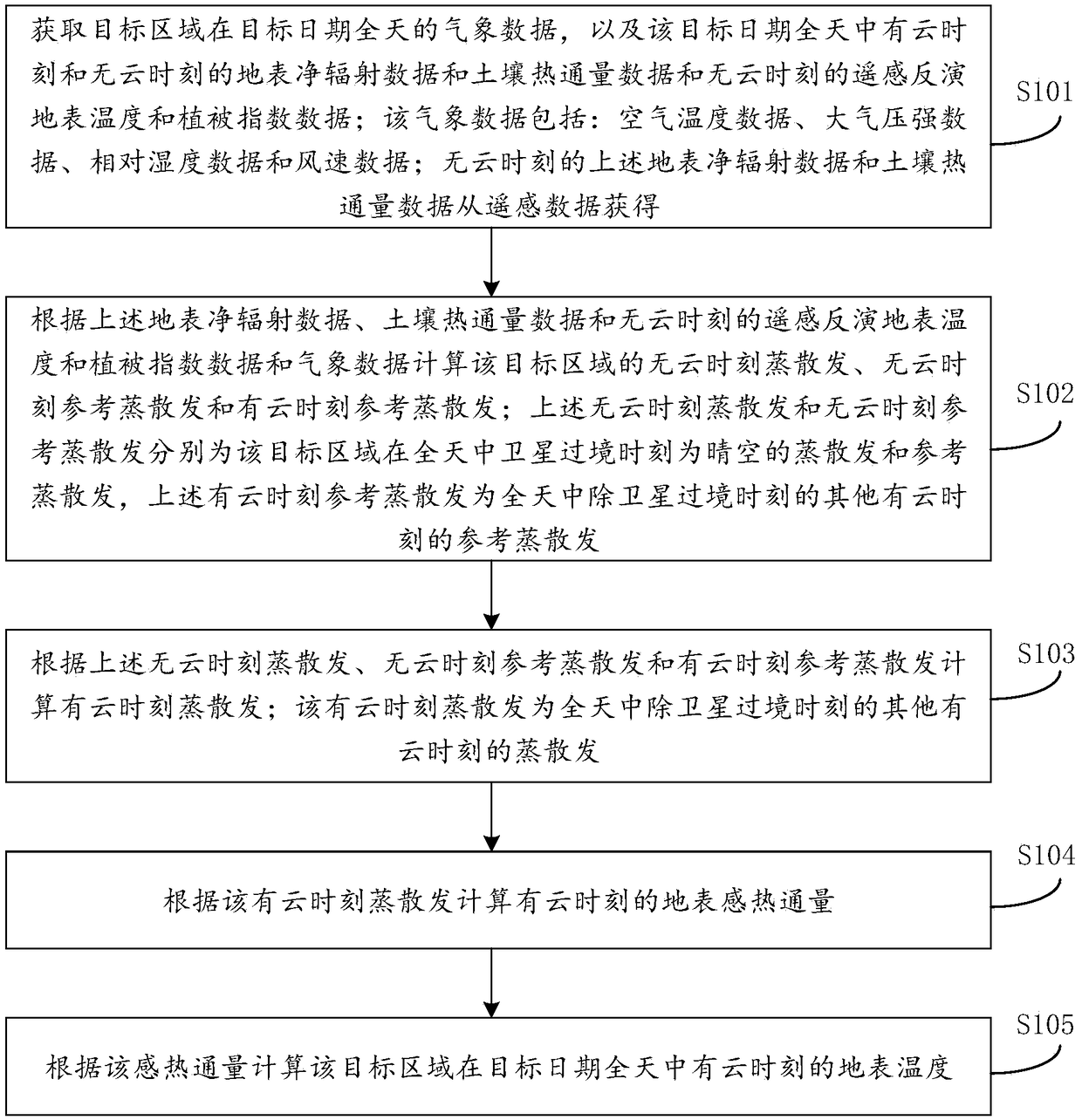
[0030] Such as figure 1 As shown, it is a flow chart of a remote sensing estimation method for the intraday variation process of the surface temperature provided by the embodiment of the present invention, consisting of figure 1 Visible, this method comprises the following steps:
[0031] Step S101: Obtain the meteorological data of the target area on the target date, as well as the surface net radiation data and soil heat flux data of the cloudy and cloudless time of the target date throughout the day, and the remote sensing retrieved surface temperature at the cloudless time Data and vegetation index data; the meteorological data include: air temperature data, atmospheric pressure data, relative humidity data and wind speed data; the above-mentioned surface net radiation data and soil heat flux data at cloudless time are obtained from remote sensing data.
[0032] For the estimation of the daily change process of the surface temperature in the target area under cloudy condi...
Embodiment approach
[0034] Here, when calculating the cloud-free time evapotranspiration of the target area based on the surface net radiation data and soil heat flux data, as figure 2 As shown, it is one of the feasible implementation modes, which includes:
[0035] S201: Using the surface temperature-vegetation index triangular space method to calculate the evaporation ratio at cloudless time;
[0036] S202: Calculate evapotranspiration at cloudless time according to the above-mentioned evaporation ratio at cloudless time, surface net radiation data and soil heat flux data.
[0037] Among them, the surface temperature-vegetation index triangular space method is to interpret the surface temperature-vegetation index scatter diagram constructed within the full range of changes in soil moisture and vegetation coverage, and use the simplified Priestley-Taylor equation to conduct regional evapotranspiration based on the full remote sensing data Estimation method of emission and evaporation ratio. ...
Embodiment 2
[0049] Embodiment 2 of the present invention further explains in detail the specific implementation of each step of the remote sensing estimation method for the intraday variation process of the surface temperature, so as to facilitate the understanding of the method. The specific implementation process is as follows.
[0050] Step 1: Preliminarily determine the input data set required for the daily variation process of surface temperature in cloudy days. For a specific date in the target area, it is necessary to collect remote sensing data when the satellite transits on that date without clouds, including: surface radiation product MOD02KM, surface temperature product MOD11_L2, surface albedo product MOD09A1, geometric correction product MOD03 and vegetation index product MOD15A2. In addition, it is also necessary to collect meteorological data for the whole day on this date, including air temperature data, atmospheric pressure data, relative humidity data and wind speed dat...
PUM
 Abstract
Description
Claims
Application Information
 - R&D
- Intellectual Property
- Life Sciences
- Materials
- Tech Scout
- Unparalleled Data Quality
- Higher Quality Content
- 60% Fewer Hallucinations
Browse by: Latest US Patents, China's latest patents, Technical Efficacy Thesaurus, Application Domain, Technology Topic, Popular Technical Reports.
© 2025 PatSnap. All rights reserved.Legal|Privacy policy|Modern Slavery Act Transparency Statement|Sitemap|About US| Contact US: help@patsnap.com


