Method and system for configuring scenic area road sign

A configuration method and road sign technology, applied in data processing applications, marketing, forecasting, etc., to achieve the effect of improving the level, uniform distribution, and enhancing the travel experience

Active Publication Date: 2018-12-07
PEKING UNIV +1
View PDF4 Cites 2 Cited by
  • Summary
  • Abstract
  • Description
  • Claims
  • Application Information

AI Technical Summary

Problems solved by technology

[0004] Purpose of the invention: Aiming at the deficiencies of the prior art, the purpose of the present invention is to provide a road sign configuration method and system in a scenic area, which is used to solve the problems of site selection and content selection of road signs in the scenic area, and can quickly, intelligently and scientifically provide personalized services for the scenic area. The road sign site selection method, and intelligently select the display content for the street sign after the site is selected

Method used


Image

  • Method and system for configuring scenic area road sign
  • Method and system for configuring scenic area road sign
  • Method and system for configuring scenic area road sign

Examples


Embodiment Construction

[0039] Below in conjunction with specific embodiment, further illustrate the present invention, should be understood that these embodiments are only used to illustrate the present invention and are not intended to limit the scope of the present invention, after having read the present invention, those skilled in the art will understand various equivalent forms of the present invention All modifications fall within the scope defined by the appended claims of the present application.

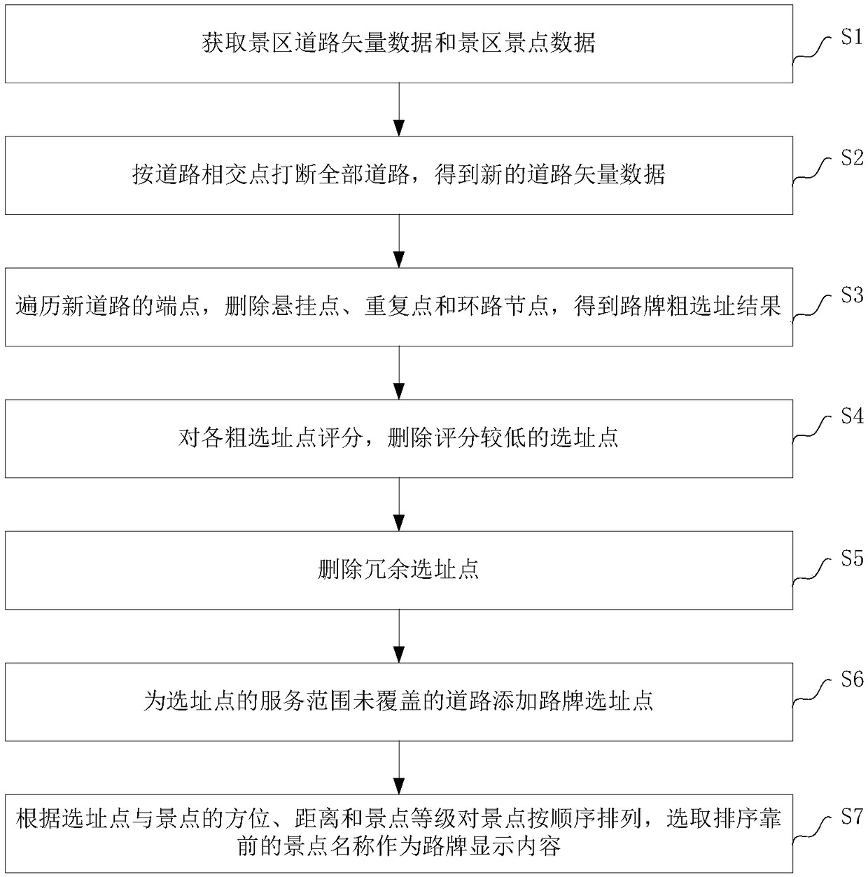
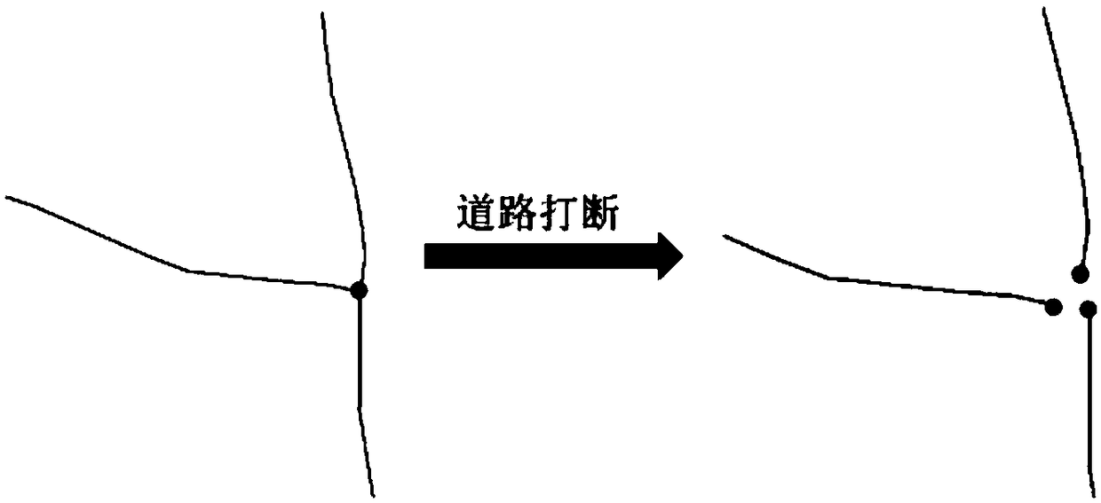
[0040] Such as figure 1 As shown, a method for configuring road signs in scenic spots disclosed in the embodiment of the present invention mainly includes the following steps:

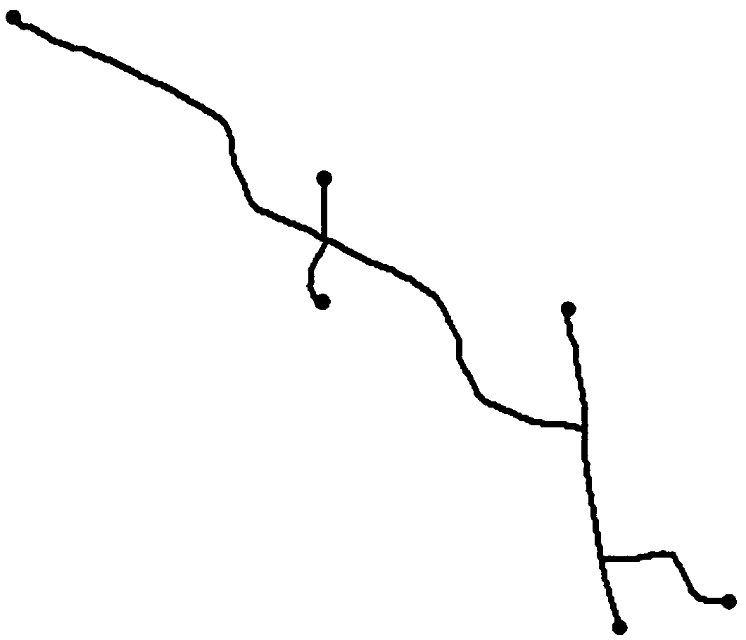
[0041] S1: Obtain scenic road vector data and scenic spot data, where road vector data mainly includes road number, road name, road grade, road corresponding vector line and other data, and scenic spot data mainly includes scenic spot number, scenic spot name, scenic spot level, and scenic spot location Wait for the data....


PUM


Abstract

The invention discloses a method and system for configuring a scenic area road sign. The method mainly comprises: acquiring scenic area road vector data and scenic area scenic spot data; interruptingall roads according to the intersections of roads to obtain new road vector data; traversing the starting points and the end points of all interrupted new roads, and using points other than suspensionpoints, repetition points and loop nodes as a road sign rough selection result; scoring locations in the road sign rough selection result according to road grades, and deleting the locations with lowscores; traversing all locations subjected to score selection, deleting redundant locations; calculating the service range of each location, adding road sign locations to the uncovered parts of the roads which are not fully covered by the service area to obtain a road sign fine selection point result; arranging the scenic spots according to the orientations and the distances of the road sign locations and the scenic spots and the grades of the scenic spots, and selecting the display content of the road signs. The method and system realize the automatic configuration of the scenic area road signs and improves the level of the road sign configuration system in the scenic area.

Description

technical field [0001] The invention relates to road sign planning in tourist scenic spots, in particular to an intelligent scenic spot road sign configuration method and system. Background technique [0002] In recent years, China's tourism industry has developed rapidly. For each tourist scenic spot, in order to scientifically protect and rationally develop various resources, effectively operate and scientifically manage tourist attractions, it is necessary to coordinate and arrange various tourist elements in the scenic spot. The location of tourist signs is one of the common problems. one. The main purpose of the road signs in the scenic area is to clearly guide the environment of the tourist area, avoid repeated detours, and shorten the time to reach the destination easily. However, the number of road signs in the scenic spot should also be determined according to the actual situation of the scenic spot. Too few will lose the role of guiding tourists, and too many wil...

Claims


Application Information

Patent Timeline
Patent Type & Authority Applications(China)
IPC IPC(8): G06Q10/04G06Q50/14G06Q30/02
CPCG06Q10/04G06Q30/0205G06Q50/14
Inventor 丁鼎刘丰源张婷龙毅周贵鹏
Owner PEKING UNIV
Why Eureka
Try Eureka