A multi-satellite task planning method based on K-means clustering

A task planning, K-means technology, applied in instruments, character and pattern recognition, data processing applications, etc., can solve problems such as complex calculation process and many iterations

Active Publication Date: 2018-12-14
湖南国科轩宇信息科技有限公司
View PDF5 Cites 11 Cited by
  • Summary
  • Abstract
  • Description
  • Claims
  • Application Information

AI Technical Summary

Problems solved by technology

[0004] Aiming at the defects existing in the prior art, the present invention provides a multi-satellite mission planning method based on K-means clustering to solve the problem of multiple iterations, complex calculation process, multi-objective comprehensive optimization of imaging quality and mission completion rate

Method used


Image

  • A multi-satellite task planning method based on K-means clustering
  • A multi-satellite task planning method based on K-means clustering
  • A multi-satellite task planning method based on K-means clustering

Examples


Embodiment Construction

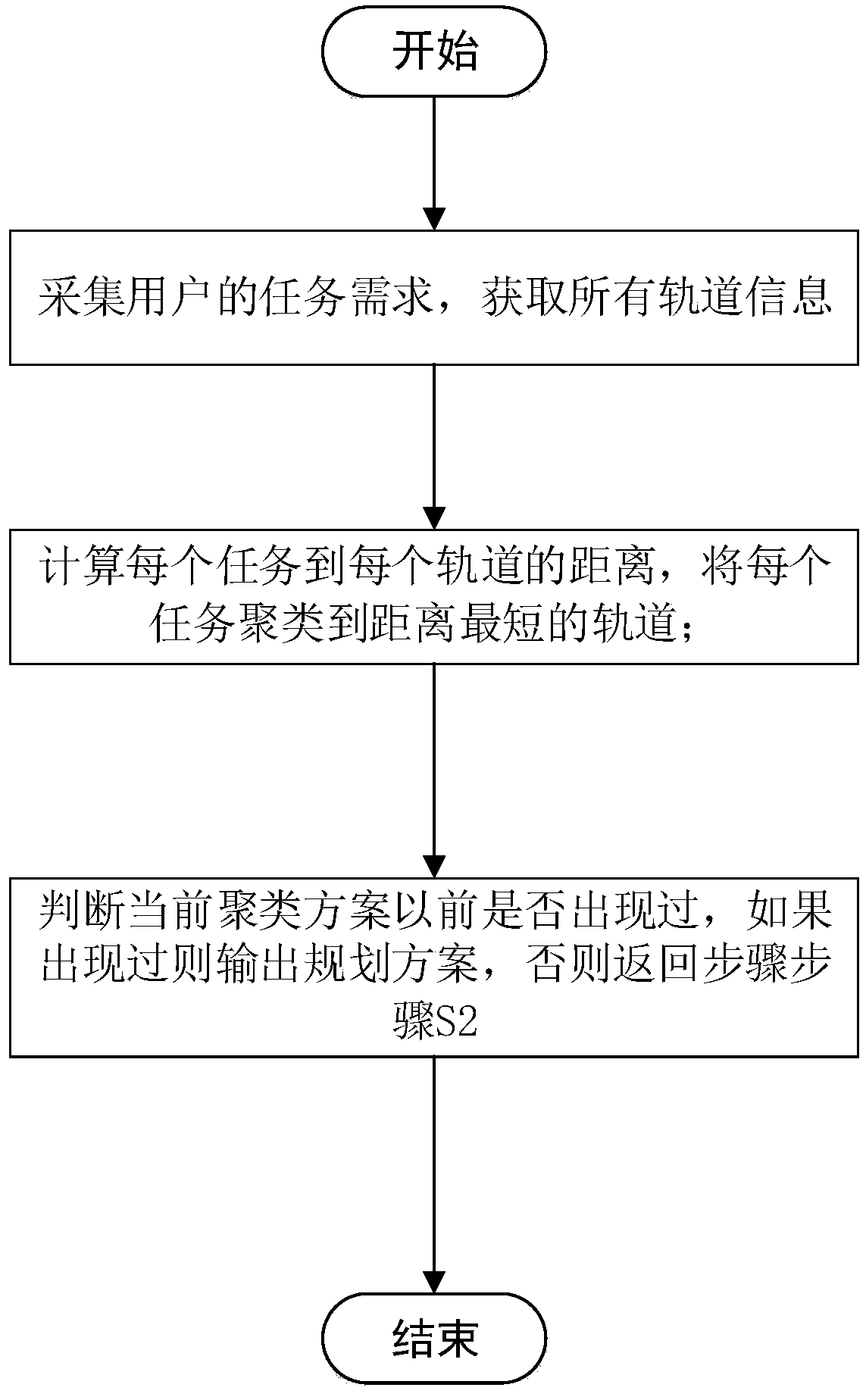
[0048] The embodiments of the present invention will be described in detail below with reference to the accompanying drawings, but the present invention can be implemented in many different ways defined and covered by the claims.
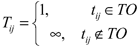
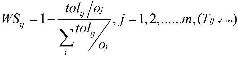
[0049] The basic idea of ​​the K-means clustering algorithm is to divide the N data in the data set into K classes, and the average vector from the data in each class to the center of the class is the shortest, which is also the distance from the point to the cluster point. Usually, the K-means clustering algorithm randomly selects K points as the cluster centers, calculates the distance from other points to each cluster center, and assigns each point to the class where the cluster center with the shortest distance is located. Find the center value of all data in a class to establish a new clustering point, and then continue to classify all points. After several iterations, until the clustering category of each point is stable, the K-means clustering...


PUM


Abstract

The invention provides a multi-satellite task planning method based on K-means clustering, the method comprises the steps of: S1, collecting task requirements of users T= {t1, t2, t3... Tn}, and obtaining an orbital working time set O= {o1, o2, o3,... Om} corresponding to each circle of sun illumination region of all currently available satellites;S 2, calculating the distance Disij between the task ti and each element oj in the set O, forming a distance set D= {di1, di2, di3... Din} between the task ti and the orbit set O, and clustering the task ti to the orbit k, Disik=Min (D) which is theshortest distance from the orbit set O; S3, judging whether the current clustering scheme sk belongs to the set S= {s1, s2, s3,... Sz}, outputting the clustering scheme sk if sk belongs to S, otherwise adding the scheme sk to the scheme set S, and returning to step S2. By analyzing the factors affecting the assignment of multi-satellite tasks and quantifying these factors and by using the K-meansclustering algorithm, a multi-satellite cooperative task assignment scheme is designed, which has fewer iterations and faster computational speed, and can meet the constraints of time complexity for large-scale optimization problems, and greatly improve the quality of imaging, and improve the completion rate of the task.

Description

technical field [0001] The invention relates to the technical field of satellite mission planning, in particular to a multi-satellite mission planning method based on K-means clustering. Background technique [0002] At the beginning of the development of imaging mission technology, due to the limited satellite load capacity and relatively few user missions, the imaging time and imaging angle of missions are relatively fixed, and mission planning problems are not prominent. With the development of imaging satellite technology and the increase in demand for ground image data, users' requirements for demand are also more complex. Satellites start to need to adjust the side view angle of remote sensing equipment for imaging. In the imaging process, various factors must be considered to meet user needs, and the earth observation satellites are scheduled and planned based on the overall optimization strategy. [0003] Simple reasoning and calculation in the existing technology c...

Claims


Application Information

Patent Timeline
Patent Type & Authority Applications(China)
IPC IPC(8): G06Q10/06G06K9/62
CPCG06Q10/06312G06F18/23213
Inventor 徐雪仁常中祥张少丁贺雷鹏
Owner 湖南国科轩宇信息科技有限公司
Why Eureka
Try Eureka