
Adaptive processing method for foggy sky and white areas in UAV aerial images

A technology of white area and processing method, which is applied in the field of adaptive processing of haze sky and white area of ​​UAV aerial images, can solve the problems of missed detection of sky parts, color distortion of dehazing, and image color distortion, so as to solve the problem of color distortion. , contrast, and color saturation enhancement

Active Publication Date: 2021-12-31
SHENZHEN LOTUT INNOVATION DESIGN CO LTD
View PDF4 Cites 0 Cited by
  • Summary
  • Abstract
  • Description
  • Claims
  • Application Information

AI Technical Summary

Problems solved by technology

This method has an ideal defogging effect, but bright areas such as the sky or white do not satisfy the prior law of the dark primary color, resulting in image color distortion in these areas after defogging. Therefore, the color distortion of bright areas such as sky or white in the image is solved problem becomes an important task in the restoration of existing images
[0004] In view of the shortcomings of the current algorithm, the key parameters in the atmospheric scattering model are studied, and the bilateral filter or guided filter with better edge-preserving effect is used to accurately estimate the atmospheric dissipation function, retain the edge details of the image, and can It is too natural between the flat area and the halo effect or fog residue after the image is restored, but the problem of distortion in the bright area such as the sky or white is still not solved; some people use a fixed threshold to repair the transmittance and protect the sky fog image to a certain extent However, it is easy to cause insufficient defogging of the image without sky; some people also use segmented sky area to avoid the color distortion of the image after defogging, but because the maximum connected area is used as the identified sky area, it is easy to cause some sky parts. Missed detection of blocks, resulting in distorted color of the missed detection part of the sky area
These algorithms do not fundamentally solve the problem of defogging color distortion, so the algorithm for improving the effect of foggy sky or white areas needs to be improved

Method used


Image

  • Adaptive processing method for foggy sky and white areas in UAV aerial images
  • Adaptive processing method for foggy sky and white areas in UAV aerial images
  • Adaptive processing method for foggy sky and white areas in UAV aerial images

Examples


Embodiment Construction

[0045] Below in conjunction with accompanying drawing, the present invention is described in further detail:

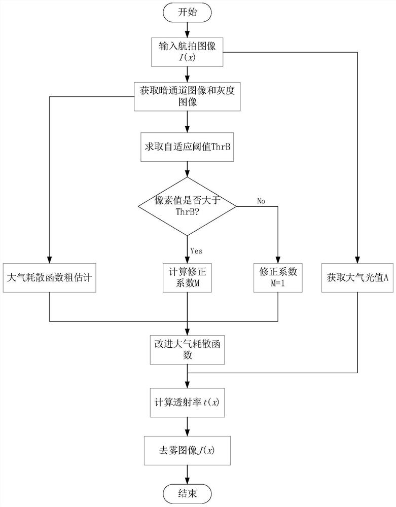
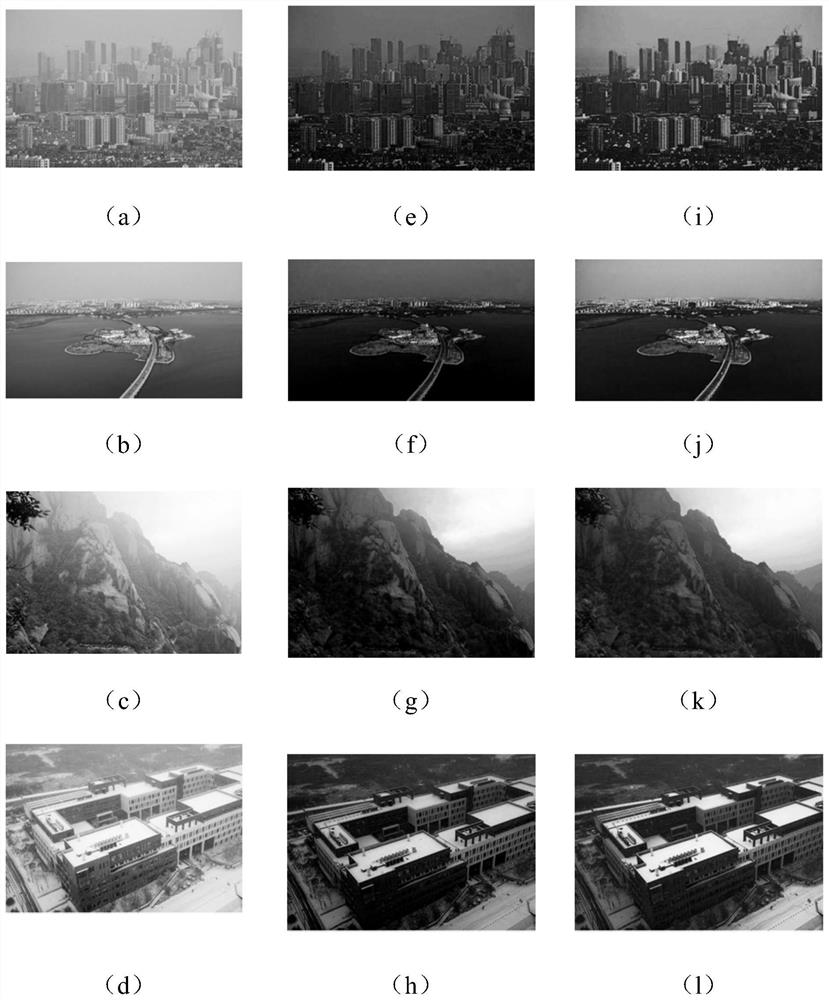
[0046] see figure 1 and figure 2 , The present invention provides an adaptive processing method for foggy sky and white areas of aerial images taken by drones.

[0047] Step 1. Acquire the aerial image of the UAV: ​​use the image acquisition device of the UAV to obtain the aerial image I(x) to be dehazed.

[0048] Step 2, the UAV aerial image obtained in step 1 is obtained based on the dark channel prior theory to obtain the dark channel image I dark (x) and grayscale image I gray (x);

[0049] The acquired dark channel image is based on the dark channel prior theory proposed by He Yuming. In most non-sky areas, some pixels always have at least one color channel with a very low value, which tends to almost zero. In other words, the minimum value of the light intensity in this area is a small number close to zero. Taking an RGB image as an example, for any input...


PUM


Abstract

The invention discloses a self-adaptive processing method for foggy sky and white areas of UAV aerial images. Firstly, the foggy images to be processed are obtained; then dark channel images and grayscale images of the foggy images are obtained; according to the dark channel The image calculates the atmospheric light value A of the image; the dark channel image is used as a rough estimate of the atmospheric dissipation function, and the adaptive threshold ThrB that can segment the close-up and the sky or white area is obtained according to the gray image; then the image is processed in different regions, and the calculation Correct the coefficient and substitute it into the improved atmospheric dissipation function formula to obtain the improved atmospheric dissipation function value; then refine the obtained improved atmospheric dissipation function through bilateral filtering; then calculate the image according to the transmittance estimation formula Transmittance t(x); Finally, the haze-free image is restored according to the image degradation model.

Description

technical field [0001] The invention belongs to the technical field of image processing, in particular to a self-adaptive processing method for foggy sky and white areas of aerial photographed images of drones. Background technique [0002] At present, the hotspot in the field of UAV research is the application of UAV in surveying and mapping, target recognition, geological disaster prevention and other fields. The execution of UAV tasks largely depends on UAV images with high imaging quality. With the deterioration of weather conditions, the images obtained by aerial photography in foggy weather are blurred and the definition is not high. The basic information features of the images obtained by aerial photography are seriously distorted and damaged, and useful information cannot be captured. The demand for defogging is getting higher and higher. [0003] In recent years, great progress has been made in single-image dehazing methods, and image dehazing methods can be divide...

Claims


Application Information

Patent Timeline
Patent Type & Authority Patents(China)
IPC IPC(8): G06T5/00G06T5/20G06T7/11G06T7/136
CPCG06T5/20G06T7/11G06T7/136G06T2207/20028G06T2207/30181G06T5/92G06T5/73
Inventor 黄鹤郭璐王会峰杜晶晶宋京胡凯益许哲惠晓滨黄莺任思奇周卓彧
Owner SHENZHEN LOTUT INNOVATION DESIGN CO LTD
Learn More