A method and a system for dividing an urban functional area by integrating landscape and social characteristics

A technology of urban functions and landscapes, applied in special data processing applications, text database clustering/classification, instruments, etc., can solve the problems of data sparseness, limited application range, etc., and achieve the effect of low cost

Active Publication Date: 2019-01-11
SOUTH CHINA NORMAL UNIVERSITY
View PDF3 Cites 15 Cited by
  • Summary
  • Abstract
  • Description
  • Claims
  • Application Information

AI Technical Summary

Problems solved by technology

However, most of this kind of data is concentrated in the core areas of the city, and the data in other areas is sparse, and its distribution has typical spatial heterogeneity, which limits its application scope.

Method used


Image

  • A method and a system for dividing an urban functional area by integrating landscape and social characteristics
  • A method and a system for dividing an urban functional area by integrating landscape and social characteristics
  • A method and a system for dividing an urban functional area by integrating landscape and social characteristics

Examples


Embodiment Construction

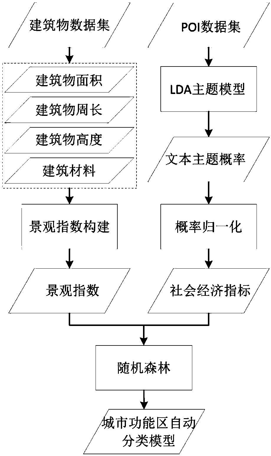
[0054] The present invention will be further described below in conjunction with the accompanying drawings and embodiments.

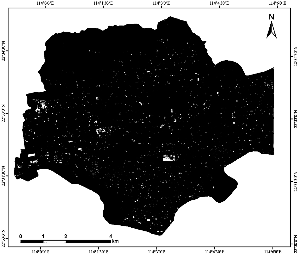
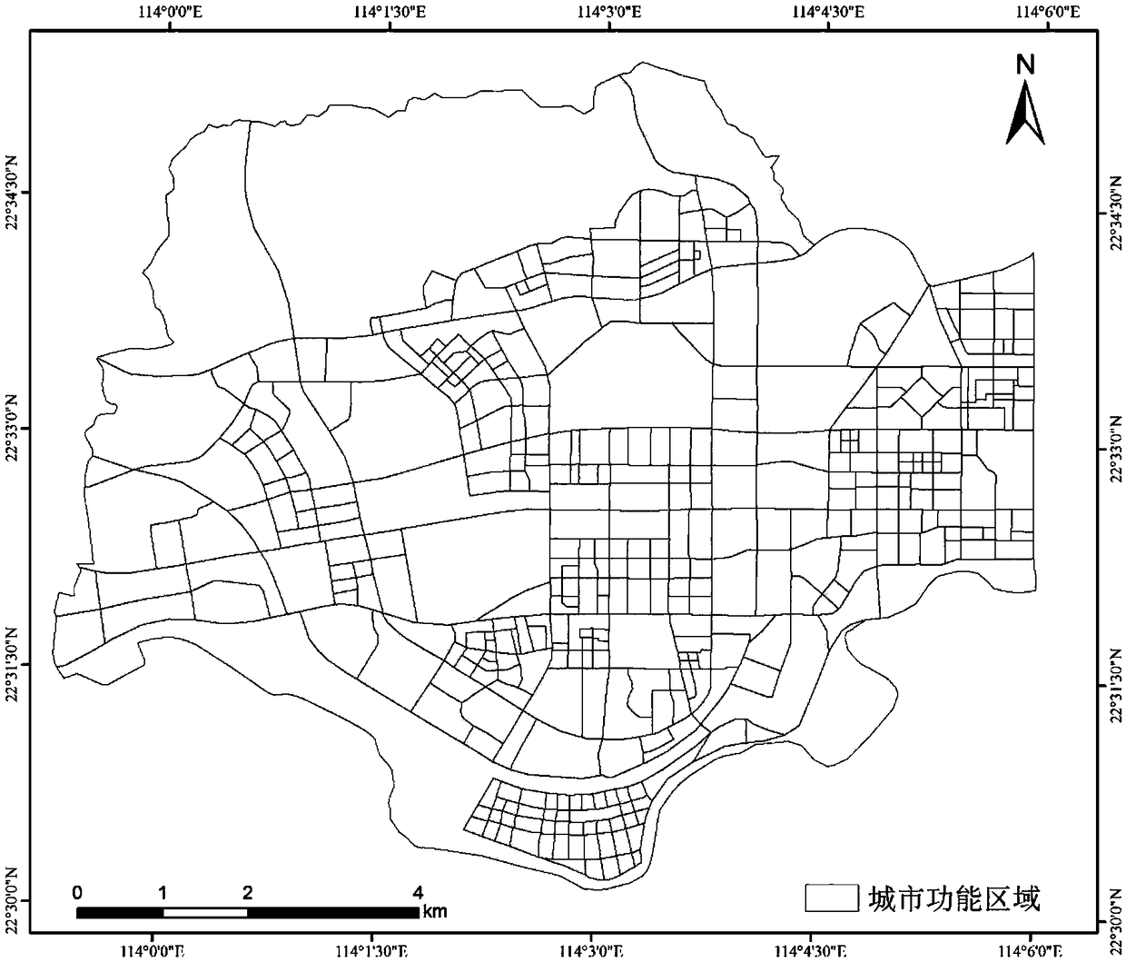
[0055] In order to have a clearer understanding of the technical characteristics, purpose and effects of the present invention, in the specific implementation of the present invention, Futian District, Shenzhen City, Guangdong Province is taken as the research area, and the POI data set and buildings of the Gaode map in Futian District, Shenzhen City, Guangdong Province are used The data set is research data, and the urban functional area is divided, and the specific implementation manner of the present invention is described with reference to the accompanying drawings.

[0056] The following will clearly and completely describe the technical solutions in the embodiments of the present invention with reference to the accompanying drawings in the embodiments of the present invention. Obviously, the described embodiments are only some, not all, embodiments...


PUM


Abstract

The invention provides a method and a system for dividing an urban functional area by integrating landscape and social characteristics. Firstly, an application programming interface (API) provided bya network electronic map is utilized to compile a Python network crawler to obtain city landscape data and social media data. Then, through the construction of landscape index, the landscape pattern of the urban functional areas is measured by using the urban landscape data; then, by using social media data and LDA theme model, the socio-economic indicators are established to extract the socio-economic characteristics of urban functional areas; finally, a stochastic forest algorithm is introduced to construct an automatic classification model of urban functional areas and realize urban functional classification. The method and system of the invention are low in cost, high in efficiency and capable of objectively constructing evaluation indexes, and can accurately depict the natural and social characteristics of different urban functions, thereby realizing more refined urban functional area division.

Description

technical field [0001] The invention belongs to the technical field of division of urban functional areas, and in particular relates to a method and system for dividing urban functional areas that integrate landscape and social features. Background technique [0002] Urban functional area refers to the geographical space that can realize the spatial aggregation of natural and social resources and effectively play a specific urban function. With the rapid development of urban construction and social economy, the natural landscape characteristics and socioeconomic characteristics of urban functional areas are becoming more and more prominent. The identification and division of urban functional areas plays an important role in measuring the degree of land use, planning various economic and social functions, and enhancing regional comprehensive competitiveness. The traditional division of urban function zones is mainly based on land use survey data, and the establishment of eva...

Claims


Application Information

Patent Timeline
Patent Type & Authority Applications(China)
IPC IPC(8): G06F16/35G06F16/9535G06F16/9537G06Q50/00
CPCG06Q50/01
Inventor 邢汉发赵耀龙孟媛
Owner SOUTH CHINA NORMAL UNIVERSITY
Why Eureka
Try Eureka