Terrain rendering method and apparatus

A technology of terrain rendering and terrain height, applied in the field of drones, can solve the problems of small application range, small coverage area, and low measurement accuracy, and achieve the effect of wide application range

Inactive Publication Date: 2019-02-26
GUANGZHOU XAIRCRAFT TECH CO LTD
View PDF2 Cites 2 Cited by
  • Summary
  • Abstract
  • Description
  • Claims
  • Application Information

AI Technical Summary

Problems solved by technology

The advantage of satellite measurement and surveying and mapping aircraft measurement is that the measurement efficiency is relatively high. The disadvantage is that the measurement accuracy is low and the scope of application is relatively small. For some special areas, such as mountainous and hilly areas, etc., due to signal coverage and other reasons, these areas cannot be measured.
However, based on handheld devices such as total stations, the measurement efficiency is low and the coverage is relatively small.

Method used


Image

  • Terrain rendering method and apparatus
  • Terrain rendering method and apparatus
  • Terrain rendering method and apparatus

Examples


Embodiment Construction

[0038] In order to make the above objects, features and advantages of the present invention more comprehensible, the present invention will be further described in detail below in conjunction with the accompanying drawings and specific embodiments. Apparently, the described embodiments are some, but not all, embodiments of the present invention. Based on the embodiments of the present invention, all other embodiments obtained by persons of ordinary skill in the art without creative efforts fall within the protection scope of the present invention.

[0039] The embodiments of the present invention will be described in detail below.

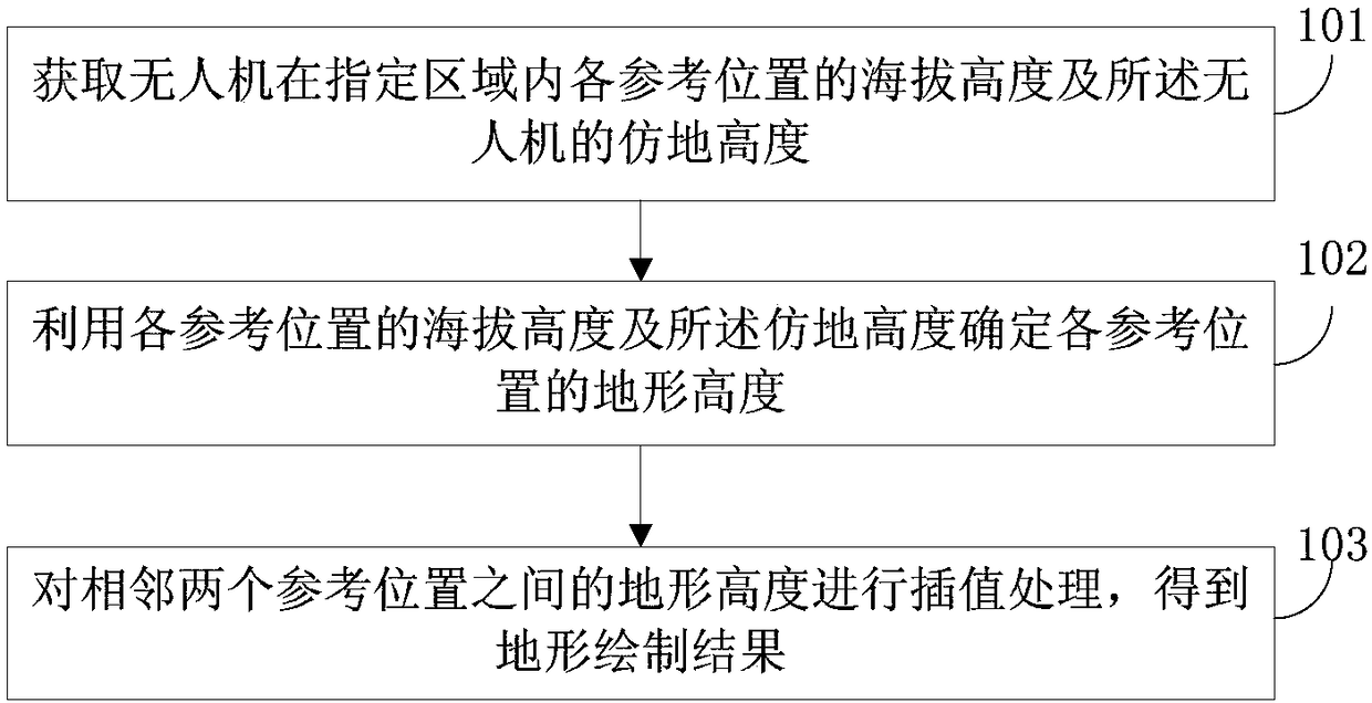
[0040] refer to figure 1 , which shows a flow chart of the steps of a terrain rendering method according to an embodiment of the present invention, which may specifically include the following steps:

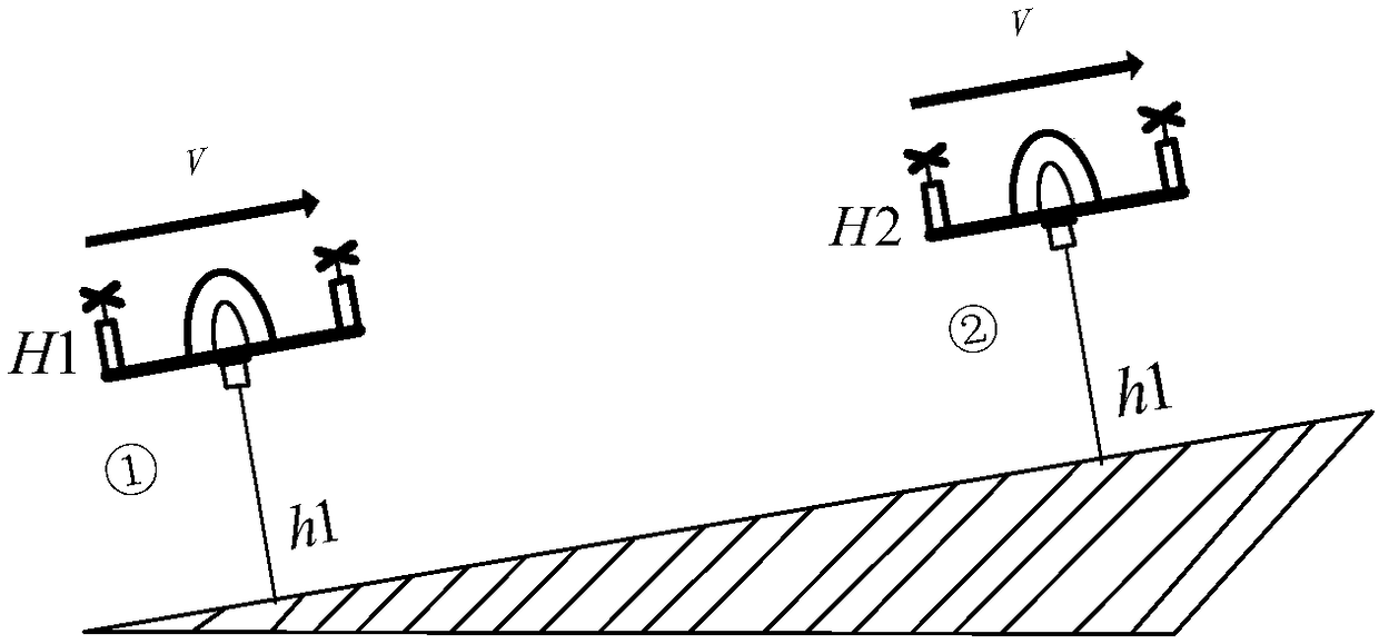
[0041] Step 101: Obtain the altitude of each reference position of the UAV in a designated area and the ground imitation height of the UAV.

[00...


PUM


Abstract

Embodiments of the invention provide a terrain rendering method and apparatus. The method comprises the following steps: acquiring the altitude of an unmanned aerial vehicle at each reference positionin a designated area and the simulated ground height of the unmanned aerial vehicle, wherein the simulated ground height refers to the vertical height between the unmanned aerial vehicle and the ground; determining the terrain height of each reference position by using the altitude of each reference position and the simulated ground height; and subjecting the terrain height between every two adjacent reference positions to interpolation processing so as to obtain terrain rendering results. The terrain rendering method and apparatus provided by the embodiments of the invention can detect the terrain of flat-bottomed land and accurately measure the terrain of some mountainous areas, and are wider in application scope.

Description

technical field [0001] The invention relates to the field of unmanned aerial vehicles, in particular to a terrain rendering method and device. Background technique [0002] Existing terrain detection generally uses satellite surveys, surveying and mapping aircraft surveys, total stations and other equipment surveys. The advantage of satellite measurement and surveying and mapping aircraft measurement is that the measurement efficiency is relatively high. The disadvantage is that the measurement accuracy is low and the scope of application is relatively small. For some special areas, such as mountainous and hilly areas, etc., due to signal coverage and other reasons, these areas cannot be measured. . However, the measurement efficiency based on handheld devices such as total stations is low, and the coverage is relatively small. [0003] Therefore, there is an urgent need for a topographic measurement scheme for mountainous areas and other areas. Contents of the invention...

Claims


Application Information

Patent Timeline
Patent Type & Authority Applications(China)
IPC IPC(8): G01C7/02
CPCG01C7/02
Inventor 陈有生
Owner GUANGZHOU XAIRCRAFT TECH CO LTD
Why Eureka
Try Eureka