A method for automatically matching images and vector road intersection points

An automatic matching and intersection technology, applied in character and pattern recognition, instruments, calculations, etc., can solve problems such as heavy workload, consuming a lot of manpower, material resources and time, and achieve the effect of high accuracy and labor saving.

Active Publication Date: 2019-03-08
WUHAN UNIV
View PDF4 Cites 13 Cited by
  • Summary
  • Abstract
  • Description
  • Claims
  • Application Information

AI Technical Summary

Problems solved by technology

[0003] The technical basis of using image data to perform data correction on vector data is the matching of feature points with the same name between image data and vector data. However, traditional feature points with the same name are mostly

Method used


Image

  • A method for automatically matching images and vector road intersection points
  • A method for automatically matching images and vector road intersection points
  • A method for automatically matching images and vector road intersection points

Examples


Embodiment Construction

[0037] In order to make the object, technical solution and advantages of the present invention clearer, the present invention will be further described in detail below in combination with specific implementation cases and with reference to the accompanying drawings.

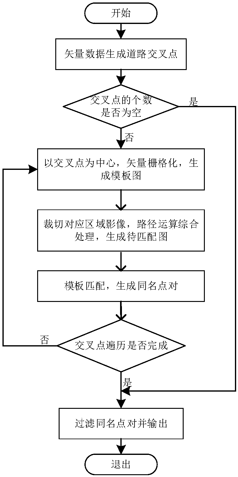
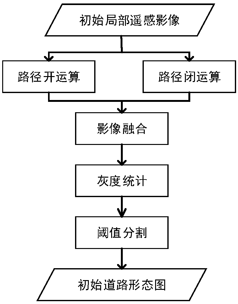
[0038] Vector road network data is data in vector format, and high-resolution remote sensing data is data in raster format. To achieve the matching of road intersections with the same name, it is necessary to unify the data in different data formats into one data format, and then find the feature points with the same name. . At present, there are two main ideas for realizing automatic calculation. One is to directly extract roads from high-resolution images, and then convert them into road network data in vector format, and then match road intersections with the same name with vector road network data; the other method is , extract road intersections as prior knowledge from the vector road network data, and raste...


PUM


Abstract

The invention relates to the application field of geographic data registration, more specifically, to a method for automatically matching images and vector road intersection points by using the template matching and the path opening and closing operation, comprising the steps of generating road characteristic points through vector road intersection and topological structure analysis, etc.; converting the vector map into a bitmap by vector rasterization, rasterizing vector data within a certain range of road intersection, and matching the vector data with processed local image data as template;cutting the image data of corresponding area, carrying out path opening and closing operation on the image data, and generating a map to be matched; generating a pair of points with the same name through template matching; filtering the overall offset of the automatically calculated road intersection points by setting the direction and distance threshold to improve the accuracy of the calculationof the feature points of the same name. The method of the invention provides an automatic extraction method for the data production of the feature point pair of the same name between the remote sensing image data and the vector road data.

Description

technical field [0001] The invention relates to the application field of geographic data registration, more specifically, a method for automatically matching image and vector road intersections by using template matching and path opening and closing operations. Background technique [0002] With the acceleration of urbanization, road data has increasingly become one of the most closely related spatial data in human life, but the continuous construction and repair of roads makes the road data in geographic databases change all the time. However, the updating of traditional road data mainly relies on professional surveying and mapping personnel, with long measurement cycles and high costs, so that traditional surveying and mapping operations often cannot meet people's needs for the current situation of urban roads. With the continuous development of sensor technology, remote sensing image data is becoming clearer and clearer. Compared with traditional vector data, remote sensi...

Claims


Application Information

Patent Timeline
IPC IPC(8): G06K9/62G06K9/34
CPCG06V10/267G06F18/23G06F18/22
Inventor 王艳东康泽慧刘波贺楷锴吴胜魏广泽赫文凤李小雨殷寒露
Owner WUHAN UNIV
Why Eureka
Try Eureka