Method, device and electronic device for constructing semantic vector map based on visual point cloud

A vector map and semantic technology, applied in the field of map construction, can solve the problems of many manual interventions and high cost of lidar, and achieve low-cost effects

Active Publication Date: 2019-03-12
NANJING INST OF ADVANCED ARTIFICIAL INTELLIGENCE LTD
View PDF3 Cites 34 Cited by
  • Summary
  • Abstract
  • Description
  • Claims
  • Application Information

AI Technical Summary

Problems solved by technology

However, due to the high cost of lidar and excessive manual intervention, the construction and dime

Method used


Image

  • Method, device and electronic device for constructing semantic vector map based on visual point cloud
  • Method, device and electronic device for constructing semantic vector map based on visual point cloud
  • Method, device and electronic device for constructing semantic vector map based on visual point cloud

Examples


Embodiment Construction

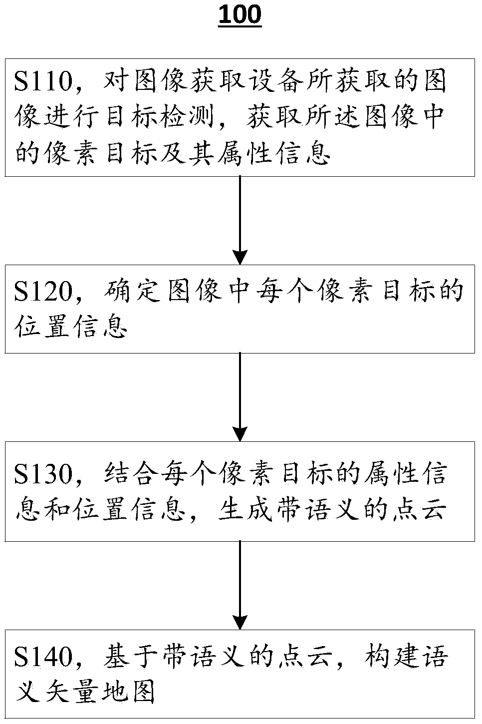
[0016] Hereinafter, exemplary embodiments according to the present application will be described in detail with reference to the accompanying drawings. Apparently, the described embodiments are only some of the embodiments of the present application, rather than all the embodiments of the present application. It should be understood that the present application is not limited by the exemplary embodiments described here.

[0017] Application overview

[0018] As mentioned above, the existing high-precision map construction methods have the following problems:

[0019] 1) The cost of the sensor is high: currently, the absolute coordinates of the point cloud in the world coordinate system are generally obtained through laser radar and high-precision integrated navigation, and the acquisition cost of 3D information is high;

[0020] 2) Much manual intervention: Objects of interest need to be manually selected, such as fences, traffic lights, signs, lane lines, etc., which requi...


PUM


Abstract

The invention discloses a semantic vector map construction method based on visual point cloud, a semantic vector map construction device based on visual point cloud and an electronic device. Accordingto an embodiment, a method for constructing a semantic map based on a visual point cloud includes performing object detection on an image acquired by an image acquisition device to acquire pixel objects in the image and attribute information thereof; Determining position information of each pixel target in the image; Combining attribute information and position information of each pixel object togenerate a point cloud with semantics; And a semantic vector map is constructed based on the point cloud with semantics. The semantic vector map construction method of the present application can complete the high-definition map construction at a very low cost by only using images and a small amount of prior information of external sensors.

Description

technical field [0001] The present application relates to the field of map construction, and more specifically, relates to a visual point cloud-based semantic vector map construction method, construction device, and electronic equipment. Background technique [0002] The map is the basis of robot navigation and positioning, and the core dependent module of unmanned vehicles. For a long time, map construction has restricted the development of mobile robots. At present, the absolute coordinates of the point cloud in the world coordinate system are obtained through lidar and high-precision integrated navigation (RTK+high-precision IMU), and then the objects of interest (such as fences, traffic lights, signboards, lane lines, etc.) are manually selected. ), perform vectorized calculations one by one, and finally convert into a standard map format to generate a high-precision map. [0003] High-precision maps of specific areas can be constructed through high-cost precision sens...

Claims


Application Information

Patent Timeline
IPC IPC(8): G06T19/00
CPCG06T19/003G06T2207/10028
Inventor 颜沁睿杨帅
Owner NANJING INST OF ADVANCED ARTIFICIAL INTELLIGENCE LTD
Why Eureka
Try Eureka