GNSS imaging method based on inter-station correlation spatial structure function construction
A technology of spatial structure and imaging method, applied in the direction of instruments, measuring devices, computing, etc., to achieve the effect of improving cognition, high temporal resolution and reliability, and overcoming the insufficiency of temporal resolution
- Summary
- Abstract
- Description
- Claims
- Application Information
AI Technical Summary
Problems solved by technology
Method used
Image
Examples
Embodiment Construction
[0026] In order to make the purpose, technical solutions and beneficial effects of the present invention more clear, the present invention will be further described below in conjunction with the accompanying drawings and embodiments.
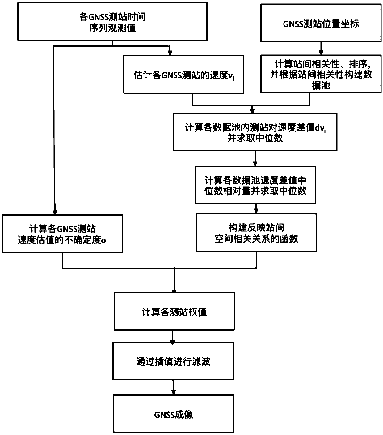
[0027] see figure 1 , the GNSS imaging method constructed based on the inter-station correlation spatial structure function provided by the embodiment of the present invention comprises steps:
[0028] Step 1, input the GNSS station coordinate time series observations, and the velocity v of each GNSS station n and its uncertainty σ n (n=1, 2, ..., N); Wherein, N is the total number of GNSS measuring stations in the whole GNSS network, and n is the label of the GNSS measuring stations in the whole GNSS network;
[0029] Step 2, combining the geology and geodesy results of the study area (such as geological fault location information, active block division model based on long-term GPS observations, etc.), cluster and divide the stations in the G...
PUM
 Abstract
Description
Claims
Application Information
 - R&D
- Intellectual Property
- Life Sciences
- Materials
- Tech Scout
- Unparalleled Data Quality
- Higher Quality Content
- 60% Fewer Hallucinations
Browse by: Latest US Patents, China's latest patents, Technical Efficacy Thesaurus, Application Domain, Technology Topic, Popular Technical Reports.
© 2025 PatSnap. All rights reserved.Legal|Privacy policy|Modern Slavery Act Transparency Statement|Sitemap|About US| Contact US: help@patsnap.com


