

Red-and-green area identifying and evaluating method for urban road network operation state
A technology of urban road network and operation status, applied in the intersection of reliability and transportation science, it can solve problems such as statistical deviation and poor stability.
- Summary
- Abstract
- Description
- Claims
- Application Information
AI Technical Summary
Problems solved by technology
Method used
Image

Examples
Embodiment Construction
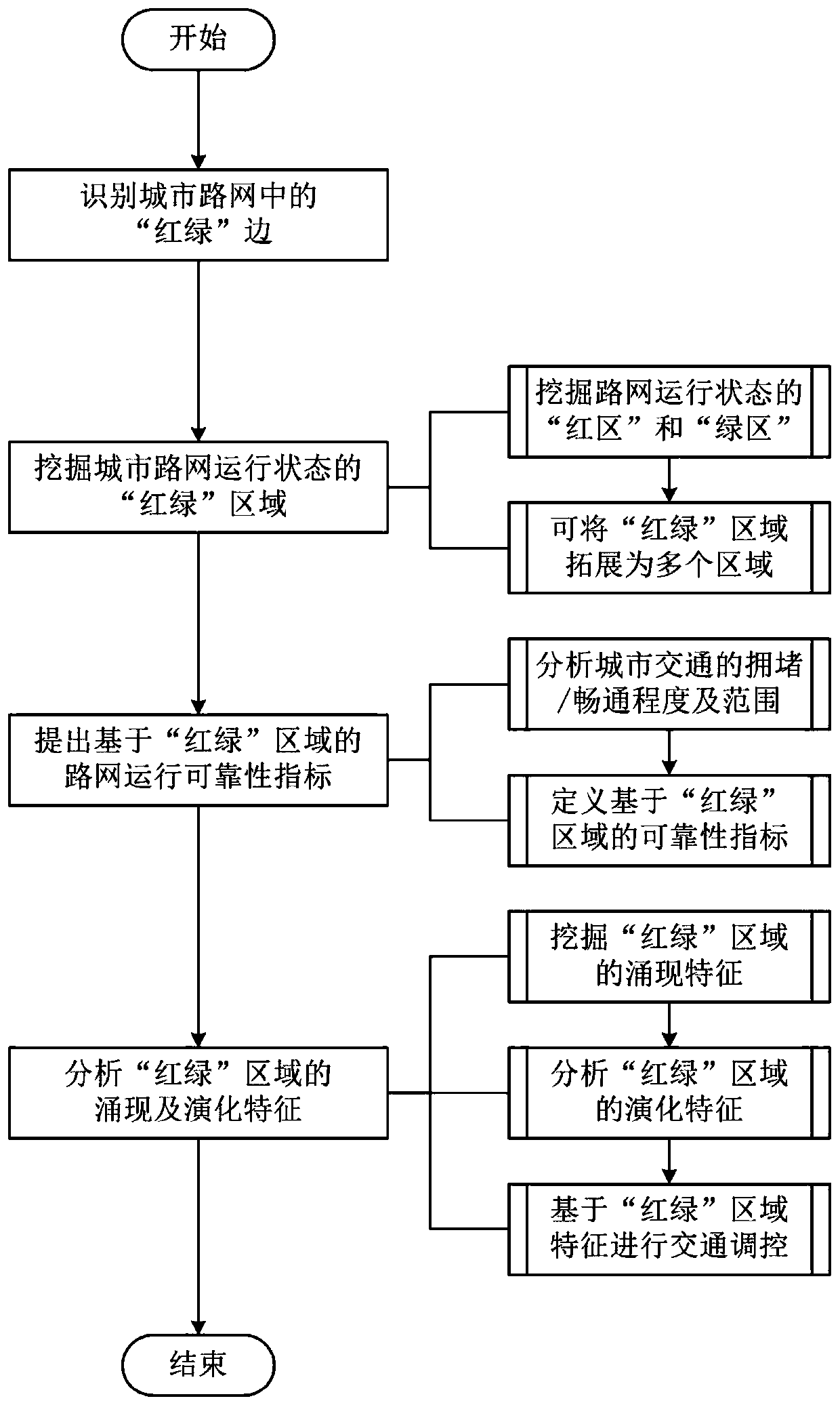
[0056] In order to make the technical problems and technical solutions to be solved by the present invention clearer, the following will describe in detail with reference to the accompanying drawings and specific implementation examples. It should be understood that the implementation examples described here are only used to illustrate and explain the present invention, not to limit the present invention.
[0057] The purpose of the present invention is to solve the limitations of the existing road network operating state evaluation methods, such as abstraction, static, statistical deviation, poor stability, etc., in road network reliability management decision-making. This patent introduces the concept of dynamic connected subgraphs under the premise of considering the needs of traffic managers for the research and judgment of the overall operation situation of the road network. The overall operation situation of the network is evaluated and reasoned. The "red and green" are...
PUM
 Abstract
Description
Claims
Application Information