
Flight track determination method and system for networked UAV (unmanned aerial vehicle)

A technology of flight trajectory and UAV, which is applied in the field of UAV, and can solve problems such as high algorithm complexity, lack of feasibility analysis of flight missions, and crash of networked UAVs.

Active Publication Date: 2019-06-28
NANCHANG UNIV
View PDF3 Cites 3 Cited by
  • Summary
  • Abstract
  • Description
  • Claims
  • Application Information

AI Technical Summary

Problems solved by technology

[0010] The above-mentioned technical solution has the following defects: 1) This solution uses a violent solution to obtain the optimal trajectory of the UAV, and the algorithm complexity is high
2) The scheme does not calculate the switching position of the base station, and the battery life of the networked UAV is extremely limited. When switching between multiple base station networks, how to determine a reasonable base station switching position will directly determine the time the UAV stays in the air. length
3) The scheme lacks the feasibility analysis of the flight mission. The networked UAV may crash due to long-term loss of connection during flight. The result of the feasibility analysis directly affects the success or failure of the mission.

Method used

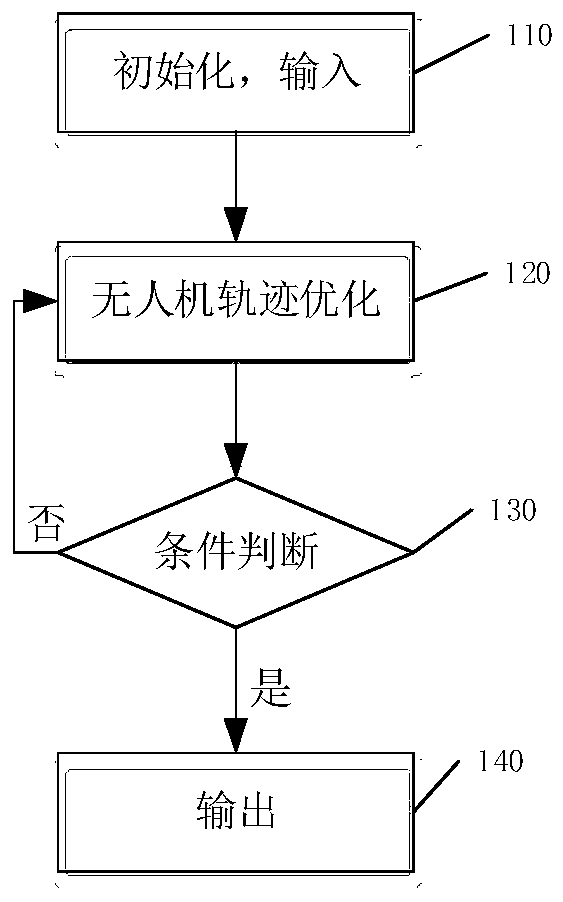

Image

  • Flight track determination method and system for networked UAV (unmanned aerial vehicle)
  • Flight track determination method and system for networked UAV (unmanned aerial vehicle)
  • Flight track determination method and system for networked UAV (unmanned aerial vehicle)

Examples


Embodiment 1

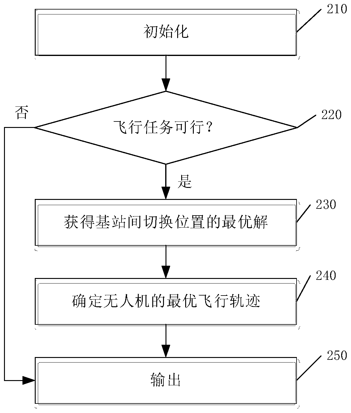
[0050] figure 2 It is a flowchart of a method for determining a flight trajectory of a networked drone according to an embodiment of the present application. like figure 2 As shown, the method includes the following steps:

[0051] Step 210: Initialization: Before the system works, an initialization operation is required. input starting point u 0 , end u F , starting point u 0 with endpoint u F All base station locations between g i , the constant flight height H of the UAV, the constant flight speed V of the UAV and the radius R of the maximum coverage area of ​​the base station. Among them, the starting point u 0 and terminal u F Not within the coverage of the same base station, the flight speed of the UAV is within the maximum and minimum flight speed range of the UAV, the radius R of the maximum coverage area of ​​the base station is determined according to the signal-to-noise ratio, the formula is as follows:

[0052]

[0053]

[0054] Among them, γ 0 I...

Embodiment 2

[0096] The present application also provides a system for determining the flight trajectory of the networked unmanned aerial vehicle corresponding to the above method, such as Image 6 As shown, the system includes an initialization module 610 , a feasibility analysis module 620 , an optimal switching position acquisition module 630 , a flight path determination module 640 and an output module 650 .

[0097] The initialization module 610 is used to input the starting point u 0 , end u F and the starting point u 0 with endpoint u F Between the base station locations, the start and end points are not within the coverage of the same base station.

[0098] The feasibility analysis module 620 is connected with the initialization module 610 , the switching position optimal solution acquisition module 630 and the output module 650 , and the feasibility analysis module 620 is used to analyze the feasibility of the flight mission under each path.

[0099] The switching position opt...


PUM


Abstract

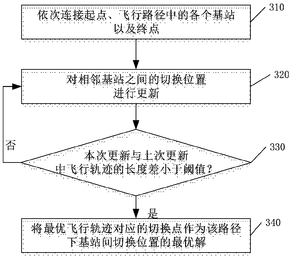
The invention discloses a flight track determination method and system for a networked UAV (unmanned aerial vehicle). The method comprises steps as follows: initialization is performed: a starting point, an end point and a base station position between the starting point and the end point are input, and the starting point and the end point are not located in the coverage area of the same base station; the optimal solution of switching positions among base stations under one flight track is obtained according to a connection state of the UAV with a triangle inequality iterative algorithm; the optimal flight track of the UAV is determined according to the optimal solution of the switching positions among the base stations under each flight track. According to the method and the system, the flight track of the networked UAV is enabled to be minimized, the optimal switching position of the UAV among multiple base stations is found rapidly, and flight time can be shortest on the premise that safe flight of the UAV is guaranteed.

Description

technical field [0001] The present application relates to the field of unmanned aerial vehicles, and in particular, relates to a method and system for determining a flight trajectory of a networked unmanned aerial vehicle. Background technique [0002] Driven by the wave of technology, the field of drones is developing rapidly. According to the research and forecast of Goldman Sachs Group, from the beginning of 2016 to 2020, drones will have a market opportunity of 100 billion US dollars. "Drones are the general trend of the future" has become a consensus in the industry, and drones have gradually played a variety of roles in China, such as drone delivery, drone delivery, drone participation in security inspections, and drones. Agricultural monitoring, etc. [0003] However, with the increase in the number of drones and the continuous expansion of the scope of application, the shortcomings of drones are also exposed. The short flight distance of drones, the easy loss of GP...

Claims


Application Information

Patent Timeline
IPC IPC(8): G05D1/10
Inventor 杨鼎成但谦肖霖张天魁
Owner NANCHANG UNIV
Learn More