Geographic location matching method and device, storage medium and server

A technology of geographic location and matching method, applied in the field of big data, can solve the problems of low matching efficiency and long matching time, and achieve the effect of improving efficiency, shortening matching time, and speeding up calculation speed.

Active Publication Date: 2019-07-05
JINGZAN ADVERTISING SHANGHAI CO LTD
View PDF7 Cites 6 Cited by
  • Summary
  • Abstract
  • Description
  • Claims
  • Application Information

AI Technical Summary

Problems solved by technology

Its matching efficiency is low, resulting in long matching time

Method used


Image

  • Geographic location matching method and device, storage medium and server
  • Geographic location matching method and device, storage medium and server
  • Geographic location matching method and device, storage medium and server

Examples


Embodiment Construction

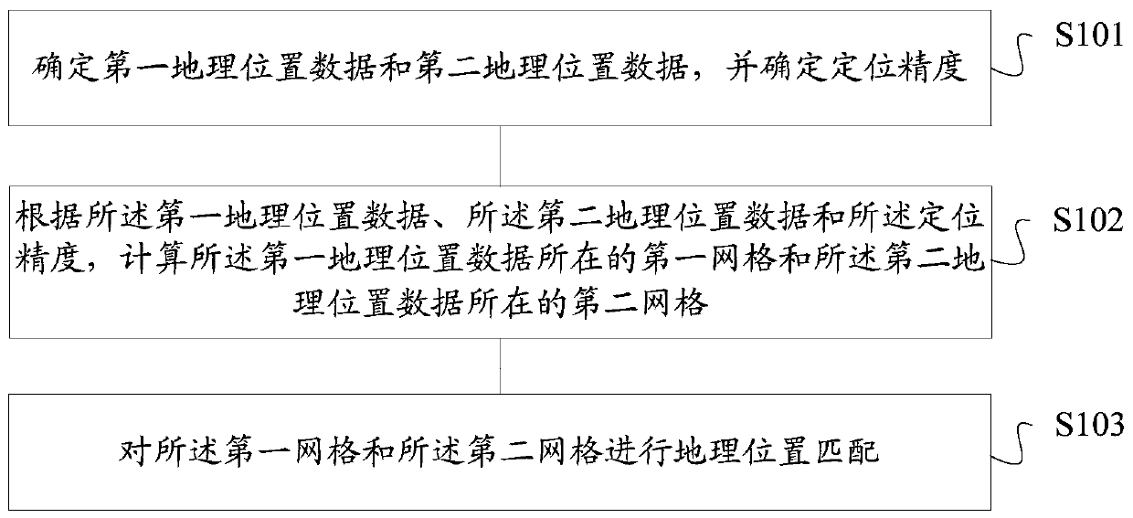
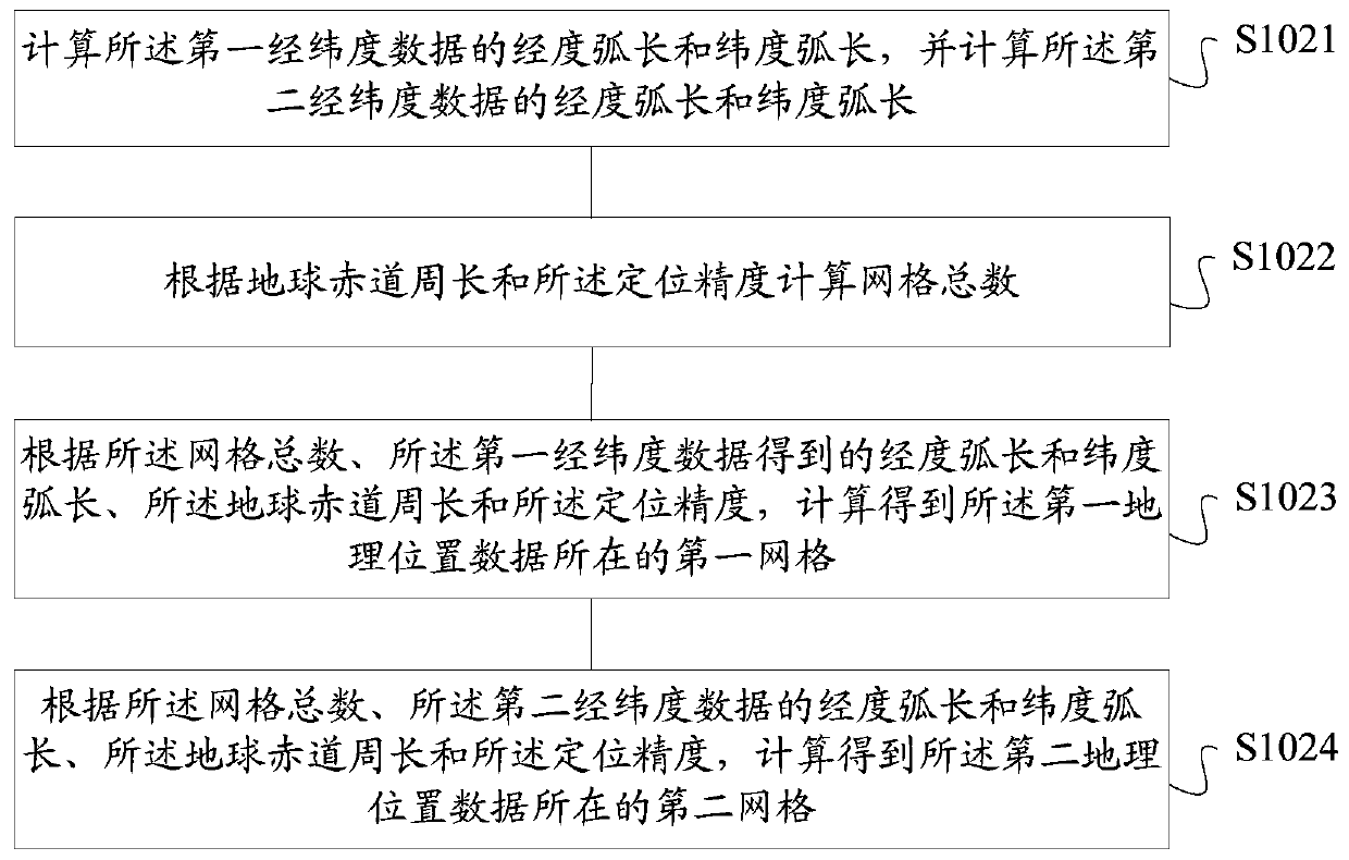
[0022] Those skilled in the art understand that, as mentioned in the background art, using the Geohash calculation in the prior art to match geographic locations is inefficient and time-consuming.

[0023] The inventor of the present application found through research that the GeoHash algorithm adopts the "latitude and longitude" encoding method, divides the earth or map into grids under the latitude and longitude coordinates, and performs binary search iteratively according to the latitude and longitude information, and can obtain two latitude and longitude characters composed of 0 and 1 string, and then encode the obtained two longitude and latitude strings to obtain the corresponding Geohash codeword.

[0024] The GeoHash algorithm includes two different encoding formats, namely the base 32 encoding (Base32) format and the base 64 encoding (Base64) format. Using these two encoding methods, the GeoHash algorithm can obtain the corresponding Geohash codeword.

[0025] Althou...


PUM


Abstract

The invention provides a geographic location matching method and device, a storage medium and a server. The method comprises the steps that first geographic location data and second geographic location data are determined, and the positioning accuracy is determined; according to the first geographic location data, the second geographic location data and the positioning accuracy, a first grid wherethe first geographic location data are located and a second grid where the second geographic location data are located are calculated; and the first grid and the second grid are geographically matched. The technical scheme provided by the embodiment of the invention can complete geographical location matching effectively and quickly, improves the geographical location matching efficiency, and shortens the matching time.

Description

technical field [0001] The present invention relates to the technical field of big data, in particular to a geographic location matching method and device, a storage medium, and a server. Background technique [0002] With the widespread use of mobile devices and the commercial Data Management Platform (DMP) stepping into the era of big data, the geographic location information of mobile users has become an important source of data for data mining and analysis. [0003] However, due to the huge amount of geographical information data generated by users, and in practical applications, there are also many geographical buildings. In the prior art, a geographic hash (Geohash) algorithm is usually used to mark the user's geographic location information. However, when the Geohash algorithm is dealing with massive latitude and longitude data and a large number of actual geographic locations. Its matching efficiency is low, resulting in long matching time. [0004] How to effecti...

Claims


Application Information

Patent Timeline
Patent Type & Authority Applications(China)
IPC IPC(8): G01C21/30G06F16/29
CPCG01C21/30
Inventor 汤奇峰刘立喆
Owner JINGZAN ADVERTISING SHANGHAI CO LTD
Why Eureka
Try Eureka