Three-dimensional geological attribute model space-time interpolation method and system

A technology of three-dimensional geological and attribute models, applied in the field of geological exploration, can solve problems such as huge differences, incorrect estimation of attributes of points to be interpolated, and influence on interpolation accuracy

Active Publication Date: 2019-08-06
CHINA ZHENGYUAN GEOMATICS CO LTD
View PDF2 Cites 10 Cited by
  • Summary
  • Abstract
  • Description
  • Claims
  • Application Information

AI Technical Summary

Problems solved by technology

There are large differences in attribute values ​​between regions with different geological conditions. For example, the attributes of two adjacent points on both side

Method used


Image

  • Three-dimensional geological attribute model space-time interpolation method and system
  • Three-dimensional geological attribute model space-time interpolation method and system
  • Three-dimensional geological attribute model space-time interpolation method and system

Examples


Embodiment Construction

[0081]The following will clearly and completely describe the technical solutions in the embodiments of the present invention with reference to the accompanying drawings in the embodiments of the present invention. Obviously, the described embodiments are only some, not all, embodiments of the present invention. Based on the embodiments of the present invention, all other embodiments obtained by persons of ordinary skill in the art without making creative efforts belong to the protection scope of the present invention.

[0082] In order to make the above objects, features and advantages of the present invention more comprehensible, the present invention will be further described in detail below in conjunction with the accompanying drawings and specific embodiments.

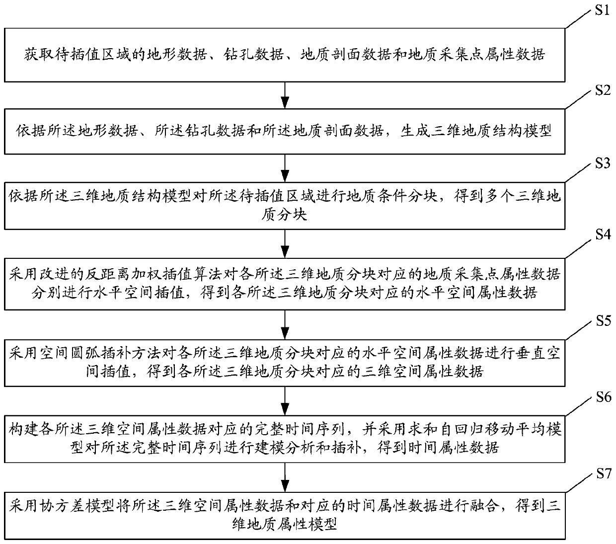
[0083] figure 1 It is a flowchart of a space-time interpolation method for a three-dimensional geological attribute model according to an embodiment of the present invention.

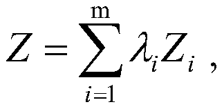
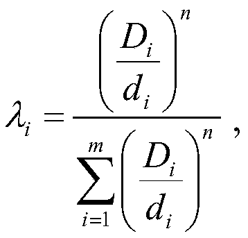
[0084] see figure 1 , the spatial-t...


PUM


Abstract

The invention discloses a three-dimensional geological attribute model space-time interpolation method and system. The method comprises the following steps: generating a three-dimensional geological structure model according to topographic data, drilling data and geological profile data; partitioning the to-be-interpolated region to obtain a plurality of three-dimensional geological blocks; sequentially performing horizontal space interpolation and vertical space interpolation on the geological acquisition point attribute data corresponding to each three-dimensional geological block to obtainthree-dimensional space attribute data; constructing a complete time sequence, and performing modeling analysis and interpolation on the complete time sequence by adopting a summation autoregressive moving average model to obtain time attribute data; and fusing the three-dimensional space attribute data and the corresponding time attribute data by adopting a covariance model to obtain a three-dimensional geological attribute model. According to the method, the interpolation precision can be improved, and the integrity of space-time data after interpolation is ensured.

Description

technical field [0001] The invention relates to the technical field of geological exploration, in particular to a three-dimensional geological attribute model spatio-temporal interpolation method and system. Background technique [0002] With the rapid economic development, the rapid urbanization process has intensified the contradiction between the supply and demand of land resources in cities. In order to solve the problems of traffic congestion and ecological environment deterioration caused by "urban diseases", it is urgent to rationally develop and utilize underground space resources. The development of underground space is inseparable from the full understanding of geological conditions and the quantitative calculation of underground space data. 3D geological modeling can intuitively understand the spatial distribution and change laws of geological entities by modeling the geometric shape of geological entities and the internal attribute parameters of geological entiti...

Claims


Application Information

Patent Timeline
IPC IPC(8): G06T17/05
CPCG06T17/05
Inventor 王琨丁志庆李学军周文潘良波宋红亮
Owner CHINA ZHENGYUAN GEOMATICS CO LTD
Why Eureka
Try Eureka