Unmanned aerial vehicle based on the internet of things

A technology of the Internet of Things and drones, applied in the field of drones, can solve problems such as drone overturning, anti-overturn protection, and increase the workload of surveying and mapping personnel, so as to reduce the burden of assembly operations, enhance take-off and landing safety, and enhance The effect of using flexibility

Inactive Publication Date: 2019-11-05
南京精微迅智能科技有限公司
View PDF7 Cites 4 Cited by
  • Summary
  • Abstract
  • Description
  • Claims
  • Application Information

AI Technical Summary

Problems solved by technology

[0003] The current surveying and mapping drones are usually assembled with an integrated structure. Since the structure of the drone is relatively integrated, when it is necessary to replace different surveying and mapping equipment, it takes a lot of manpower to disassemble and assembl

Method used


Image

  • Unmanned aerial vehicle based on the internet of things
  • Unmanned aerial vehicle based on the internet of things
  • Unmanned aerial vehicle based on the internet of things

Examples


Embodiment Construction

[0047] The following will clearly and completely describe the technical solutions in the embodiments of the present invention with reference to the accompanying drawings in the embodiments of the present invention. Obviously, the described embodiments are only some, not all, embodiments of the present invention.

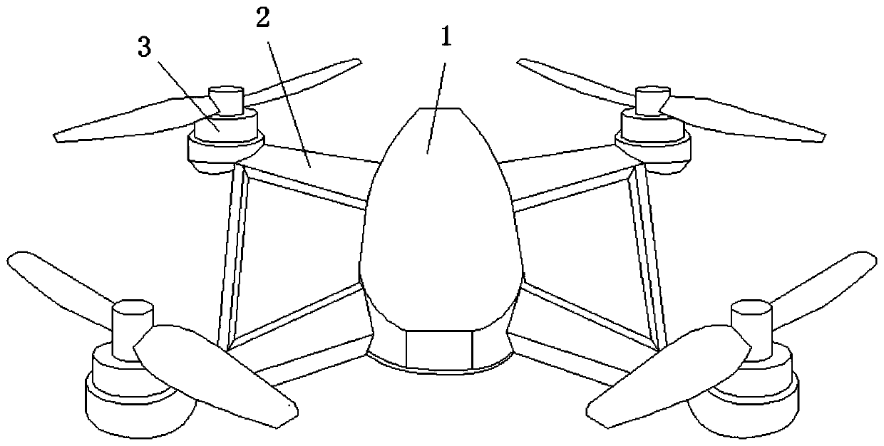
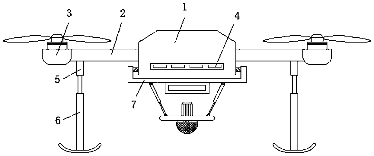
[0048] like figure 1 , figure 2 and Figure 4 As shown, a drone for surveying and mapping based on the Internet of Things includes a fuselage 1, a frame 2, a rotor 3, a landing gear 6, a surveying frame 7 and a mounting plate 77;

[0049] The frame 2 is bolted to the four corners of the fuselage 1, and the rotor 3 is arranged at the four corners of the frame 2;

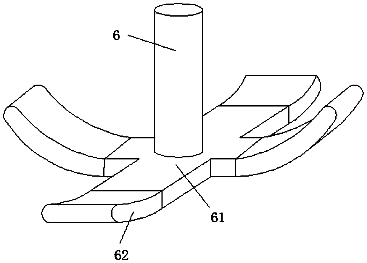
[0050] The top of the landing gear 6 is connected with a lifting electric control push rod 5, and the lifting electric control push rod 5 is arranged on the bottom of the frame 2;

[0051] The cross-section of the surveying frame 7 is a U-shaped structure, the vertical ends on both sides of the surveying...


PUM


Abstract

The invention discloses an unmanned aerial vehicle based on the internet of things. The unmanned aerial vehicle comprises a fuselage, a frame, rotors, an undercarriage, a surveying frame and a mounting plate; bolts of the frame are fixed at the four corners of the fuselage, the rotors are arranged at the four corners on the frame, the top portion of the undercarriage is connected with a lifting electric control push rod, the lifting electric control push rod is arranged at the bottom portion of the frame, the bottom portion of the surveying frame is provided with a storage battery pack, the wall of the mounting plate is provided with a servo motor, and the lower portion of the servo motor is in transmission connection with a surveying probe though a shaft coupling. In the invention, the unmanned aerial vehicle can have an elastic compensation effect on the inclination amplitude of the undercarriage to prevent the undercarriage from be overturned by landed on an uneven ground, and can also rotate the surveying probes with different specifications and models to install and use according to the actual surveying and drawing requirements so as to effectively reduce the assembling operation burden of surveyors and enhance the use flexibility of the unmanned aerial vehicle.

Description

technical field [0001] The invention relates to the technical field of unmanned aerial vehicles, in particular to an unmanned aerial vehicle for surveying and mapping based on the Internet of Things. Background technique [0002] Unmanned aircraft is referred to as "unmanned aerial vehicle", and the English abbreviation is "UAV". Surveying and mapping is based on computer technology, photoelectric technology, network communication technology, space science, and information science. The feature points and boundaries of the ground and obtain the graphics and position information reflecting the current situation of the ground through measurement means for engineering construction, planning and design and administrative management. Due to the complexity and cumbersome mapping process, UAVs are used for auxiliary surveying and mapping. So as to achieve efficient and comprehensive surveying and mapping processing. [0003] The current surveying and mapping drones are usually ass...

Claims


Application Information

Patent Timeline
IPC IPC(8): B64C25/08B64C25/32B64D47/00
CPCB64C25/08B64C25/32B64D47/00B64U10/10
Inventor 鲁京
Owner 南京精微迅智能科技有限公司
Why Eureka
Try Eureka