Remote sensing image building automatic extraction method and system based on residual network
A remote sensing image and automatic extraction technology, applied in the field of multi-spectral remote sensing images, can solve the problems of low degree of automation, achieve the effect of improving accuracy, reducing interpretation cost, and improving interpretation efficiency
- Summary
- Abstract
- Description
- Claims
- Application Information
AI Technical Summary
Problems solved by technology
Method used
Image
Examples
Embodiment 1
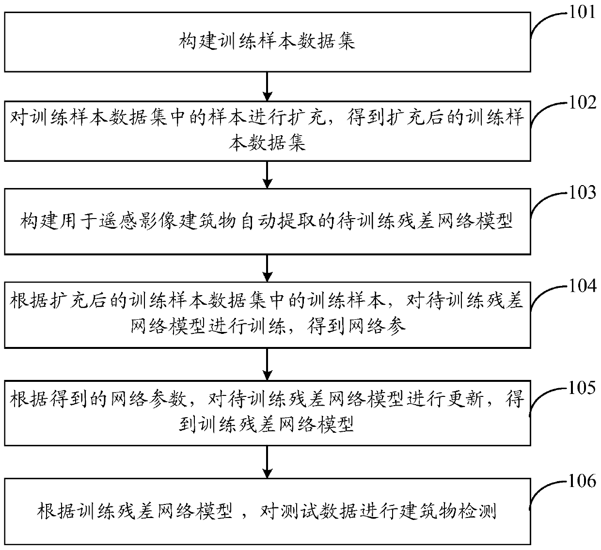
[0030] like figure 1 , in this embodiment, the method for automatically extracting buildings from remote sensing images based on the residual network includes:
[0031] Step 101, constructing a training sample data set.
[0032] In this embodiment, the training sample data set can be constructed in the following manner: obtain multispectral (including four bands of red, green, blue, and infrared) and panchromatic images collected by remote sensing satellite cameras; combine multispectral and panchromatic The images are fused to obtain a fused image; the fused image is segmented to obtain a segmented image; the label corresponding to the segmented image is determined; and the training sample data set is obtained according to the obtained segmented images with labels. Among them, the label is used to indicate the location of the building.
[0033] Preferably, when performing segmentation processing on the fused image, the segmentation size includes but not limited to: 500x500 ...
Embodiment 2
[0051] On the basis of the above embodiments, the following will be described in conjunction with a specific example.
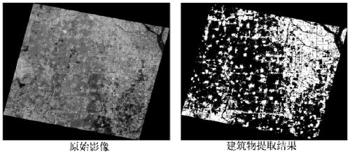
[0052]The embodiment of the invention discloses a method for automatically extracting buildings from remote sensing images based on a residual network, which is used for extracting buildings in a wide range. Under the Caffe framework, first complete the construction of the network, migrate the model trained on ImageNet, train the expanded training samples, and then use the tuned model parameters to extract buildings from the test remote sensing images.
[0053] Step 1: Prepare the training sample data set.
[0054] In this embodiment, 10 scenes of Gaofen No. 1 images and 5 scenes of ZY302 images in Beijing, Tianjin, Zhejiang and other regions were used to make training samples. The training sample in this experiment is a panchromatic and multi-spectral fusion image, with a resolution of 2 meters, including four channels, namely blue, green, red and infrared ...
Embodiment 3
[0072] On the basis of the above embodiments, the present invention also discloses a system for automatically extracting buildings from remote sensing images based on a residual network, including: a training set construction module, used to construct a training sample data set; a training set processing module, used to The samples in the training sample data set are expanded to obtain the expanded training sample data set; the model building module is used to construct a residual network model to be trained for automatic extraction of remote sensing image buildings; the parameter training module is used to The training samples in the final training sample data set are trained to train the residual network model to obtain network parameters; the model update module is used to update the parameters of the residual network model to be trained according to the obtained network parameters to obtain the training residual network The model; the detection module is used to perform bui...
PUM
 Abstract
Description
Claims
Application Information
 - R&D
- Intellectual Property
- Life Sciences
- Materials
- Tech Scout
- Unparalleled Data Quality
- Higher Quality Content
- 60% Fewer Hallucinations
Browse by: Latest US Patents, China's latest patents, Technical Efficacy Thesaurus, Application Domain, Technology Topic, Popular Technical Reports.
© 2025 PatSnap. All rights reserved.Legal|Privacy policy|Modern Slavery Act Transparency Statement|Sitemap|About US| Contact US: help@patsnap.com


