Side slope DEM generation method based on ground three-dimensional laser point cloud
A 3D laser and point cloud technology, applied in 3D modeling, geographic information database, image enhancement, etc., can solve the problem of losing important features of slope topography, and achieve the effect of great theoretical reference value
- Summary
- Abstract
- Description
- Claims
- Application Information
AI Technical Summary
Problems solved by technology
Method used
Image
Examples
Embodiment Construction
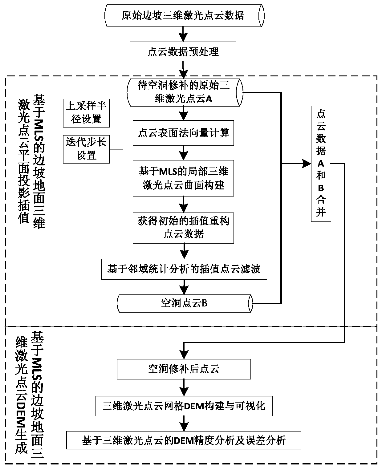
[0023] With reference to the accompanying drawings, the specific implementation method of the present invention will be described by taking the construction of a slope three-dimensional laser point cloud data grid DEM as an example in conjunction with the accompanying drawings:
[0024] 1. Obtain the slope point cloud through the ground 3D laser scanning system, and perform data preprocessing on it to obtain the original point cloud to be repaired.
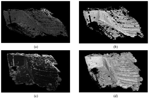
[0025] A Riegl VZ-1000 3D laser scanner is used to collect data on a certain slope, and the 3D laser point cloud data of the slope is obtained. The scanning mode is set to Panorama_20, so as to obtain denser laser point cloud data. After data collection in the field, RiSCAN PRO software is used in the office to perform preprocessing operations such as denoising, configuration, and filtering on the obtained 3D laser point cloud data. For obvious occlusion points and non-slope noise points such as buildings, trees, cars, pedestrians...
PUM
 Abstract
Description
Claims
Application Information
 - Generate Ideas
- Intellectual Property
- Life Sciences
- Materials
- Tech Scout
- Unparalleled Data Quality
- Higher Quality Content
- 60% Fewer Hallucinations
Browse by: Latest US Patents, China's latest patents, Technical Efficacy Thesaurus, Application Domain, Technology Topic, Popular Technical Reports.
© 2025 PatSnap. All rights reserved.Legal|Privacy policy|Modern Slavery Act Transparency Statement|Sitemap|About US| Contact US: help@patsnap.com


