Satellite-borne radar wide-area surface two-dimensional deformation field monitoring method and device

A spaceborne radar, deformation field technology, applied in measurement devices, radio wave measurement systems, radio wave reflection/re-radiation and other directions, can solve the problems of inaccurate monitoring results, different observation times in different orbits, etc., to ensure safety The effect of sex, accurate prevention and control

Pending Publication Date: 2020-07-28
HENAN UNIVERSITY
View PDF0 Cites 11 Cited by
  • Summary
  • Abstract
  • Description
  • Claims
  • Application Information

AI Technical Summary

Problems solved by technology

[0008] The purpose of the present invention is to provide a method and device for monitoring the two-dimensional deformation field of the spaceborne radar wide-area surface to solve the problem of inaccurate monitoring results caused by the inconsistency of observation time in different orbits

Method used


Image

  • Satellite-borne radar wide-area surface two-dimensional deformation field monitoring method and device
  • Satellite-borne radar wide-area surface two-dimensional deformation field monitoring method and device
  • Satellite-borne radar wide-area surface two-dimensional deformation field monitoring method and device

Examples


Embodiment

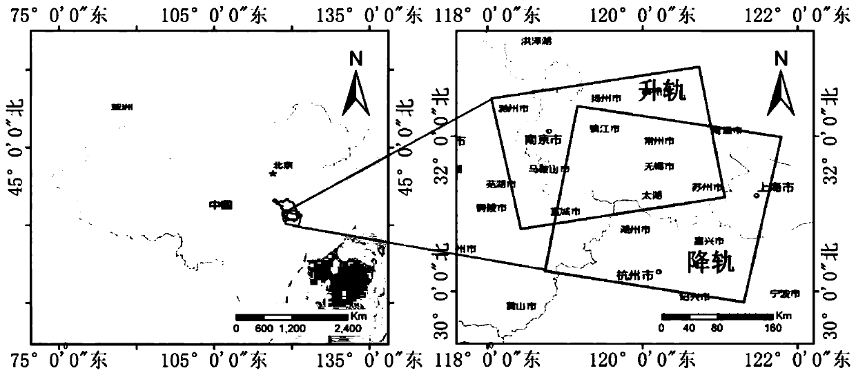
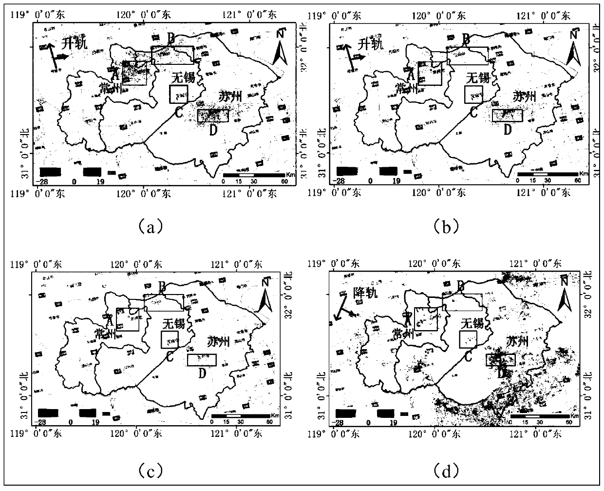
[0035] Such as figure 1 Shown is a SAR image of the Suzhou, Wuxi and Changzhou (Suzhou, Wuxi, and Changzhou) regions taken by a satellite in the elevating orbit mode. The Suzhou, Wuxi and Changzhou area has become one of the most industrialized cities in China. The excessive exploitation of groundwater has caused serious problems in this area. The ground subsidence and ground fissures and other geological hazards. This long-term slow surface deformation has a serious impact on the development of the local economy. Obtaining the vertical and horizontal two-dimensional deformation field of the surface is important for the prevention and control of urban disasters. significance.

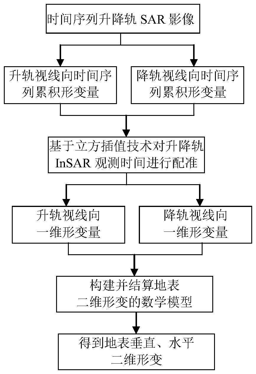
[0036] Then, by adopting the satellite-borne radar wide-area two-dimensional surface deformation field monitoring method of the present invention to monitor the surface deformation in real time, effective safety prevention and control can be made timely and accurately. Such as figure 2 As shown, including...


PUM


Abstract

The invention provides a satellite-borne radar wide-area surface two-dimensional deformation field monitoring method and device. The monitoring method comprises the following steps: step 1, acquiringaccumulated deformation quantity of sight lines of a lifting rail towards a time sequence through an InSAR technology; step 2, registering the lifting rail sight line direction observation time through cubic interpolation, and obtaining a lifting rail sight line direction time sequence cumulative deformation quantity after time registration; step 3, according to the registered lifting rail sight line direction time sequence accumulation deformation quantity, obtaining lifting rail sight line direction one-dimensional deformation quantity; step 4, constructing a mathematical model of surface two-dimensional deformation based on a radar imaging geometrical relationship; step 5, resolving the mathematical model according to the one-dimensional deformation quantity of the sight line of the lifting rail to obtain a two-dimensional deformation quantity of the earth surface; and step 6, monitoring through the two-dimensional deformation quantity of the earth surface. According to the invention, high-precision ground surface two-dimensional deformation monitoring can be carried out on lifting rail InSAR data, and a ground surface two-dimensional deformation field can be inversed more accurately, so that geological disaster prevention and control can be carried out more accurately.

Description

Technical field [0001] The invention relates to the field of deformation monitoring, in particular to a method and device for monitoring a two-dimensional deformation field on a wide-area surface of a spaceborne radar. Background technique [0002] Geological disasters have brought huge disasters to the economic life of human beings. Most of the reasons are caused by the deformation of the earth's surface. Among them are not only earthquake deformation, ground subsidence, volcanic movement, glacier drift, and landslides. Disasters include man-made geological disasters caused by engineering excavation, groundwater extraction, blasting, and spoil. These irreversible surface deformations have become an important factor affecting the sustainable development of regional economy and society. [0003] Interferometric Synthetic Aperture Radar (InSAR) measurement technology is a microwave coherent imaging method, which can image different scattering characteristics of the earth's surface b...

Claims


Application Information

Patent Timeline
Patent Type & Authority Applications(China)
IPC IPC(8): G01S13/88G01S13/90
CPCG01S13/885G01S13/90G01S13/9023
Inventor 闵林刘向前李宁郭拯危毋琳赵建辉王博
Owner HENAN UNIVERSITY
Why Eureka
Try Eureka